
Warrenton–Fauquier Airport | |||||||||||
|---|---|---|---|---|---|---|---|---|---|---|---|
 | |||||||||||
| Summary | |||||||||||
| Airport type | Public | ||||||||||
| Owner | Fauquier County | ||||||||||
| Serves | Warrenton, Virginia | ||||||||||
| Elevation AMSL | 336 ft / 102 m | ||||||||||
| Coordinates | 38°35′11″N 077°42′38″W / 38.58639°N 77.71056°W | ||||||||||
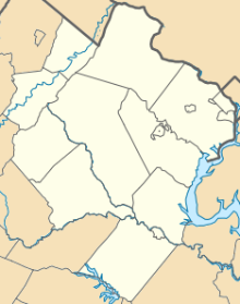
| Map | |||||||||||
 HWY 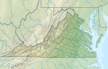 HWY  HWY | |||||||||||
| Runways | |||||||||||
| |||||||||||
| Statistics (2007) | |||||||||||
| |||||||||||
Warrenton–Fauquier Airport (ICAO: KHWY, FAA LID: HWY, formerly W66) is a public airport 14 miles southeast of Warrenton, a town in Fauquier County, Virginia.[1]
Most U.S. airports use the same three-letter location identifier for the FAA and IATA, but this airport is HWY to the FAA and has no IATA code.[2]

Facilities
Warrenton–Fauquier Airport covers 407 acres (165 ha) at an elevation of 336 feet (102 m). Its single runway, 15/33, is 5,000 by 100 feet (1,524 m × 30 m) asphalt.[1]
In the year ending June 29, 2007 the airport had 42,184 aircraft operations, average 115 per day: 98% general aviation, 1% air taxi and <1% military. 119 aircraft were then based at this airport: 84% single-engine (100), 13% multi-engine, 3% ultralight and 1% helicopter.[1]
Accidents and incidents
On December 3, 2023, a 62-year-old pilot was killed while piloting a Beechcraft C23 aircraft when it collided with several trees while attempting to land at the airport.[3] The aircraft had no other occupants other than the pilot, and no one was injured on the ground.[4]
See also
References
- ^ a b c d FAA Airport Form 5010 for HWY PDF, effective 2008-04-10
- ^ Great Circle Mapper: KHWY - Warrenton, Virginia
- ^ Allen, Gabby; Belloso, Paola; Bass, Randi (3 December 2023). "Pilot who died in plane crash in Fauquier County identified". DC News Now. Retrieved 5 December 2023.
- ^ Lyons, Ivy; Newton, Grace (4 December 2023). "62-year-old man identified as pilot killed in Fauquier County plane crash". WTOP News. Retrieved 5 December 2023.
External links
- Resources for this airport:
- FAA airport information for HWY
- AirNav airport information for KHWY
- FlightAware airport information and live flight tracker
- NOAA/NWS weather observations: current, past three days
- SkyVector aeronautical chart, Terminal Procedures
- FAA Terminal Procedures for HWY, effective January 25, 2024