
Warm Springs, Oregon | |
|---|---|
 Warm Springs | |
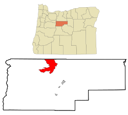 Location of Warm Springs, Oregon | |
| Coordinates: 44°45′37″N 121°16′6″W / 44.76028°N 121.26833°W | |
| Country | United States |
| State | Oregon |
| County | Jefferson |
| Area | |
| • Total | 42.57 sq mi (110.25 km2) |
| • Land | 42.44 sq mi (109.92 km2) |
| • Water | 0.13 sq mi (0.34 km2) |
| Elevation | 1,539 ft (469 m) |
| Population | |
| • Total | 2,435 |
| • Density | 57.38/sq mi (22.15/km2) |
| Time zone | UTC-8 (Pacific (PST)) |
| • Summer (DST) | UTC-7 (PDT) |
| ZIP code | 97761 |
| Area code | 541 |
| FIPS code | 41-78600[3] |
| GNIS feature ID | 1128648[4] |
Warm Springs is a census-designated place (CDP) and an unincorporated community in Jefferson County, Oregon, United States.[5] Located on the Warm Springs Indian Reservation, the community is also known as the "Warm Springs Agency". The population was 2,945 at the 2010 census,[6] up from 2,431 at the 2000 census.
YouTube Encyclopedic
-
1/3Views:2 2122 249959
-
Warm Springs Tribes COCC Salmon Bake Part 1
-
Warm Springs near Oakridge, Oregon
-
Rafting the Deschutes River in Oregon- Sept 2012 Warm Springs to Maupin GoPro 720p
Transcription
Geography

Warm Springs is located in northern Jefferson County at 44°45′37″N 121°16′06″W / 44.760168°N 121.268233°W (44.760168, -121.268233).[7] The center of the community is situated at 1,539 feet (469 m) above sea level in the valley of Shitike Creek.[5] The Deschutes River forms the eastern boundary of the CDP.
U.S. Route 26 passes through the center of the community, leading southeast 14 miles (23 km) to Madras and northwest 100 miles (160 km) to Portland.
According to the United States Census Bureau, the Warm Springs CDP has a total area of 42.6 square miles (110.4 km2), of which 42.5 square miles (110.1 km2) are land and 0.1 square miles (0.3 km2), or 0.30%, are water.[6]
Climate
This region experiences warm, (but not hot), and dry summers, with no average monthly temperatures above 71.6 °F (22.0 °C). According to the Köppen Climate Classification system, Warm Springs has a warm-summer Mediterranean climate, abbreviated "Csb" on climate maps.[8]
Demographics
As of the census[3] of 2000, there were 2,431 people, 603 households, and 507 families residing in the CDP. The population density was 57.2 inhabitants per square mile (22.1/km2). There were 642 housing units at an average density of 15.1 per square mile (5.8/km2). The racial makeup of the CDP was 93.46% Native American, 2.47% White, 0.08% African American, 0.08% Pacific Islander, 1.11% from other races, and 2.80% from two or more races. Hispanic or Latino of any race were 6.50% of the population.
There were 603 households, out of which 50.9% had children under the age of 18 living with them, 35.3% were married couples living together, 34.2% had a female householder with no husband present, and 15.9% were non-families. 11.4% of all households were made up of individuals, and 2.7% had someone living alone who was 65 years of age or older. The average household size was 4.02 and the average family size was 4.19.
| Census | Pop. | Note | %± |
|---|---|---|---|
| 1930 | 50 | — | |
| 1940 | 150 | 200.0% | |
| 1950 | 550 | 266.7% | |
| 1960 | 450 | −18.2% | |
| 1970 | 550 | 22.2% | |
| 1980 | 500 | −9.1% | |
| 1990 | 2,287 | 357.4% | |
| 2000 | 2,431 | 6.3% | |
| 2010 | 2,945 | 21.1% | |
| 2020 | 2,435 | −17.3% | |
| source:[9][2] | |||
In the CDP, the population was spread out, with 41.1% under the age of 18, 10.7% from 18 to 24, 28.4% from 25 to 44, 15.4% from 45 to 64, and 4.4% who were 65 years of age or older. The median age was 24 years. For every 100 females, there were 104.8 males. For every 100 females age 18 and over, there were 101.5 males.
The median income for a household in the CDP was $29,886, and the median income for a family was $28,300. Males had a median income of $27,083 versus $20,897 for females. The per capita income for the CDP was $8,583. About 28.2% of families and 32.3% of the population were below the poverty line, including 37.9% of those under age 18 and 15.9% of those age 65 or over.
See also
References
- ^ "ArcGIS REST Services Directory". United States Census Bureau. Retrieved October 12, 2022.
- ^ a b "Census Population API". United States Census Bureau. Retrieved October 12, 2022.
- ^ a b "U.S. Census website". United States Census Bureau. Retrieved January 31, 2008.
- ^ "US Board on Geographic Names". United States Geological Survey. October 25, 2007. Retrieved January 31, 2008.
- ^ a b "Warm Springs". Geographic Names Information System. United States Geological Survey, United States Department of the Interior. November 28, 1980. Retrieved August 29, 2010.
- ^ a b "Geographic Identifiers: 2010 Census Summary File 1 (G001): Warm Springs CDP, Oregon". American Factfinder. U.S. Census Bureau. Archived from the original on February 13, 2020. Retrieved October 31, 2018.
- ^ "US Gazetteer files: 2010, 2000, and 1990". United States Census Bureau. February 12, 2011. Retrieved April 23, 2011.
- ^ Climate Summary for Warm Springs, Oregon
- ^ Moffatt, Riley. Population History of Western U.S. Cities & Towns, 1850–1990. Lanham: Scarecrow, 1996, 216.
Municipalities and communities of Jefferson County, Oregon, United States | ||
|---|---|---|
| Cities |  | |
| CDPs | ||
| Other communities | ||
| Indian reservation | ||
| Ghost towns | ||
| Footnotes | ‡This populated place also has portions in an adjacent county or counties | |