
Walden, Colorado | |
|---|---|
 Main Street in Walden, July 2010 | |
 Location of Walden in Jackson County, Colorado. | |
| Coordinates: 40°43′54″N 106°16′53″W / 40.73167°N 106.28139°W | |
| Country | |
| State | |
| County[1] | Jackson County - seat[2] |
| Established | 1889 |
| Incorporated | December 2, 1890[3] |
| Named for | Marcus Aurelius Walden (former postmaster) |
| Government | |
| • Type | Statutory Town[1] |
| Area | |
| • Total | 0.34 sq mi (0.87 km2) |
| • Land | 0.34 sq mi (0.87 km2) |
| • Water | 0.00 sq mi (0.00 km2) |
| Elevation | 8,098 ft (2,468 m) |
| Population | |
| • Total | 606 |
| • Density | 1,800/sq mi (700/km2) |
| Time zone | UTC−7 (Mountain (MST)) |
| • Summer (DST) | UTC−6 (MDT) |
| ZIP codes[7] | 80430, 80480 |
| Area code | 970 |
| FIPS code | 08-82130 |
| GNIS feature ID | 2413440[5] |
| Website | Official website |
Walden is the Statutory Town that is the county seat, the most populous community, and the only incorporated municipality in Jackson County, Colorado, United States.[1][8] It is situated in the center of a large open valley called North Park. People from Walden and the surrounding area refer to themselves as "North Parkers".[citation needed] The town population was 606 at the 2020 census.[6] The town sits at an elevation of 8,099 feet (2,469 meters). It was established in 1889 and was incorporated 2 December 1890.[3] Mark A. Walden, an early postmaster, gave the community his name.[9]
YouTube Encyclopedic
-
1/5Views:1 2213387171 814787
-
Walden, Colorado 08 19 2013
-
Riverton to Walden. Back to Colorado.
-
Walden-Colorado Movie.wmv
-
Night Tour of Walden Colorado
-
Elk Running - Walden, Colorado
Transcription
Geography
According to the United States Census Bureau, the town has a total area of 0.3 square miles (0.78 km2), all of it land.
Climate
Due to its elevation, Walden has a semi-arid climate (BSk), closely bordering on a subalpine climate (Köppen climate classification Dfc). The hottest temperature recorded in Walden was 94 °F (34 °C) on July 6, 1989, August 1, 2000 and July 15, 2002, while the coldest temperature recorded was −48 °F (−44 °C) on January 12, 1963, February 2, 2011 and January 6, 2017.[10]
| Climate data for Walden, Colorado, 1991–2020 normals, extremes 1897–present | |||||||||||||
|---|---|---|---|---|---|---|---|---|---|---|---|---|---|
| Month | Jan | Feb | Mar | Apr | May | Jun | Jul | Aug | Sep | Oct | Nov | Dec | Year |
| Record high °F (°C) | 56 (13) |
54 (12) |
70 (21) |
74 (23) |
84 (29) |
92 (33) |
94 (34) |
94 (34) |
89 (32) |
78 (26) |
66 (19) |
58 (14) |
94 (34) |
| Mean maximum °F (°C) | 43.6 (6.4) |
45.9 (7.7) |
56.5 (13.6) |
66.2 (19.0) |
75.4 (24.1) |
82.1 (27.8) |
86.9 (30.5) |
85.0 (29.4) |
80.2 (26.8) |
70.8 (21.6) |
57.1 (13.9) |
46.4 (8.0) |
86.9 (30.5) |
| Mean daily maximum °F (°C) | 26.7 (−2.9) |
29.6 (−1.3) |
38.6 (3.7) |
47.4 (8.6) |
58.1 (14.5) |
68.8 (20.4) |
76.1 (24.5) |
74.1 (23.4) |
66.4 (19.1) |
52.9 (11.6) |
38.3 (3.5) |
27.7 (−2.4) |
50.4 (10.2) |
| Daily mean °F (°C) | 14.3 (−9.8) |
17.0 (−8.3) |
25.8 (−3.4) |
33.7 (0.9) |
42.9 (6.1) |
51.7 (10.9) |
57.3 (14.1) |
55.2 (12.9) |
47.9 (8.8) |
36.8 (2.7) |
25.1 (−3.8) |
15.4 (−9.2) |
35.3 (1.8) |
| Mean daily minimum °F (°C) | 1.9 (−16.7) |
4.4 (−15.3) |
13.1 (−10.5) |
20.0 (−6.7) |
27.6 (−2.4) |
34.5 (1.4) |
38.4 (3.6) |
36.3 (2.4) |
29.4 (−1.4) |
20.7 (−6.3) |
11.8 (−11.2) |
3.2 (−16.0) |
20.1 (−6.6) |
| Mean minimum °F (°C) | −22.2 (−30.1) |
−19.7 (−28.7) |
−8.4 (−22.4) |
4.9 (−15.1) |
15.5 (−9.2) |
27.5 (−2.5) |
32.4 (0.2) |
28.9 (−1.7) |
17.4 (−8.1) |
2.1 (−16.6) |
−10.4 (−23.6) |
−21.2 (−29.6) |
−28.9 (−33.8) |
| Record low °F (°C) | −48 (−44) |
−48 (−44) |
−34 (−37) |
−16 (−27) |
2 (−17) |
17 (−8) |
21 (−6) |
19 (−7) |
5 (−15) |
−28 (−33) |
−32 (−36) |
−39 (−39) |
−48 (−44) |
| Average precipitation inches (mm) | 0.58 (15) |
0.64 (16) |
0.72 (18) |
1.14 (29) |
1.53 (39) |
1.21 (31) |
1.34 (34) |
1.27 (32) |
1.34 (34) |
0.98 (25) |
0.75 (19) |
0.62 (16) |
12.12 (308) |
| Average snowfall inches (cm) | 9.3 (24) |
9.0 (23) |
7.7 (20) |
10.1 (26) |
3.8 (9.7) |
0.5 (1.3) |
0.0 (0.0) |
0.0 (0.0) |
1.0 (2.5) |
6.0 (15) |
9.5 (24) |
10.2 (26) |
67.1 (171.5) |
| Average precipitation days (≥ 0.01 in) | 7.9 | 8.1 | 7.3 | 9.4 | 10.3 | 7.7 | 9.9 | 10.6 | 8.3 | 7.3 | 7.8 | 8.3 | 102.9 |
| Average snowy days (≥ 0.1 in) | 8.3 | 8.5 | 6.2 | 6.7 | 2.6 | 0.3 | 0.0 | 0.0 | 0.7 | 3.6 | 7.3 | 8.8 | 53.0 |
| Source 1: NOAA[11] | |||||||||||||
| Source 2: National Weather Service[10] | |||||||||||||
Demographics
| Census | Pop. | Note | %± |
|---|---|---|---|
| 1890 | 64 | — | |
| 1900 | 141 | 120.3% | |
| 1910 | 162 | 14.9% | |
| 1920 | 260 | 60.5% | |
| 1930 | 284 | 9.2% | |
| 1940 | 668 | 135.2% | |
| 1950 | 696 | 4.2% | |
| 1960 | 809 | 16.2% | |
| 1970 | 907 | 12.1% | |
| 1980 | 947 | 4.4% | |
| 1990 | 890 | −6.0% | |
| 2000 | 734 | −17.5% | |
| 2010 | 608 | −17.2% | |
| 2020 | 606 | −0.3% | |
| U.S. Decennial Census | |||
Transportation
OATS (Older Americans Transport Service) provides seniors with transportation to Laramie, Wyoming or Steamboat Springs, CO and to Denver International Airport.
See also
References
- ^ a b c "Active Colorado Municipalities". State of Colorado, Department of Local Affairs. Archived from the original on December 12, 2009. Retrieved September 1, 2007.
- ^ "Colorado County Seats". State of Colorado, Department of Public Health and Environment. Retrieved December 31, 2007.
- ^ a b "Colorado Municipal Incorporations". State of Colorado, Department of Personnel & Administration, Colorado State Archives. December 1, 2004. Retrieved September 2, 2007.
- ^ "2019 U.S. Gazetteer Files". United States Census Bureau. Retrieved July 1, 2020.
- ^ a b U.S. Geological Survey Geographic Names Information System: Walden, Colorado
- ^ a b United States Census Bureau. "Walden town; Colorado". Retrieved April 23, 2023.
- ^ "ZIP Code Lookup". United States Postal Service. Archived from the original (JavaScript/HTML) on November 22, 2010. Retrieved January 8, 2008.
- ^ "Find a County". National Association of Counties. Retrieved June 7, 2011.
- ^ Dawson, John Frank (1954). Place names in Colorado: why 700 communities were so named, 150 of Spanish or Indian origin. Denver, CO: The J. Frank Dawson Publishing Co. p. 51.
- ^ a b "NOAA Online Weather Data". National Weather Service. Retrieved September 9, 2022.
- ^ "U.S. Climate Normals Quick Access". National Oceanic and Atmospheric Administration. Retrieved September 9, 2022.
External links
Municipalities and communities of Jackson County, Colorado, United States | ||
|---|---|---|
| Town | 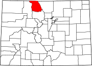 | |
| Unincorporated communities | ||
| International | |
|---|---|
| National | |