
Wakefield-Peacedale, Rhode Island | |
|---|---|
 Peace Dale Congregational Church | |
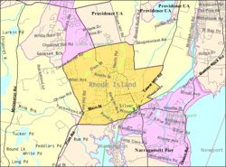 Map of Wakefield-Peacedale with its boundaries in 2000 | |
| Coordinates: 41°26′28″N 71°29′57″W / 41.44111°N 71.49917°W | |
| Country | United States |
| State | Rhode Island |
| County | Washington |
| Area | |
| • Total | 5.1 sq mi (13.2 km2) |
| • Land | 4.9 sq mi (12.6 km2) |
| • Water | 0.2 sq mi (0.6 km2) |
| Population (2010) | |
| • Total | 8,487 |
| • Density | 1,739.4/sq mi (671.6/km2) |
| Time zone | UTC-5 (Eastern (EST)) |
| • Summer (DST) | UTC-4 (EDT) |
| FIPS code | 44-73130[1] |
Wakefield-Peacedale (listed as "Wakefield-Peace Dale" by the United States Census Bureau) is a census-designated place (CDP) in the town of South Kingstown in Washington County, Rhode Island, United States that includes the villages of Peace Dale and Wakefield. The population was 8,487 at the 2010 census.
YouTube Encyclopedic
-
1/1Views:2 405
-
"Discover Rhode Island" EP17: Wakefield - Full Episode
Transcription
Geography
Wakefield-Peacedale is located at 41°26′28″N 71°29′57″W / 41.44111°N 71.49917°W (41.441234, -71.499290).[2]
According to the United States Census Bureau, the CDP has a total area of 5.1 mi2 (13.2 km2). 4.9 mi2 (12.6 km2) of it is land and 0.2 mi2 (0.6 ²) (4.70%) is water.
Demographics
2020 census
The 2020 United States census counted 8,925 people, 3,751 households, and 2,641 families in Wakefield-Peacedale. The population density was 1,810.3 per square mile (699.0/km2). There were 4,027 housing units at an average density of 816.8 per square mile (315.4/km2).[3][4] The racial makeup was 84.18% (7,513) white or European American (83.62% non-Hispanic white), 2.1% (187) black or African-American, 3.11% (278) Native American or Alaska Native, 2.04% (182) Asian, 0.03% (3) Pacific Islander or Native Hawaiian, 1.48% (132) from other races, and 7.06% (630) from two or more races.[5] Hispanic or Latino of any race was 3.98% (355) of the population.[6]
Of the 3,751 households, 23.1% had children under the age of 18; 43.5% were married couples living together; 32.0% had a female householder with no spouse or partner present. 32.6% of households consisted of individuals and 17.4% had someone living alone who was 65 years of age or older.[3] The average household size was 2.4 and the average family size was 2.9.[7] The percent of those with a bachelor’s degree or higher was estimated to be 38.6% of the population.[8]
19.2% of the population was under the age of 18, 7.6% from 18 to 24, 22.2% from 25 to 44, 28.1% from 45 to 64, and 22.9% who were 65 years of age or older. The median age was 45.9 years. For every 100 females, the population had 110.4 males.[3] For every 100 females ages 18 and older, there were 113.1 males.[3]
The 2016-2020 5-year American Community Survey estimates show that the median household income was $87,684 (with a margin of error of +/- $22,963) and the median family income was $111,016 (+/- $15,344). Males had a median income of $44,708 (+/- $18,824) versus $25,422 (+/- $7,849) for females.[9] The median income for those above 16 years old was $33,509 (+/- $7,659).[10] Approximately, 4.6% of families and 6.8% of the population were below the poverty line, including 8.8% of those under the age of 18 and 3.8% of those ages 65 or over.[11][12]
2000 census
At the 2000 census,[1] there were 8,468 people, 3,221 households and 2,174 families residing in the CDP. The population density was 671.4/km2 (1,739.4/mi2). There were 3,385 housing units at an average density of 268.4/km2 (695.3/mi2). The racial makeup of the CDP was 90.34% White, 2.01% African American, 3.08% Native American, 1.23% Asian, 0.56% from other races, and 2.79% from two or more races. Hispanic or Latino of any race were 1.56% of the population.
There were 3,221 households, of which 36.5% had children under the age of 18 living with them, 50.4% were married couples living together, 13.1% had a female householder with no husband present, and 32.5% were non-families. 25.8% of all households were made up of individuals, and 10.2% had someone living alone who was 65 years of age or older. The average household size was 2.58 and the average family size was 3.14.
28.4% of the population were under the age of 18, 6.5% from 18 to 24, 29.6% from 25 to 44, 22.2% from 45 to 64, and 13.2% who were 65 years of age or older. The median age was 37 years. For every 100 females, there were 87.8 males. For every 100 females age 18 and over, there were 83.4 males.
The median household income was $50,313 and the median family income was $61,541. Males had a median income of $47,470 compared with $26,922 for females. The per capita income was $24,191. About 3.9% of families and 5.4% of the population were below the poverty line, including 4.4% of those under age 18 and 6.0% of those age 65 or over.
References
- ^ a b "U.S. Census website". United States Census Bureau. Retrieved January 31, 2008.
- ^ "US Gazetteer files: 2010, 2000, and 1990". United States Census Bureau. February 12, 2011. Retrieved April 23, 2011.
- ^ a b c d "US Census Bureau, Table DP1: PROFILE OF GENERAL POPULATION AND HOUSING CHARACTERISTICS". data.census.gov. Retrieved December 29, 2023.
- ^ Bureau, US Census. "Gazetteer Files". Census.gov. Retrieved December 30, 2023.
- ^ "US Census Bureau, Table P1: RACE". data.census.gov. Retrieved December 29, 2023.
- ^ "US Census Bureau, Table P2: HISPANIC OR LATINO, AND NOT HISPANIC OR LATINO BY RACE". data.census.gov. Retrieved December 29, 2023.
- ^ "US Census Bureau, Table S1101: HOUSEHOLDS AND FAMILIES". data.census.gov. Retrieved December 29, 2023.
- ^ "US Census Bureau, Table S1501: EDUCATIONAL ATTAINMENT". data.census.gov. Retrieved December 29, 2023.
- ^ "US Census Bureau, Table S1903: MEDIAN INCOME IN THE PAST 12 MONTHS (IN 2020 INFLATION-ADJUSTED DOLLARS)". data.census.gov. Retrieved December 29, 2023.
- ^ "US Census Bureau, Table S2001: EARNINGS IN THE PAST 12 MONTHS (IN 2020 INFLATION-ADJUSTED DOLLARS)". data.census.gov. Retrieved December 29, 2023.
- ^ "US Census Bureau, Table S1701: POVERTY STATUS IN THE PAST 12 MONTHS". data.census.gov. Retrieved December 29, 2023.
- ^ "US Census Bureau, Table S1702: POVERTY STATUS IN THE PAST 12 MONTHS OF FAMILIES". data.census.gov. Retrieved December 29, 2023.
External links
Municipalities and communities of Washington County, Rhode Island, United States | ||
|---|---|---|
| Towns |  | |
| CDPs | ||
| Other villages | ||
| Indian reservation | ||