
Wake
和気町 | |
|---|---|
 Wake Fuji Park | |
 Flag  Seal | |
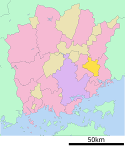
 Location of Wake in Okayama Prefecture | |
 | |
 Wake Location in Japan | |
| Coordinates: 34°48′10″N 134°9′27″E / 34.80278°N 134.15750°E | |
| Country | Japan |
| Region | Chūgoku San'yō |
| Prefecture | Okayama |
| District | Wake |
| Area | |
| • Total | 144.21 km2 (55.68 sq mi) |
| Population (March 31, 2021) | |
| • Total | 13,833 |
| • Density | 96/km2 (250/sq mi) |
| Time zone | UTC+09:00 (JST) |
| City hall address | 555 Shakusho, Wake-cho, Wake-gun, Okayama-ken 709-0495 |
| Climate | Cfa |
| Website | Official website |
| Symbols | |
| Flower | Wisteria floribunda |
| Tree | Sakura |

Wake (和気町, Wake-chō) is a town located in Wake District, Okayama Prefecture, Japan. As of 31 March 2022[update], the town had an estimated population of 13,833 in 6353 households and a population density of 96 persons per km2.[1] The total area of the town is 144.21 square kilometres (55.68 sq mi). The town is famous in the region for the 'Wamojiyaki' festival that takes place every year on August 15 during the Obon period, and the town is also home to the largest Wisteria park in Japan.
YouTube Encyclopedic
-
1/5Views:3361 0102 4988963 730
-
Wisteria Flowers Park in Wake town, Okayama
-
Q2 Japan: Wake Wisteria Festival in Okayama, Japan 和気町藤まつり岡山県
-
赤・黒・ピンク…こいのぼり作り真っ盛り 岡山・和気
-
岡山県和気町藤公園の幻想的なライトアップ
-
people in Okayama(Japan), Okayama-station
Transcription
Geography
Wake is located in southeastern Okayama Prefecture. The Yoshii River and the Kongo River flow through the town, which is largely covered by hills and forests.The center of the town forms a small basin at the point where the Yoshii River and the Kongo River meet.
Adjoining municipalities
Climate
Wake has a humid subtropical climate (Köppen climate classification Cfa). The average annual temperature in Wake is 14.2 °C (57.6 °F). The average annual rainfall is 1,208.1 mm (47.56 in) with July as the wettest month. The temperatures are highest on average in August, at around 26.5 °C (79.7 °F), and lowest in January, at around 2.9 °C (37.2 °F).[2] The highest temperature ever recorded in Wake was 37.9 °C (100.2 °F) on 8 August 2016; the coldest temperature ever recorded was −10.6 °C (12.9 °F) on 9 January 2021.[3]
| Climate data for Wake (1991−2020 normals, extremes 1979−present) | |||||||||||||
|---|---|---|---|---|---|---|---|---|---|---|---|---|---|
| Month | Jan | Feb | Mar | Apr | May | Jun | Jul | Aug | Sep | Oct | Nov | Dec | Year |
| Record high °C (°F) | 16.4 (61.5) |
21.9 (71.4) |
24.6 (76.3) |
29.5 (85.1) |
33.1 (91.6) |
36.5 (97.7) |
37.1 (98.8) |
37.9 (100.2) |
37.0 (98.6) |
30.9 (87.6) |
25.1 (77.2) |
20.8 (69.4) |
37.9 (100.2) |
| Mean daily maximum °C (°F) | 9.0 (48.2) |
10.1 (50.2) |
13.8 (56.8) |
19.6 (67.3) |
24.3 (75.7) |
27.1 (80.8) |
30.6 (87.1) |
32.1 (89.8) |
28.3 (82.9) |
22.9 (73.2) |
17.0 (62.6) |
11.4 (52.5) |
20.5 (68.9) |
| Daily mean °C (°F) | 2.9 (37.2) |
3.7 (38.7) |
7.0 (44.6) |
12.4 (54.3) |
17.5 (63.5) |
21.6 (70.9) |
25.6 (78.1) |
26.5 (79.7) |
22.4 (72.3) |
16.1 (61.0) |
10.1 (50.2) |
4.9 (40.8) |
14.2 (57.6) |
| Mean daily minimum °C (°F) | −2.4 (27.7) |
−2.0 (28.4) |
0.6 (33.1) |
5.4 (41.7) |
10.9 (51.6) |
16.8 (62.2) |
21.6 (70.9) |
22.2 (72.0) |
17.7 (63.9) |
10.7 (51.3) |
4.3 (39.7) |
−0.4 (31.3) |
8.8 (47.8) |
| Record low °C (°F) | −10.6 (12.9) |
−9.3 (15.3) |
−7.2 (19.0) |
−3.8 (25.2) |
−0.5 (31.1) |
5.7 (42.3) |
12.5 (54.5) |
13.9 (57.0) |
5.3 (41.5) |
−0.9 (30.4) |
−3.6 (25.5) |
−7.8 (18.0) |
−10.6 (12.9) |
| Average precipitation mm (inches) | 37.9 (1.49) |
45.4 (1.79) |
86.9 (3.42) |
96.1 (3.78) |
122.5 (4.82) |
162.6 (6.40) |
189.5 (7.46) |
112.2 (4.42) |
156.8 (6.17) |
98.6 (3.88) |
55.9 (2.20) |
46.6 (1.83) |
1,208.1 (47.56) |
| Average precipitation days (≥ 1.0 mm) | 5.4 | 6.6 | 8.9 | 9.3 | 9.4 | 11.3 | 10.4 | 8.1 | 9.4 | 7.5 | 5.9 | 5.7 | 97.9 |
| Mean monthly sunshine hours | 142.2 | 142.3 | 179.6 | 201.5 | 211.1 | 154.5 | 169.8 | 212.9 | 161.3 | 175.0 | 152.9 | 148.3 | 2,051.5 |
| Source: Japan Meteorological Agency[2][3] | |||||||||||||
Demographics
Per Japanese census data, the population of Wake in 2020 is 13,623 people.[4] Wake has been conducting censuses since 1920.
| Year | Pop. | ±% |
|---|---|---|
| 1920 | 16,404 | — |
| 1925 | 16,745 | +2.1% |
| 1930 | 17,564 | +4.9% |
| 1935 | 16,755 | −4.6% |
| 1940 | 16,510 | −1.5% |
| 1945 | 21,949 | +32.9% |
| 1950 | 21,995 | +0.2% |
| 1955 | 21,637 | −1.6% |
| 1960 | 20,586 | −4.9% |
| 1965 | 19,009 | −7.7% |
| 1970 | 17,945 | −5.6% |
| 1975 | 18,385 | +2.5% |
| 1980 | 19,088 | +3.8% |
| 1985 | 18,827 | −1.4% |
| 1990 | 17,841 | −5.2% |
| 1995 | 17,227 | −3.4% |
| 2000 | 16,815 | −2.4% |
| 2005 | 16,180 | −3.8% |
| 2010 | 15,362 | −5.1% |
| 2015 | 14,412 | −6.2% |
| 2020 | 13,623 | −5.5% |
| Wake population statistics[4] | ||
History
The Wake area is part of ancient Bizen Province. The important Nara period official Wake no Kiyomaro is from this area. During the Edo Period, it was part of the holdings of Okayama Domain. Following the Meiji restoration, the village of Wake was established within Wake District, Okayama with the creation of the modern municipalities system on April 1, 1889. It was raised to town status on February 6, 1901. On March 1, 2006 Wake was officially merged with the neighboring town of Saeki, also from Wake District. The newly merged town retains the name 'Wake'.
Government
Wake has a mayor-council form of government with a directly elected mayor and a unicameral city council of 12 members. Wake, collectively with the city of Bizen, contributes two members to the Okayama Prefectural Assembly. In terms of national politics, the town is part of the Okayama 1st district of the lower house of the Diet of Japan.
Economy
The economy of Wake is based agriculture and food processing, and the cultivation of fruit trees such as grapes, apples, plums, and cherries.
Education
Wake has three public elementary schools and two public junior high schools operated by the city government, and one public high school operated by the Okayama prefectural Board of Education.
Transportation
Railway
![]() JR West (JR West) - San'yō Main Line
JR West (JR West) - San'yō Main Line
Highways
Sister city relations
 - Jiading District, Shanghai, China, since July 31, 1989
 - Hanna, Alberta, Canada., since March 31, 1993
References
- ^ "Wake town official statistics" (in Japanese). Japan.
- ^ a b 気象庁 / 平年値(年・月ごとの値). JMA. Retrieved May 7, 2022.
- ^ a b 観測史上1~10位の値(年間を通じての値). JMA. Retrieved May 7, 2022.
- ^ a b Wake population statistics
External links
 Media related to Wake, Okayama at Wikimedia Commons
- Wake official website (in Japanese)
| International | |
|---|---|
| National | |
This Okayama Prefecture location article is a stub. You can help Wikipedia by expanding it. |