
| Waimea River | |
|---|---|
 Waimea Falls on the Kamananui stream a tributary of the Waimea | |
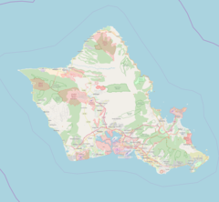 Location of the mouth within Oahu | |
| Location | |
| Country | United States |
| State | Hawaii |
| County | Honolulu County |
| Physical characteristics | |
| Source | |
| • location | Waimea Valley |
| Mouth | |
• location | Waimea Bay |
• coordinates | 21°38′27″N 158°03′48″W / 21.64074°N 158.06324°W |
| Length | 1.5 mi (2.4 km), 24.4 km (15.2 mi) total length |
| Basin size | 13.6 sq mi (35 km2) |
The Waimea River is a river in Honolulu County on the island of Oʻahu in the U.S. state of Hawaii. The river's main channel is 1.5 miles (2.4 km) long and has a watershed spanning 13.6 square miles, with a total length of 24.4 km (15.2 mi) when its tributaries are included.[1][2] It is formed by the confluence of the Kamananui stream and the Kaiwikoʻele stream northeast of Haleiwa and flows northwest through the Waimea Valley to the Pacific Ocean at Waimea Bay. The name Waimea translates to "red water."[3]
The mouth of the river has become famous for its waves that are created when residents dredge the beach, creating a channel that allows the watercourse to drain when it is cut off by the beach.[4][5]
YouTube Encyclopedic
-
1/3Views:11 69534 24475 008
-
BEST THINGS TO DO ON THE NORTH SHORE OF OAHU (WAIMEA RIVER)
-
INSANE River Surfing in Hawaii | River Break 2022 | Man-Made River Waves
-
Waimea Valley: Sacred Lands In Oahu | Swimming Hole Safari Ep 5
Transcription
See also
References
- ^ U.S. Geological Survey Geographic Names Information System: Waimea River
- ^ "Waimea River, Oahu" (PDF). Hawaii watershed atlas. Retrieved September 11, 2022.
- ^ Pukui, Mary Kawena. Place Names of Hawaii. University of Hawaii Press. ISBN 0-8248-0524-0.
- ^ "Waimea Bay - Best North Shore Beach".
- ^ Connecting river to Ocean, "Skid Kids", YouTube.com, 2022-02-09, accessed 2022-02-22