
Wachtebeke | |
|---|---|
 | |
 Flag Coat of arms | |
Location of Wachtebeke  | |
 Wachtebeke Location in Belgium
Location of Wachtebeke in East Flanders 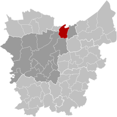 | |
| Coordinates: 51°10′N 03°52′E / 51.167°N 3.867°E | |
| Country | |
| Community | Flemish Community |
| Region | Flemish Region |
| Province | East Flanders |
| Arrondissement | Ghent |
| Government | |
| • Mayor | Rudy van Cronenburg (ANDERS) |
| • Governing party/ies | ANDERS, Open Vld |
| Area | |
| • Total | 34.63 km2 (13.37 sq mi) |
| Population (2018-01-01)[1] | |
| • Total | 7,683 |
| • Density | 220/km2 (570/sq mi) |
| Postal codes | 9185 |
| NIS code | 44073 |
| Area codes | 09 |
| Website | www.wachtebeke.be |
Wachtebeke (Dutch pronunciation: [ˈʋɑxtəbeːkə]) is a municipality located in the Belgian province of East Flanders. The municipality comprises the town of Wachtebeke proper, and a smaller town: Overslag.[2] In 2021, Wachtebeke had a total population of 7.769. The total area is 34.53 km2.[3]
The current mayor of Wachtebeke (as of 2012) is Rudy van Cronenburg.
The Langelede is a small canal and corresponding residential street in the town. The neighborhood is slowly migrating from a poor agricultural environment towards a higher middle-class residential area.
In Wachtebeke lies the provincial park Puyenbroeck[4]
People from Wachtebeke
- Bart De Pauw was born in Wachtebeke
- Jonas Geirnaert, animated film maker and comedian
- Lieven Scheire, comedian
Neighboring municipalities
- 1. Moerbeke
- 2. Eksaarde (Lokeren)
- 3. Zaffelare (Lochristi)
- 4. Mendonk (Gent)
- 5. Sint-Kruis-Winkel (Gent)
- 6. Zelzate
References
- ^ "Wettelijke Bevolking per gemeente op 1 januari 2018". Statbel. Retrieved 9 March 2019.
- ^ "The Overslag". Retrieved 3 April 2006.
- ^ "Bevolking per statistische sector - Sector 44073". Statistics Belgium. Retrieved 7 May 2022.
- ^ "Startpagina - Provinciaal domein Puyenbroeck". www.puyenbroeck.be.
External links
 Media related to Wachtebeke at Wikimedia Commons
- Official website (in Dutch)
| Aalst |  | |
|---|---|---|
| Dendermonde | ||
| Eeklo | ||
| Ghent | ||
| Oudenaarde | ||
| Sint-Niklaas | ||
| ||
| International | |
|---|---|
| Geographic | |
This East Flanders location article is a stub. You can help Wikipedia by expanding it. |