
Włodawa County
Powiat włodawski | |
|---|---|
 Flag  Coat of arms | |
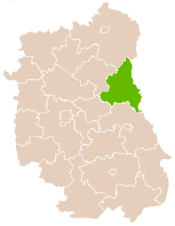 Location within the voivodeship | |
| Coordinates (Włodawa): 51°33′N 23°33′E / 51.550°N 23.550°E | |
| Country | |
| Voivodeship | Lublin |
| Seat | Włodawa |
| Gminas | |
| Area | |
| • Total | 1,256.27 km2 (485.05 sq mi) |
| Population (2019) | |
| • Total | 38,524 |
| • Density | 31/km2 (79/sq mi) |
| • Urban | 13,167 |
| • Rural | 25,357 |
| Car plates | LWL |
| Website | http://www.powiat.wlodawa.pl |
Włodawa County (Polish: powiat włodawski) is a unit of territorial administration and local government (powiat) in Lublin Voivodeship, eastern Poland, on the border with Ukraine and Belarus. It was established on January 1, 1999, as a result of the Polish local government reforms passed in 1998. Its administrative seat and only town is Włodawa, which lies 76 kilometres (47 mi) north-east of the regional capital Lublin.
The county covers an area of 1,256.27 square kilometres (485.0 sq mi). As of 2019, its total population is 38,524, including a population of 13,167 in Włodawa and a rural population of 25,357.[1]
Neighbouring counties
Włodawa County is bordered by Chełm County to the south, Łęczna County and Parczew County to the west, and Biała Podlaska County to the north. It also borders Ukraine and Belarus to the east.
Administrative division
The county is subdivided into eight gminas (one urban and seven rural). These are listed in the following table, in descending order of population.
| Gmina | Type | Area (km2) |
Population (2019) |
Seat |
|---|---|---|---|---|
| Włodawa | urban | 18.0 | 13,167 | |
| Gmina Włodawa | rural | 243.8 | 6,074 | Włodawa[a] |
| Gmina Urszulin | rural | 171.6 | 4,156 | Urszulin |
| Gmina Wola Uhruska | rural | 150.9 | 3,860 | Wola Uhruska |
| Gmina Hańsk | rural | 179.4 | 3,732 | Hańsk |
| Gmina Hanna | rural | 139.0 | 2,868 | Hanna |
| Gmina Wyryki | rural | 219.5 | 2,562 | Wyryki |
| Gmina Stary Brus | rural | 133.4 | 2,105 | Stary Brus |
- ^ seat not part of the gmina
References
- ^ GUS. "Population. Size and structure and vital statistics in Poland by territorial division in 2019. As of 30th June". stat.gov.pl. Retrieved 2020-09-14.
Seat: Włodawa (urban gmina) | ||
| Rural gminas |  | |
| City counties |
|  |
|---|---|---|
| Land counties | ||