
Vona, Colorado | |
|---|---|
 1st Avenue in Vona, the town's main street. | |
 Location of Vona in Kit Carson County, Colorado. | |
| Coordinates: 39°18′10″N 102°44′39″W / 39.30278°N 102.74417°W | |
| Country | |
| State | |
| County[1] | Kit Carson County |
| Incorporated | August 9, 1919[2] |
| Government | |
| • Type | Statutory Town[1] |
| Area | |
| • Total | 0.22 sq mi (0.57 km2) |
| • Land | 0.22 sq mi (0.57 km2) |
| • Water | 0.00 sq mi (0.00 km2) |
| Elevation | 4,514 ft (1,376 m) |
| Population | |
| • Total | 95 |
| • Density | 430/sq mi (170/km2) |
| Time zone | UTC-7 (Mountain (MST)) |
| • Summer (DST) | UTC-6 (MDT) |
| ZIP code | 80861 |
| Area code | 719/970 |
| FIPS code | 08-81690 |
| GNIS feature ID | 0195120 |
Vona is a statutory town in Kit Carson County, Colorado, United States. The population was 95 at the 2020 census.[5]
YouTube Encyclopedic
-
1/3Views:2 7852 6892 614
-
BigRigTravels LIVE! Flagler to Vona, Colorado I-70 Eastbound-Nov. 27, 2019
-
I-70, The Story of Eastern Colorado
-
BigRigTravels LIVE! Gypsum, Colorado area-Dec. 19, 2019
Transcription
History
Vona was named after Vona, the niece of an attorney from Burlington by the name of Pearl S. King.[6]
Geography
Vona is located at 39°18′10″N 102°44′39″W / 39.302695°N 102.744111°W.[7]
According to the United States Census Bureau, the town has a total area of 0.2 square miles (0.52 km2), all of it land.
Demographics
| Census | Pop. | Note | %± |
|---|---|---|---|
| 1920 | 268 | — | |
| 1930 | 183 | −31.7% | |
| 1940 | 226 | 23.5% | |
| 1950 | 209 | −7.5% | |
| 1960 | 130 | −37.8% | |
| 1970 | 114 | −12.3% | |
| 1980 | 94 | −17.5% | |
| 1990 | 104 | 10.6% | |
| 2000 | 95 | −8.7% | |
| 2010 | 106 | 11.6% | |
| 2020 | 95 | −10.4% | |
| U.S. Decennial Census | |||
Transportation
Interstate 70 passes just south of Vona. The Vona exit from I-70 is exit 412. U.S. Highway 24 runs just north of the interstate, from Seibert through Vona, Stratton and Bethune to Burlington.
See also
References
- ^ a b "Active Colorado Municipalities". State of Colorado, Department of Local Affairs. Archived from the original on December 12, 2009. Retrieved September 1, 2007.
- ^ "Colorado Municipal Incorporations". State of Colorado, Department of Personnel & Administration, Colorado State Archives. December 1, 2004. Retrieved September 2, 2007.
- ^ "2019 U.S. Gazetteer Files". United States Census Bureau. Retrieved July 1, 2020.
- ^ "US Board on Geographic Names". United States Geological Survey. October 25, 2007. Retrieved January 31, 2008.
- ^ a b United States Census Bureau. "Vona town; Colorado". Retrieved April 22, 2023.
- ^ Bright, William (2004). Colorado place names (3rd ed.). Boulder: Johnson Books. p. 182. ISBN 1555663338.
- ^ "US Gazetteer files: 2010, 2000, and 1990". United States Census Bureau. February 12, 2011. Retrieved April 23, 2011.
External links
Wikimedia Commons has media related to Vona, Colorado.
Municipalities and communities of Kit Carson County, Colorado, United States | ||
|---|---|---|
| City | 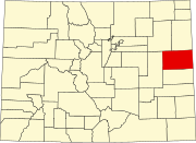 | |
| Towns | ||