
Vitória de Santo Antão
Municipality of Pernambuco | |
|---|---|
 Flag  Seal | |
| Nickname: "Victory"
"City of Braga" "Capital of the Zone da Mata" "Pitú Land " | |
| Motto: Victory | |
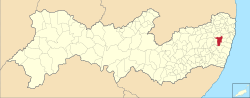 Location in the state of Pernambuco and Brazil | |
 Vitória de Santo Antão Location in Brazil | |
| Coordinates: 08°07′35″S 35°18′27″W / 8.12639°S 35.30750°W | |
| Country | Brazil |
| Region | Northeast Region |
| State | Pernambuco |
| Government | |
| • Mayor | Paulo Roberto(MDB) |
| Area | |
| • Total | 335.941 km2 (129.708 sq mi) |
| Elevation | 165 m (541 ft) |
| Population (2020 [2]) | |
| • Total | 140.389 |
| • Density | 0.42/km2 (1.1/sq mi) |
| Time zone | UTC−3 (BRT) |
Vitória de Santo Antão is a city in Pernambuco State, Brazil, 46 kilometers west of Recife. Its territorial area is 335,942 km², 5,717 km² of which lies within the urban perimeter. In 2021, the Brazilian Institute of Geography and Statistics (IBGE) estimated its population at approximately 140 389 inhabitants, being the tenth most populous city in Pernambuco, the fourth most populous in the interior of the state and the most populous in Zona da Mata. According to the Firjan Municipal Development Index (IFDM), Vitória de Santo Antão was elected the 8th best city of Pernambuco to live in.
Synopsis
Its predominant native vegetation is Atlantic forest, although much of its green landscape has been replaced by sugarcane monoculture. With approximately 87.2% of the population living in the urban area of the municipality, the city had 57 health facilities in 2009. Its Human Development Index is 0.640 and is considered medium.(8°07′S 35°18′W / 8.12°S 35.3°W).
It was founded by a Portuguese man from Cape Verde named António Diogo de Braga in 1626. In 1774 it became a village with 4,000 inhabitants. In 1811 it was promoted into a city by royal decree of Dom João IV.
Geography
- State - Pernambuco
- Region - Zona da mata Pernambucana(-2018)
- Intermediate Geographic Region of Recife.(2018–Present)
- Boundaries - Glória do Goitá and Chã de Alegria (N); Primavera and Escada (S); Pombos (W); Moreno, Cabo de Santo Agostinho and São Lourenço da Mata (E)
- Area - 371.8 km2
- Elevation - 156 m
- Hydrography - Capibaribe, Ipojuca and Tapacurá
- Vegetation - Subperenifólia forest
- Climate - Hot tropical and humid
- Annual average temperature - 23.4 c
- Distance to Recife - 45 km
Climate
With a hot and humid climate, the city is concentrated on the Borborema plateau, in the mountainous region of Pernambuco.
The average temperature is 23.8 °C. It has rainy and mild winters with temperatures between 13 °C and 18 °C. In summer the highs are up to 32° in regions west of the city.
Economy
The main economic activities in Vitoria de Santo Antão are based in commerce, food and beverage industry (including the traditional Pitú cachaça), and primary sector especially sugarcane, lemons and cattle.
It has the 8th largest economy in Pernambuco, has an industrial pole with some of the largest companies in the world. There is also Victory Park Shopping, the shopping mall in the region.
The city also has a tradition in agriculture.
Economic Indicators
| Population[3] | GDP x(1000 R$).[4] | GDP pc (R$) | PE |
|---|---|---|---|
| 126.399 | 745.504 | 6.149 | 1.22% |
Economy by Sector 2006
| Primary sector | Secondary sector | Service sector |
|---|---|---|
| 4.91% | 27.64% | 67.45% |
Health Indicators
| HDI (2000) | Hospitals (2007) | Hospitals beds (2007) | Children's Mortality every 1000 (2005) |
|---|---|---|---|
| 0.663 | 5 | 494 | 15.6 |
References
- ^ "Brazilian Institute of Geography and Statistics" (in Portuguese). 2017. Retrieved 27 March 2019.
2018 Area Total
- ^ IBGE 2020
- ^ http://www.ibge.gov.br/home/estatistica/populacao/estimativa2009/POP2009_DOU.pdf IBGE Population 2009 Vitoria de Santo Antao, page 35]
- ^ Vitoria de Santo Antão 2007 GDP IBGE page 32 Archived March 4, 2016, at the Wayback Machine
- ^ PE State site - City by city profile Archived August 4, 2009, at the Wayback Machine
Capital: Recife | ||||||||||||||
| Mesoregion Agreste Pernambucano |
|  | ||||||||||||
| Mesoregion Mata Pernambucana |
| |||||||||||||
| Mesoregion Metropolitana de Recife |
| |||||||||||||
| Mesoregion Sao Francisco Pernambucano |
| |||||||||||||
| Mesoregion Sertão Pernambucano |
| |||||||||||||
| International | |
|---|---|
| National | |
This Pernambuco, Brazil location article is a stub. You can help Wikipedia by expanding it. |