
Vincenzo A. Sagun | |
|---|---|
| Municipality of Vincenzo A. Sagun | |
 Municipal Hall | |
 Flag  Seal | |
| Nickname: Sagun | |
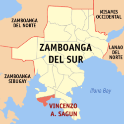 Map of Zamboanga del Sur with Vincenzo A. Sagun highlighted | |
OpenStreetMap  | |
 Vincenzo A. Sagun Location within the Philippines | |
| Coordinates: 7°30′53″N 123°10′15″E / 7.5147°N 123.1708°E | |
| Country | Philippines |
| Region | Zamboanga Peninsula |
| Province | Zamboanga del Sur |
| District | 2nd district |
| Founded | 17 May 1982 |
| Named for | Vincenzo A. Sagun |
| Barangays | 14 (see Barangays) |
| Government | |
| • Type | Sangguniang Bayan |
| • Mayor | Jeffry P. Maata |
| • Vice Mayor | Noel D. Reales |
| • Representative | Jeyzel Victoria C. Yu |
| • Municipal Council | Members |
| • Electorate | 15,227 voters (2022) |
| Area | |
| • Total | 63.00 km2 (24.32 sq mi) |
| Elevation | 102 m (335 ft) |
| Highest elevation | 421 m (1,381 ft) |
| Lowest elevation | 0 m (0 ft) |
| Population (2020 census)[3] | |
| • Total | 24,852 |
| • Density | 390/km2 (1,000/sq mi) |
| • Households | 5,791 |
| Economy | |
| • Income class | 5th municipal income class |
| • Poverty incidence | 30.81 |
| • Revenue | ₱ 99.15 million (2020) |
| • Assets | ₱ 292.3 million (2020) |
| • Expenditure | ₱ 94.48 million (2020) |
| • Liabilities | ₱ 45.15 million (2020) |
| Service provider | |
| • Electricity | Zamboanga del Sur 1 Electric Cooperative (ZAMSURECO 1) |
| Time zone | UTC+8 (PST) |
| ZIP code | 7036 |
| PSGC | |
| IDD : area code | +63 (0)62 |
| Native languages | Subanon Cebuano Chavacano Tagalog |
| Website | zds-vsagun |
Vincenzo A. Sagun, officially the Municipality of Vincenzo A. Sagun (Cebuano: Lungsod sa Vincenzo A. Sagun; Subanen: Benwa Vincenzo A. Sagun; Chavacano: Municipalidad de Vincenzo A. Sagun; Tagalog: Bayan ng Vincenzo A. Sagun), is a 5th class municipality in the province of Zamboanga del Sur, Philippines. According to the 2020 census, it has a population of 24,852 people.[3]
The municipality is named after Zamboanga del Sur Governor and Representative Vincenzo Sagun.
YouTube Encyclopedic
-
1/1Views:1 338
-
TRITON ISLAND (VICENCIO SAGUN) ZAMBOANGA DEL SUR || LakWatchEro
Transcription
History
The municipality was created as Vincenzo Sagun through Batas Pambansa Blg. 173 which was approved on February 8, 1982; thirteen barangays in Margosatubig had been separated with Cabatan designated the seat of government.[5] A plebiscite for ratification, along with ten more newly-created local entities including Roseller Lim (now in Zamboanga Sibugay), was held on May 17, coinciding with the barangay elections.[6]
Government expenses was minimized relative to this political exercise. Majority of the electorate of the affected barangays voted in favor of the creation of the municipality.
Geography
Vicenzo A. Sagun is a coastal municipality that is found in the southern section of Zamboanga del Sur. It is in the Baganian Peninsula, some 60 kilometers northwest of the province's capital of Pagadian City. As for its boundaries, the municipality of Margosatubig can be found on the north, while the south is occupied by Maligay Bay and Dumanquilas Bay, on the southeast and the southwest, respectively. The municipality of Dimataling cradles it on the east. The total area of Vincenzo A. Sagun makes up 8.15% of Zamboanga del Sur's area, and .041% of the whole Zamboanga Peninsula Region.
Of the 14 barangays that Vincenzo Sagun has, 11 of them are coastal, and most of the inhabitants are fisherfolk by trade and livelihood. The municipality is noted for its rich marine resources, with some parts being groomed to be prime tourist aquatic spot. One of the Vincenzo Sagun's featured products are the dried fish which are usually exported to the other provinces.
Climate
| Climate data for Vincenzo A. Sagun, Zamboanga del Sur | |||||||||||||
|---|---|---|---|---|---|---|---|---|---|---|---|---|---|
| Month | Jan | Feb | Mar | Apr | May | Jun | Jul | Aug | Sep | Oct | Nov | Dec | Year |
| Mean daily maximum °C (°F) | 30 (86) |
31 (88) |
32 (90) |
32 (90) |
30 (86) |
29 (84) |
28 (82) |
28 (82) |
29 (84) |
29 (84) |
30 (86) |
30 (86) |
30 (86) |
| Mean daily minimum °C (°F) | 21 (70) |
21 (70) |
22 (72) |
23 (73) |
24 (75) |
24 (75) |
23 (73) |
23 (73) |
23 (73) |
23 (73) |
23 (73) |
21 (70) |
23 (73) |
| Average precipitation mm (inches) | 22 (0.9) |
18 (0.7) |
23 (0.9) |
24 (0.9) |
67 (2.6) |
120 (4.7) |
132 (5.2) |
156 (6.1) |
119 (4.7) |
124 (4.9) |
54 (2.1) |
24 (0.9) |
883 (34.6) |
| Average rainy days | 9.4 | 9.1 | 11.5 | 11.9 | 20.1 | 22.5 | 22.4 | 23.2 | 21.5 | 22.2 | 15.7 | 11.5 | 201 |
| Source: Meteoblue[7] | |||||||||||||
Barangays
Vincenzo A. Sagun is politically subdivided into 14 barangays. Each barangay consists of puroks while some have sitios.
- Ambulon
- Biu-os
- Cogon
- Danan
- Kabatan (Poblacion)
- Kapatagan
- Limason
- Linoguayan
- Lumbal
- Lunib
- Maculay
- Maraya
- Sagucan
- Walingwaling
Demographics
| Year | Pop. | ±% p.a. |
|---|---|---|
| 1990 | 17,294 | — |
| 1995 | 17,410 | +0.13% |
| 2000 | 19,072 | +1.97% |
| 2007 | 19,984 | +0.65% |
| 2010 | 20,583 | +1.08% |
| 2015 | 23,759 | +2.77% |
| 2020 | 24,852 | +0.89% |
| Source: Philippine Statistics Authority[8][9][10][11] | ||
Economy
Education
College
- Josephina H. Cerilles State College-Vincenzo Sagun External Studies Unit
High schools
- Cogon National High School
- Judge Edmundo S. Pinga National High School
- Kabatan National High School
- Sagucan National High School
References
- ^ Municipality of Vincenzo A. Sagun | (DILG)
- ^ "2015 Census of Population, Report No. 3 – Population, Land Area, and Population Density" (PDF). Philippine Statistics Authority. Quezon City, Philippines. August 2016. ISSN 0117-1453. Archived (PDF) from the original on May 25, 2021. Retrieved July 16, 2021.
- ^ a b Census of Population (2020). "Region IX (Zamboanga Peninsula)". Total Population by Province, City, Municipality and Barangay. Philippine Statistics Authority. Retrieved 8 July 2021.
- ^ "PSA Releases the 2018 Municipal and City Level Poverty Estimates". Philippine Statistics Authority. 15 December 2021. Retrieved 22 January 2022.
- ^ "Batas Pambansa Blg. 173". The Lawphil Project. Arellano Law Foundation. February 8, 1982. Retrieved March 24, 2022.
- ^ "Proclamation No. 2188, s. 1982". Official Gazette (Philippines). Government of the Philippines. April 29, 1982. Retrieved March 24, 2022.
- ^ "Vincenzo A. Sagun: Average Temperatures and Rainfall". Meteoblue. Retrieved 1 May 2020.
- ^ Census of Population (2015). "Region IX (Zamboanga Peninsula)". Total Population by Province, City, Municipality and Barangay. Philippine Statistics Authority. Retrieved 20 June 2016.
- ^ Census of Population and Housing (2010). "Region IX (Zamboanga Peninsula)" (PDF). Total Population by Province, City, Municipality and Barangay. National Statistics Office. Retrieved 29 June 2016.
- ^ Censuses of Population (1903–2007). "Region IX (Zamboanga Peninsula)". Table 1. Population Enumerated in Various Censuses by Province/Highly Urbanized City: 1903 to 2007. National Statistics Office.
{{cite encyclopedia}}: CS1 maint: numeric names: authors list (link) - ^ "Province of Zamboanga del Sur". Municipality Population Data. Local Water Utilities Administration Research Division. Retrieved 17 December 2016.
- ^ "Poverty incidence (PI):". Philippine Statistics Authority. Retrieved December 28, 2020.
- ^ "Estimation of Local Poverty in the Philippines" (PDF). Philippine Statistics Authority. 29 November 2005.
- ^ "2003 City and Municipal Level Poverty Estimates" (PDF). Philippine Statistics Authority. 23 March 2009.
- ^ "City and Municipal Level Poverty Estimates; 2006 and 2009" (PDF). Philippine Statistics Authority. 3 August 2012.
- ^ "2012 Municipal and City Level Poverty Estimates" (PDF). Philippine Statistics Authority. 31 May 2016.
- ^ "Municipal and City Level Small Area Poverty Estimates; 2009, 2012 and 2015". Philippine Statistics Authority. 10 July 2019.
- ^ "PSA Releases the 2018 Municipal and City Level Poverty Estimates". Philippine Statistics Authority. 15 December 2021. Retrieved 22 January 2022.
External links
- Vincenzo A. Sagun Profile at PhilAtlas.com
- Philippine Standard Geographic Code
- Philippine Census Information
Places adjacent to Vincenzo A. Sagun | ||||||||||||||||
|---|---|---|---|---|---|---|---|---|---|---|---|---|---|---|---|---|
| ||||||||||||||||
| Municipalities | |
|---|---|
| Component city | |
| Highly urbanized city |
|