
Vienna Township | |
|---|---|
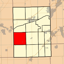 Location in Grundy County | |
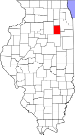 Grundy County's location in Illinois | |
| Coordinates: 41°14′41″N 88°31′55″W / 41.24472°N 88.53194°W | |
| Country | United States |
| State | Illinois |
| County | Grundy |
| Established | November 6, 1849 |
| Area | |
| • Total | 35.67 sq mi (92.4 km2) |
| • Land | 35.65 sq mi (92.3 km2) |
| • Water | 0.02 sq mi (0.05 km2) 0.06% |
| Elevation | 640 ft (195 m) |
| Population (2010) | |
| • Estimate (2016)[1] | 673 |
| • Density | 19.3/sq mi (7.5/km2) |
| Time zone | UTC-6 (CST) |
| • Summer (DST) | UTC-5 (CDT) |
| ZIP codes | 60437, 60444, 60450, 60479, 61360 |
| FIPS code | 17-063-77850 |
Vienna Township is one of seventeen townships in Grundy County, Illinois, USA. As of the 2010 census, its population was 687 and it contained 266 housing units.[2]
Geography
According to the 2010 census, the township has a total area of 35.67 square miles (92.4 km2), of which 35.65 square miles (92.3 km2) (or 99.94%) is land and 0.02 square miles (0.052 km2) (or 0.06%) is water.[2]
Cities, towns, villages
Unincorporated towns
(This list is based on USGS data and may include former settlements.)
Demographics
| Census | Pop. | Note | %± |
|---|---|---|---|
| 2016 (est.) | 673 | [1] | |
| U.S. Decennial Census[3] | |||
Political districts
- Illinois' 11th congressional district
- State House District 75
- State Senate District 38
References
- "Vienna Township, Grundy County, Illinois". Geographic Names Information System. United States Geological Survey, United States Department of the Interior. Retrieved January 17, 2010.
- United States Census Bureau 2007 TIGER/Line Shapefiles
- United States National Atlas
- ^ a b "Population and Housing Unit Estimates". Retrieved June 9, 2017.
- ^ a b "Population, Housing Units, Area, and Density: 2010 - County -- County Subdivision and Place -- 2010 Census Summary File 1". United States Census. Archived from the original on February 12, 2020. Retrieved May 28, 2013.
- ^ "Census of Population and Housing". Census.gov. Retrieved June 4, 2016.
External links
Places adjacent to Vienna Township, Grundy County, Illinois | |
|---|---|
Municipalities and communities of Grundy County, Illinois, United States | ||
|---|---|---|
| Cities |  | |
| Villages | ||
| Townships | ||
| Unincorporated communities | ||
| Ghost towns | ||
| Footnotes | ‡This populated place also has portions in an adjacent county or counties | |