
Vidora | |
|---|---|
 Main Street Vidora 2010 | |
| Motto: "The Place to Be" (1910s) | |
 Vidora  Vidora | |
| Coordinates: 49°19′38″N 109°24′30″W / 49.3272°N 109.4084°W | |
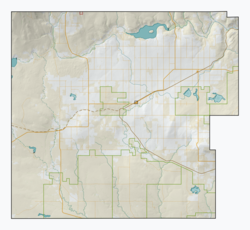
| Country | Canada |
| Province | Saskatchewan |
| Region | Southwest |
| Rural municipality | Reno No. 51 |
| Established | 1910 |
| Incorporated (Village) | 1917 |
| Restructured (Unincorporated) | January 1, 1952 |
| Government | |
| • Reeve | Brian McMillan |
| • Administrator | Lacelle Kim |
| • Governing body | Reno No. 51 |
| • MLA | Doug Steele |
| • MP | Jeremy Patzer |
| Population (1920) | |
| • Total | 200 |
| Postal code | S0N 2W0 |
| Area code | 306 |
| Highways | Highway 13 |
| Railways | Great Western Railway |
| [1][2][3][4] | |
Vidora is an unincorporated community within the Rural Municipality of Reno No. 51, Saskatchewan, Canada. The community once had a population of 200 people in 1940 and has since declined to 1 resident. It previously held village status until it was dissolved as an unincorporated community on January 1, 1952. The community is located between Robsart and Consul on highway 21 & highway 13 known as the Red Coat Trail. Very little remains of the former village, only one home that is also used as a post office still stands as of 2008. There are many cement foundations and sidewalks still found scattered around the town site, including the remnants of the old bank vault to the former Municipality Office that was moved to Consul.
YouTube Encyclopedic
-
1/1Views:820
-
Vidora, Saskatchewan
Transcription
History

In 1910 construction of the Canadian Pacific Railway line came through Vidora. Many of the CPR's engineers and surveyors were housed at a local farm house during construction of the rail line. Living at the same house where two girls named "Vivian" and "Dorothy", the engineers and surveyors decided to use their names to name the new area, because of their great hospitality, thus giving the town its name "Vidora". After the land was named, settlers as well as bootleggers began to settle the area starting the community of Vidora. By 1917, the community was incorporated as a village, and now had its very own town Council, and mayor. After becoming a village, Vidora began to grow quite fast and prosperous. By 1920, the village business districts consist of more than twenty businesses, including businesses such as a post office, cafe, pool hall, main hall, banks, lumber yards, general stores, a hotel and a spectacular row of 5 grain elevators. Vidora even had its very own electrical power plant, powering the whole town.
Prior to January 1, 1952, Vidora was incorporated as a village, and was restructured as an unincorporated community under the jurisdiction of the Rural municipality of Reno on that date.[5]
Prohibition
Like most towns throughout Alberta and Saskatchewan, Vidora began as a small parcel of land owned by the Canadian Pacific Railway. Like many towns of southwest Alberta and Saskatchewan such as Govenlock, Senate and Whiskey Gap, Alberta Vidora had a fair amount of bootleggers, that came into the area to smuggle rum, alcohol, and whisky across the border during Prohibition in the United States.
The Great Depression

Vidora's future looked promising but due to the Great Depression years, with accompanying droughts, falling grain prices and poor crop yields, Vidora's population slowly began to decline. Beginning in 1924 a devastating fire destroyed many important businesses including Vidora's first store, post office, cafe, pool hall and main hall. Then in 1926 and 1928 more vital businesses would also be wiped out by fire. In 1936 the CPR station closed and afterwards moved to Frontier. In 1961 the Vidora General Store was moved to Robsart, then in 1969 the rural municipal office was also moved to Consul as did the Vidora Community Hall in 1976. To mark the end of its long prosperous life, Vidora's five grain elevators closed and were torn down sometime in the 1970s or 1980s.
Notable people
- Lee Morrison (born 6 March 1932) was a member of the House of Commons of Canada from 1993 to 2000.
See also
- List of communities in Saskatchewan
- List of ghost towns in Canada
- Ghost towns in Saskatchewan
- List of geographic names derived from portmanteaus
- Prohibition in Canada
References
- ^ National Archives, Archivia Net, Post Offices and Postmasters, archived from the original on 6 October 2006, retrieved 18 January 2008
- ^ Government of Saskatchewan, MRD Home, Municipal Directory System, archived from the original on 21 November 2008
- ^ Canadian Textiles Institute. (2005), CTI Determine your provincial constituency, archived from the original on 11 September 2007
- ^ Commissioner of Canada Elections, Chief Electoral Officer of Canada (2005), Elections Canada On-line
- ^ "Restructured Villages". Saskatchewan Ministry of Municipal Affairs. Archived from the original on 25 March 2008. Retrieved 10 February 2008.
Places adjacent to Vidora | |
|---|---|
Subdivisions of Saskatchewan | |
|---|---|
| Subdivisions | |
| Communities | |
| Cities | |
| Topics | |

49°19′38″N 109°24′30″W / 49.3272°N 109.4084°W