
Veyo, Utah | |
|---|---|
 | |
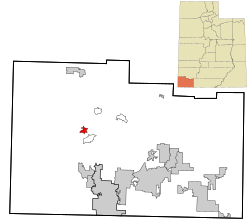 Location in Washington County and the State of Utah | |
| Coordinates: 37°20′34″N 113°42′12″W / 37.34278°N 113.70333°W | |
| Country | United States |
| State | Utah |
| County | Washington |
| Elevation | 4,472 ft (1,363 m) |
| Population | |
| • Total | 483 |
| Time zone | UTC-7 (Mountain (MST)) |
| • Summer (DST) | UTC-6 (MDT) |
| ZIP code | 84782 |
| Area code | 435 |
| GNIS feature ID | 2629956[1] |
Veyo is a census-designated place in western Washington County, Utah, United States,[1] on the edge of the Dixie National Forest. The population was 483 at the 2010 census. The town lies along State Route 18 north of the city of St. George.[3][4]
History
Veyo became a distinct community from Gunlock in 1918. One tradition says the community name is an acronym of virtue, enterprise, youth, and order; another says it combines verdure and youth. There is a town of Veyo in Spain that is also referred to as La Peña, which means "rocky outcrop".[5]
Geography
The elevation of Veyo is 4,485 feet (1,367 m).[1]
Climate
According to the Köppen Climate Classification system, Veyo has a semi-arid climate, abbreviated "BSk" on climate maps.[6]
Demographics
| Census | Pop. | Note | %± |
|---|---|---|---|
| 1920 | 79 | — | |
| 1930 | 167 | 111.4% | |
| 1940 | 114 | −31.7% | |
| 1950 | 84 | −26.3% | |
| 2010 | 483 | — | |
| Source: U.S. Census Bureau[7] | |||
As of the census[2] of 2010, there were 483 people living in the CDP. There were 193 housing units. The racial makeup of the town was 94.6% White, 0.8% American Indian and Alaska Native, 0.4% Asian, 0.2% Native Hawaiian and Other Pacific Islander, 2.3% from some other race, and 1.7% from two or more races. Hispanic or Latino of any race were 5.2% of the population.
Government
Although Veyo is unincorporated, it has a post office with the ZIP code of 84782.[8]
See also
References
- ^ a b c d U.S. Geological Survey Geographic Names Information System: Veyo, Utah
- ^ a b "U.S. Census website". United States Census Bureau. Retrieved May 23, 2011.
- ^ "MyTopo Maps - Veyo, UT, USA" (Map). mytopo.com. Trimble Navigation, Ltd. Retrieved March 18, 2018.
- ^ Rand McNally. The Road Atlas '08. Chicago: Rand McNally, 2008, p. 102.
- ^ Van Cott, John W. (1990). Utah Place Names: A Comprehensive Guide to the Origins of Geographic Names: A Compilation. Salt Lake City: University of Utah Press. p. 384. ISBN 978-0-87480-345-7. OCLC 797284427. Retrieved March 18, 2018.
- ^ Climate Summary for Veyo, Utah
- ^ "Census of Population and Housing". census.gov. United States Census Bureau. Retrieved 18 November 2011.
- ^ Zip Code Lookup
External links
![]() Media related to Veyo, Utah at Wikimedia Commons
Media related to Veyo, Utah at Wikimedia Commons
Municipalities and communities of Washington County, Utah, United States | ||
|---|---|---|
| Cities |  | |
| Towns | ||
| CDPs | ||
| Unincorporated communities | ||
| Ghost towns | ||
| Indian reservation | ||
| Footnotes | ‡This populated place also has portions in an adjacent county or counties | |
| International | |
|---|---|
| National | |