
| Varaždin County | |||||||
|---|---|---|---|---|---|---|---|
| County of the Kingdom of Croatia-Slavonia | |||||||
| 12th century–1922 | |||||||
 Coat of arms
| |||||||
 Location of Varaždin County (yellow) within the Kingdom of Croatia-Slavonia (green) | |||||||
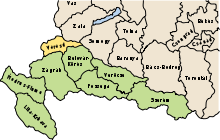
 Early 20th century map of Varaždin County | |||||||
| Capital | Varaždin | ||||||
| Area | |||||||
| • Coordinates | 46°18′N 16°20′E / 46.300°N 16.333°E | ||||||
• 1910 | 2,521 km2 (973 sq mi) | ||||||
| Population | |||||||
• 1910 | 307010 | ||||||
| History | |||||||
• Established | 12th century | ||||||
• Treaty of Trianon | 4 June 1920 | ||||||
• Disestablished | 1922 | ||||||
| |||||||
| Today part of | Croatia | ||||||
Varaždin County (Croatian: Varaždinska županija; Hungarian: Varasd vármegye) was an administrative subdivision (županija) of the Kingdom of Croatia-Slavonia. Croatia-Slavonia was an autonomous kingdom within the Lands of the Crown of Saint Stephen (Transleithania), the Hungarian part of the dual Austro-Hungarian Empire. Its territory is now in northern Croatia. The capital of the county was Varaždin (Croatian, in Hungarian: Varasd).[1]
YouTube Encyclopedic
-
1/3Views:3743 1722 464
-
Varazdin County by TouristarTV
-
Varazdin, Croatia
-
Trakoscan - Part 1
Transcription
Geography
Varaždin County shared borders with the Austrian land Styria, the Hungarian county of Zala, and the Croatian-Slavonian county of Bjelovar-Križevci and Zagreb. The river Drava formed its northern border.[2] Its area was 2521 km² around 1910.
History
The territory of Varaždin County was part of the Kingdom of Croatia when it entered a personal union with the Kingdom of Hungary in 1102, and with it became part of the Habsburg monarchy in 1526. After 1607, the position of the county's župan was hereditary, given to the Erdődy noble family.[3] Until the 18th century it was part of the Varaždin Generalate of the Military Frontier.
In 1850, following the revolutions of 1848, Varaždin County gained Međimurje from the Hungarian Zala County (except for the area around Legrad, which went to Križevci County). It was divided into four (political) districts ((politische) Bezirke):[4]
In 1854, as part of Bach's absolutism, it was restructured again, absorbing much of Križevci County. The 1850 districts were replaced with a different system (still referred to as Bezirke but functionally different).[5]
The cities of Kreutz (Križevci), Kopreinitz (Koprivnica) and Warasdin/Varasdin (Varaždin) themselves were city-districts (Stadtbezirke) separate from the districts listed above (which were Landbezirke).
Its territory was restored to its pre-1850 state in 1860.

In 1871 the Varaždin Generalate of the Military Frontier was integrated into Croatia-Slavonia. As a result the territory of the surrounding counties was altered; Varaždin County gained some territory from both Zagreb and Križevci Counties. In 1886 its territory was altered again, with some returned to Zagreb and some more gained from Križevci (which became part of Bjelovar-Križevci County in the same reform). This configuration would remain in place until the county's dissolution.
In 1918 Croatia-Slavonia de facto seceded from Austria-Hungary as part of the State of Slovenes, Croats and Serbs, which joined the Kingdom of Serbs, Croats and Slovenes (later renamed to Yugoslavia) soon after. This was recognised in the 1920 Treaty of Trianon. The county was formally abolished in 1922 when the Vidovdan Constitution came into force. Since 1991, when Croatia became independent from Yugoslavia, the county is part of the Republic of Croatia.[6]
Demographics
In 1900, the county had a population of 279,448 people and was composed of the following linguistic communities:[7]
Total:
- Croatian: 270,897 (96.9%)
- Serbian: 2,464 (0.9%)
- German: 1,654 (0.6%)
- Hungarian: 1,061 (0.4%)
- Slovak: 126 (0.0%)
- Ruthenian: 4 (0.0%)
- Romanian: 1 (0.0%)
- Other or unknown: 3,241 (1.2%)
According to the census of 1900, the county was composed of the following religious communities:[8]
Total:
- Roman Catholic: 275,111 (98.5%)
- Serbian Orthodox: 2,502 (0.9%)
- Jewish: 1,612 (0.6%)
- Lutheran: 161 (0.0%)
- Calvinist: 31 (0.0%)
- Greek Catholic: 26 (0.0%)
- Unitarian: 0 (0.0%)
- Other or unknown: 5 (0.0%)
In 1910, the county had a population of 307,010 people and was composed of the following linguistic communities:[9]
Total:
- Croatian: 300,033 (97.7%)
- Serbian: 2,384 (0.8%)
- German: 1,172 (0.4%)
- Hungarian: 1,095 (0.4%)
- Slovak: 41 (0.0%)
- Ruthenian: 0 (0.0%)
- Romanian: 2 (0.0%)
- Other or unknown: 2,283 (0.7%)
According to the census of 1910, the county was composed of the following religious communities:[10]
Total:
- Roman Catholic: 303,038 (98.7%)
- Serbian Orthodox: 2,409 (0.8%)
- Jewish: 1,341 (0.4%)
- Lutheran: 114 (0.0%)
- Calvinist: 42 (0.0%)
- Greek Catholic: 61 (0.0%)
- Unitarian: 0 (0.0%)
- Other or unknown: 5 (0.0%)
Subdivisions
In the early 20th century, the subdivisions of Varasd county were:
| Districts | |
|---|---|
| District | Capital |
| Ivanec | Ivanec |
| Klanjec | Klanjec |
| Krapina | Krapina |
| Ludbreg | Ludbreg |
| Novi Marof | Novi Marof |
| Pregrada | Pregrada |
| Varasd | Varaždin |
| Zlatar | Zlatar |
| Urban counties | |
| Varaždin | |
See also
- Current Varaždin County
Notes
- ^ Oliver, Jeanne (January 1, 2007). Croatia. Lonely Planet. ISBN 9781741044751.
- ^ Abraham, Rudolf (January 1, 2011). National Geographic Traveler: Croatia. National Geographic Society. ISBN 9781426207099.
- ^ Ivana Horbec (September 2010). "Slavonske županije između Banske Hrvatske i Mađarske: uspostava civilne uprave i pitanje poreznog sustava u 18. stoljeću" [Slavonia between Croatian and Hungarian kingdom: The establishment of county administration and the tax system issue in the 18th century]. Arhivski Vjesnik (in Croatian). Croatian State Archives (53): 180. Retrieved September 7, 2012.
- ^ Gesetz vom 12. Juni 1850, RGBl. 245/1850: "Verordnung des Ministeriums des Innern vom 12. Juni 1850, betreffend die Organisirung der politischen Verwaltungsbehörden im Königreiche Croatien und Slavonien". Reichs-Gesetz-Blatt für das Kaiserthum Österreich (in German). June 12, 1850. Retrieved September 4, 2023 – via ÖNB-ALEX - Historische Rechts- und Gesetztexte Online.
- ^ Gesetz vom 3. Juni 1854, RGBl. 136/1854: "Verordnung der Ministerien des Innern, der Justiz und der Finanzen vom 3. Juni 1854, betreffend die politische und gerichtliche Organisirung der Königreiche Kroatien und Slawonien". Reichs-Gesetz-Blatt für das Kaiserthum Österreich (in German). June 3, 1854. Retrieved September 4, 2023 – via ÖNB-ALEX - Historische Rechts- und Gesetztexte Online.
- ^ Ethnic Groups and Population Changes in Twentieth-Century Central-Eastern Europe. M.E. Sharpe. ISBN 9780765618337.
- ^ "KlimoTheca :: Könyvtár". Kt.lib.pte.hu. Retrieved December 6, 2012.
- ^ "KlimoTheca :: Könyvtár". Kt.lib.pte.hu. Retrieved December 6, 2012.
- ^ "KlimoTheca :: Könyvtár". Kt.lib.pte.hu. Retrieved December 6, 2012.
- ^ "KlimoTheca :: Könyvtár". Kt.lib.pte.hu. Retrieved December 6, 2012.

| History | Siege of Varaždin (1527) · Varaždin Generalate · 1776 Fire · Croatian Royal Council · Varaždin County (1850–1924) · Liberation of the Varaždin barracks (1991) · Varaždin County |  |
|---|---|---|
| Memorials and landmarks | Old City · County Palace · Patačić Palace · Prašinski–Sermage Palace · Town Hall · Croatian National Theatre · Town Museum · Cemetery | |
| Church buildings | Cathedral · St. Nicholas Church · Franciscan monastery and St. John the Baptist Church · Ursuline monastery and Nativity of Jesus Church · Capuchine monastery and Holy Trinity Church · St. Florian Church | |
| Culture | Špancirfest · Varaždin Baroque Evenings · Town Guard · Good Shepherd Festival | |
| Education | ||
| Sport | ||
| Nature | Vindija Cave · Drava Park-Forest | |
| International | |
|---|---|
| National | |