
Aran | |
|---|---|
 Panorama of Aran, with Bossòst to the left | |
 Coat of arms | |
| Anthem: Montanhes araneses (Occitan) "Aranese mountains" | |
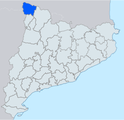 Location of Aran in Catalonia | |
| Country | |
| Autonomous community | |
| Region | Alt Pirineu i Aran |
| Province | Lleida |
| Capital | Vielha e Mijaran |
| Municipalities | |
| Government | |
| • Body | Conselh Generau d'Aran |
| • Síndic d'Aran | Maria Vergés Pérez (UA-PSC) |
| Area | |
| • Total | 633.5 km2 (244.6 sq mi) |
| Population (2014) | |
| • Total | 9,993 |
| • Density | 16/km2 (41/sq mi) |
| Demonyms | |
| Time zone | UTC+1 (CET) |
| • Summer (DST) | UTC+2 (CEST) |
| Largest municipality | Vielha e Mijaran |
| Official languages | |
| Website | Conselh Generau d'Aran |

Aran (Occitan: [aˈɾan]; Catalan: [əˈɾan]; Spanish: [aˈɾan]) (often known as the Aran Valley, or Val d'Aran in Aranese Occitan;[1][2][3][4][5] in other forms of Occitan: Vath d'Aran or Vau d'Aran, in Catalan: Vall d'Aran, in Spanish: Valle de Arán) is an autonomous administrative entity (formerly considered a comarca) in northwest Catalonia, Spain, consisting of 620.47 square kilometres (239.56 sq mi) in area, located in the Pyrenees mountains, in the Alt Pirineu i Aran region and in the province of Lleida. The capital is Vielha e Mijaran.
This valley constitutes the only contiguous part of Catalonia located on the northern side of the Pyrenees. Hence, this valley holds the only Catalan rivers to flow into the Atlantic Ocean (for the same reason, the region is characterized by an Atlantic climate, instead of a Mediterranean one). The Garonne river flows through Aran from its source on the Pla de Beret (Beret Flat) near the Port de la Bonaigua. It is joined by the Joèu river (from the slopes of Aneto mountain) which passes underground at the Forau d'Aigualluts.[6] It then reappears in the Val dera Artiga de Lin before reaching the Aran valley, then through France and eventually to the Atlantic Ocean. The Noguera Pallaresa river, whose source is only a hundred meters from that of the Garonne, flows the opposite way towards the Mediterranean.
Aran borders France on the north, the Autonomous Community of Aragon to the west and the Catalan comarques of Alta Ribagorça to the south and Pallars Sobirà to the east. Its capital, Vielha e Mijaran, has 5,474 inhabitants (2014). The entire population of the valley is about 9,991 (2014). As of 2001, a plurality of people in Aran spoke Spanish (38.78%) as their native language, followed by Aranese (34.19%), then Catalan (19.45%) with 7.56% having a different native language.[7] While Aranese is the mother tongue of 62.87% of people born in the region, it is less frequent among residents born outside the valley.[8]
History
In 1313, James II of Aragon granted administrative and political autonomy to the Aran Valley, the legal details of which are described in a Latin manuscript called the Querimonia. The devolution of power was a reward for the Aranese pledging allegiance to James II in a dispute with the kingdoms of France and Mallorca over control of the valley.[9] This status was suppressed in 1834, when the Valley was integrated into the new Province of Lleida, in the context of the establishment of the Spanish provinces at the beginning of the liberal state.
On 19 October 1944, Spanish Communist Party guerrillas invaded the valley in an attempt to bring about the fall of the Spanish dictatorship. They took control of several villages until October 27, 1944, but were forced to retreat back into France after Franco sent reinforcements to defend Vielha.[10]
Before the construction of the Vielha tunnel, opened in 1948, the Aran valley had no direct communication with the south side of the mountains during winter.
In 1987 it became an administrative comarca. In 1990 the special status of Aran within Catalonia was restored by the Parliament of Catalonia, reestablishing the Conselh Generau, granting it a degree of home rule and declaring Occitan as official language. In 2015 the Catalan Parliament passed a new law which increased the powers of the Conselh Generau and recognized Aran as an "Occitan national reality".[11]
The population of Val d'Aran has generally been opposed to the Catalan independence movement due to lack of a strong Catalan identity.[11]
Name and local language
Aranese is the standardized form of the local Gascon variety of the Occitan language. Aranese has been regularly taught at school since 1984. Like several other minority languages in Europe that recently faced decline, Aranese is experiencing a renaissance.[12]
The name Aran comes from Basque haran, meaning valley. Maps and road signs in Spain use the name "era Val d'Aran" to refer to the valley, where era is the Aranese singular feminine article. The same practice goes for all towns and other locations in Aran, for example, the Aranese spelling Vielha is used instead of Catalan and Spanish Viella to refer to the capital of Aran.
Basque toponyms reveal that Basque was spoken further east along the Pyrenees than today. The growing influence of Latin began to drive Basque out after the turn of the first millennium.
Government and economy
Administratively, Aran is a "unique territorial entity" roughly equivalent to a comarca with additional powers, and informally referred to as a comarca. This status was most recently formalised in February 2015.[13] The area is divided into six administrative divisions called terçons (meaning "thirds", as there were formerly three divisions). The current arrangement of the divisions dates from the 15th century. Since 1991, Aran has an autonomous government called the Conselh Generau d'Aran (Occitan: General Council of Aran), headed by the Síndic d'Aran.
The major political parties are the Unity of Aran - Aranese Nationalist Party (the local chapter of the Socialists' Party of Catalonia), the Aranese Democratic Convergence (the local chapter of the (Democratic Convergence of Catalonia). The Occitan Republican Left party was founded in 2008.
The main economic activity in the valley is tourism; from the ski resorts in the winter and from other tourist activity in the summer. Other primary sectors of the economy include forest products, cattle ranching and agriculture, all of which have become progressively less important since the opening of ski resorts.[14]
Municipalities

| Municipality | Population (2014)[15] |
Area km2[15] |
|---|---|---|
| Arres | 73 | 11.6 |
| Bausen | 49 | 17.7 |
| Es Bòrdes | 234 | 21.4 |
| Bossòst | 1,140 | 28.2 |
| Canejan | 102 | 48.3 |
| Les | 968 | 23.4 |
| Naut Aran | 1,782 | 255.8 |
| Vielha e Mijaran | 5,474 | 211.7 |
| Vilamòs | 171 | 15.4 |
| • Total: 9 | 9,993 | 633.5 |
Fauna
Many native animals of Aran are in danger of extinction. There are programs to reintroduce and/or protect:
- Aran rock lizard (Lacerta aranica)
- Bearded vulture (Gypaetus barbatus)
- Brown bear (Ursus arctos)
- Rock ptarmigan (Lagopus mutus)
References
- ^ "Patrimoni culturau dera Val d'Aran | Conselh Generau d'Aran" (in Occitan). Retrieved 2023-05-30.
- ^ "Ua lengua oficiau | Conselh Generau d'Aran" (in Occitan). Retrieved 2023-05-30.
- ^ "Ua lengua romanica | Conselh Generau d'Aran" (in Occitan). Retrieved 2023-05-30.
- ^ "Visit Val d'Aran". Visit Val d'Aran - Val d'Aran. Era esséncia des Pirinèus, official tourist website of Val d'Aran (in Catalan). Retrieved 2023-05-30.
- ^ "Val d'Aran | Visit Pirineus (part of the official tourist website of the Generalitat de Catalunya)". www.visitpirineus.com. Retrieved 2023-05-30.
- ^ "Forau de Aigualluts ✅". Portal Benasque (in Spanish). Retrieved 2023-05-30.
- ^ "Cens lingüístic de l'aranès de 2001" (PDF). Retrieved 2012-08-06.
- ^ Cens lingüístic de l'aranès de 2001 (section 10: Llengua materna de la població de la Val d'Aran. Distribució per lloc de naixement. 2001) (in Catalan)
- ^ Turell, M. Teresa, ed. (2001). Multilingualism in Spain : sociolinguistic and psycholinguistic aspects of linguistic minority groups ([Online-Ausg.]. ed.). Clevedon [u.a.]: Multilingual Matters. p. 142. ISBN 9781853594915. Retrieved 19 August 2015.
- ^ Rodríguez Marcos, Javier. "El valle de la libertad". elpais.com (in Spanish). El Pais. Retrieved 18 August 2015.
- ^ a b Brandtjen, Roland (2021). The valley and the rock: europeanized separatism and Iberian micro-nations: secession to gain full EU-Membership?: an analysis of Gibraltar and the Val d'Aran. Schriftenreihe Schriften zur Europapolitik. Hamburg: Verlag Dr. Kovač. ISBN 978-3-339-12272-8.
- ^ Collett, Richard. "Aranese: Spain's little-known language". BBC. Retrieved 2022-01-18.
- ^ "LLEI 1/2015, del 5 de febrer, del règim especial d'Aran" (PDF) (in Catalan). Generalitat of Catalonia. 2015-02-13. Retrieved 2015-11-19.
- ^ Brandtjen, Roland (2021). The valley and the rock: europeanized separatism and Iberian micro-nations: secession to gain full EU-Membership?: an analysis of Gibraltar and the Val d'Aran. Schriftenreihe Schriften zur Europapolitik. Hamburg: Verlag Dr. Kovač. ISBN 978-3-339-12272-8.
- ^ a b "El municipi en xifres". Institut d'Estadística de Catalunya. Retrieved 2015-05-25.
External links
- Page of the Conselh Generau d'Aran (in Occitan)
- Information from the Generalitat de Catalunya (in Catalan)
- Touristic information about the Val d'Aran (in Occitan)
- Smith, Dominic. "Language planning in the Val d'Aran: The recent work of the Conselh Generau d'Aran's 'Oficina de Foment e Ensenhament der Aranés' and its effects on the Aranés-speaking population." (PDF). 2003.
Places adjacent to Val d'Aran | ||||||||||||||||
|---|---|---|---|---|---|---|---|---|---|---|---|---|---|---|---|---|
| ||||||||||||||||
Municipalities of Aran | ||
|---|---|---|
42°43′21″N 0°50′14″E / 42.72250°N 0.83722°E
| International | |
|---|---|
| National | |
| Other | |