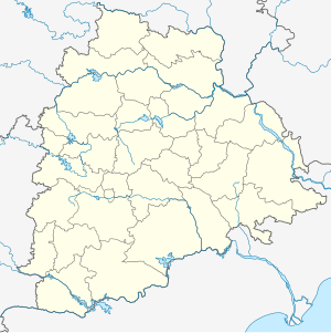
Uppal | |||||||||||
|---|---|---|---|---|---|---|---|---|---|---|---|
| General information | |||||||||||
| Location | Inner Ring Rd, Survey Colony, Industrial Development Area, Uppal, Hyderabad,Telangana 500039[1] | ||||||||||
| Coordinates | 17°23′56″N 78°33′14″E / 17.3987948°N 78.5538439°E | ||||||||||
| Line(s) | Blue Line | ||||||||||
| Tracks | 2 | ||||||||||
| Construction | |||||||||||
| Structure type | Elevated | ||||||||||
| Platform levels | 2 | ||||||||||
| History | |||||||||||
| Opened | 29 November 2017 | ||||||||||
| Services | |||||||||||
| |||||||||||
| Location | |||||||||||
Uppal metro station is located on the Blue Line of the Hyderabad Metro India.[2][3] It is near to Kendriya Vidyalaya, Uppal X Roads, Uppal Police station, Karachi Bakery, Rajlakshmi Theatre, Uppal Bus stop.[1]
YouTube Encyclopedic
-
1/3Views:1 06827 3825 894
-
Uppal main road || Metro Railway Station || PrashiModi
-
Aerial view of Nagole & Uppal Metro Rail Stations
-
LB Nagar to Uppal - Bus Journey Visuals - ComeTube
Transcription
History
It was opened on 29 November 2017.
The station
Structure
Uppal elevated metro station situated on the Blue Line of Hyderabad Metro.[1]
Station layout
- Street Level
- This is the first level where passengers may park their vehicles and view the local area map.[4]
- Concourse level
- Ticketing office or Ticket Vending Machines (TVMs) is located here. Retail outlets and other facilities like washrooms, ATMs, first aid, etc., will be available in this area.[4]
- Platform level
- This layer consists of two platforms. Trains takes passengers from this level.[4]
| G | Street level | Exit/Entrance |
| L1 | Mezzanine | Fare control, station agent, Metro Card vending machines, crossover |
| L2 | Side platform No- 1, doors will open on the left | |
| Southbound | Towards →Raidurg→ → | |
| Northbound | →Towards ← Nagole← ← | |
| Side platform No- 2, doors will open on the left | ||
| L2 | ||
Entry/exit
| Uppal station Entry/exits | ||||
|---|---|---|---|---|
| Gate No-A | Gate No-B | Gate No-C | Gate No-D | |
See also
References
- ^ a b c "Metro Stations".
- ^ Kumar, V. Rishi (5 November 2018). "Hyderabad metro to commission line up to Hitec City by year end". The Hindu Business Line. Retrieved 20 February 2020.
- ^ Sripada, Krishna (3 May 2018). "Hyderabad metro stations we keenly await". The Hindu.
- ^ a b c "Metro Stations".

