
Unnan
雲南市 | |
|---|---|
 Unnan city hall | |
 Flag  Emblem | |
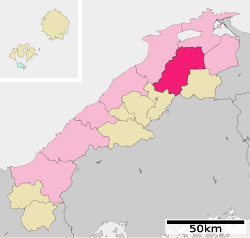
 Location of Unnan in Shimane Prefecture | |
 | |
 Unnan Location in Japan | |
| Coordinates: 35°18′28″N 132°54′01″E / 35.30778°N 132.90028°E | |
| Country | Japan |
| Region | Chūgoku (San'in) |
| Prefecture | Shimane |
| Kisuki town settled | April 1, 1891 |
| Kamo town settled | May 1, 1934 |
| Both town merged and city settled | November 1, 2004 |
| Government | |
| • Mayor | Atsushi Ishitobi (from January 2021) |
| Area | |
| • Total | 553.18 km2 (213.58 sq mi) |
| Population (July 31, 2023) | |
| • Total | 35,279 |
| • Density | 64/km2 (170/sq mi) |
| Time zone | UTC+09:00 (JST) |
| City hall address | 521-1 Satokata, Kisuki-cho, Unnan-shi, Shimane-ken 699-1392 |
| Climate | Cfa |
| Website | Official website |
| Symbols | |
| Flower | Sakura |
| Tree | Ginkgo biloba |


Unnan (雲南市, Unnan-shi) is a city located in Shimane Prefecture, Japan. As of 31 July 2023[update], the city had an estimated population of 35,279 in 13575 households and a population density of 64 persons per km2.[1] The total area of the city is 553.18 square kilometres (213.58 sq mi).
Geography
Unnan City is located in southeastern Shimane Prefecturem with the southern areas in the Chugoku Mountains. Most of the city is forest.
Neighboring municipalities
Shimane Prefecture
Hiroshima Prefecture
Climate
Unnan has a humid subtropical climate (Köppen climate classification Cfa) with very warm summers and cool winters. Precipitation is abundant throughout the year. The average annual temperature in Unnan is 13.4 °C (56.1 °F). The average annual rainfall is 1,952.6 mm (76.87 in) with July as the wettest month. The temperatures are highest on average in August, at around 25.3 °C (77.5 °F), and lowest in February, at around 2.4 °C (36.3 °F).[2] The highest temperature ever recorded in Unnan was 37.2 °C (99.0 °F) on 6 August 2021; the coldest temperature ever recorded was −9.7 °C (14.5 °F) on 26 February 1981.[3]
| Climate data for Kakeya, Unnan (1991−2020 normals, extremes 1978−present) | |||||||||||||
|---|---|---|---|---|---|---|---|---|---|---|---|---|---|
| Month | Jan | Feb | Mar | Apr | May | Jun | Jul | Aug | Sep | Oct | Nov | Dec | Year |
| Record high °C (°F) | 17.5 (63.5) |
22.2 (72.0) |
25.0 (77.0) |
31.0 (87.8) |
33.1 (91.6) |
34.9 (94.8) |
37.1 (98.8) |
37.2 (99.0) |
35.6 (96.1) |
31.6 (88.9) |
25.4 (77.7) |
21.3 (70.3) |
37.2 (99.0) |
| Mean daily maximum °C (°F) | 6.3 (43.3) |
7.6 (45.7) |
11.9 (53.4) |
18.2 (64.8) |
23.3 (73.9) |
26.2 (79.2) |
29.6 (85.3) |
30.8 (87.4) |
26.1 (79.0) |
20.7 (69.3) |
15.2 (59.4) |
9.1 (48.4) |
18.7 (65.8) |
| Daily mean °C (°F) | 2.4 (36.3) |
3.0 (37.4) |
6.3 (43.3) |
11.8 (53.2) |
16.9 (62.4) |
20.6 (69.1) |
24.7 (76.5) |
25.3 (77.5) |
20.8 (69.4) |
14.9 (58.8) |
9.7 (49.5) |
4.8 (40.6) |
13.4 (56.2) |
| Mean daily minimum °C (°F) | −0.8 (30.6) |
−1.0 (30.2) |
1.1 (34.0) |
5.5 (41.9) |
10.7 (51.3) |
15.7 (60.3) |
20.8 (69.4) |
21.1 (70.0) |
16.6 (61.9) |
10.1 (50.2) |
5.0 (41.0) |
1.1 (34.0) |
8.8 (47.9) |
| Record low °C (°F) | −8.0 (17.6) |
−9.7 (14.5) |
−6.4 (20.5) |
−3.8 (25.2) |
−0.1 (31.8) |
4.9 (40.8) |
8.2 (46.8) |
13.1 (55.6) |
4.0 (39.2) |
0.6 (33.1) |
−2.0 (28.4) |
−6.5 (20.3) |
−9.7 (14.5) |
| Average precipitation mm (inches) | 167.0 (6.57) |
139.2 (5.48) |
155.6 (6.13) |
123.2 (4.85) |
126.9 (5.00) |
186.5 (7.34) |
236.0 (9.29) |
157.0 (6.18) |
234.8 (9.24) |
131.2 (5.17) |
124.6 (4.91) |
170.8 (6.72) |
1,952.6 (76.87) |
| Average precipitation days (≥ 1.0 mm) | 19.2 | 15.9 | 15.1 | 11.4 | 9.9 | 11.9 | 12.9 | 11.2 | 12.0 | 10.5 | 12.6 | 18.5 | 161.1 |
| Mean monthly sunshine hours | 58.0 | 79.5 | 136.8 | 185.0 | 210.6 | 153.1 | 165.9 | 189.9 | 137.5 | 144.7 | 109.0 | 65.9 | 1,635.2 |
| Source: Japan Meteorological Agency[3][2] | |||||||||||||
Demographics
Per Japanese census data, the population of Unnan in 2020 is 36,007 people.[4]
| Year | Pop. | ±% |
|---|---|---|
| 1995 | 48,248 | — |
| 2000 | 46,323 | −4.0% |
| 2005 | 44,403 | −4.1% |
| 2010 | 41,917 | −5.6% |
| 2015 | 39,032 | −6.9% |
| 2020 | 36,007 | −7.8% |
| Unnan population statistics[4] | ||
History
The area of Unnan was part of ancient Izumo Province. During the Edo Period, the area was controlled by Matsue Domain. After the Meiji restoration, the area was divided between the Ohara District, Shimane and Iishi District, Shimane, and furtehr divided into villages on April 1, 1889 with the creation of the modern municipalities system.
The city of Unnan was established on November 1, 2004, from the merger of the towns of Daitō, Kamo, and Kisuki (all from Ōhara District), the towns of Mitoya and Kakeya, and the village of Yoshida (all from Iishi District).
Government
Unnan has a mayor-council form of government with a directly elected mayor and a unicameral city council of 19 members. Unnan contributes nine members to the Shimane Prefectural Assembly. In terms of national politics, the city is part of the Shimane 1st district of the lower house of the Diet of Japan.
Economy
Unnan is a regional commercial center with a local economy based heavily on agriculture, forestry and light manufacturing.
Education
Unnan has 15 public elementary school and seven public junior high schools operated by the city government, and two public high schools operated by the Shimane Prefectural Board of Education.
Transportation
Railway
![]() JR West (JR West) - Kisuki Line
JR West (JR West) - Kisuki Line
- Kamonaka - Hataya - Izumo Daitō - Minami Daitō - Kisuki - Hinobori - Shimokuno
Highways
Sister cities / Friendship cities
Local attractions
- Kamoiwakura site, National Historic Site
- Lake Shinji
- Ushio Hot Springs
- Matsue Shinji Furusato Forest Park
- Ohara Dam
- Okuizumoyumura Hot Springs
- Okuizumotane Natural Museum
- Hikawabijin Hot Spring
- Akagawahotaru Park,
- Suga Shrine
- Shimaneken Akashimidorigaoka Park
- Kisuki Health Forest,
- Sajiroonsen Choja Hot Spring
- Historical Museum of Iron
References
- ^ "Unnan City official statistics" (in Japanese). Japan.
- ^ a b 気象庁 / 平年値(年・月ごとの値). JMA. Retrieved April 24, 2022.
- ^ a b 観測史上1~10位の値(年間を通じての値). JMA. Retrieved April 24, 2022.
- ^ a b Unnan population statistics
External links
- Unnan City official website (in Japanese)
| Core city | ||
|---|---|---|
| Cities | ||
| Districts | ||
| International | |
|---|---|
| Geographic | |
This Shimane Prefecture location article is a stub. You can help Wikipedia by expanding it. |