
Union Dale, Pennsylvania | |
|---|---|
 Looking south along Main Street | |
 Location of Union Dale in Susquehanna County, Pennsylvania. | |
 Union Dale  Union Dale | |
| Coordinates: 41°42′58″N 75°29′13″W / 41.71611°N 75.48694°W | |
| Country | United States |
| State | Pennsylvania |
| County | Susquehanna |
| Incorporated | 1885 |
| Area | |
| • Total | 2.47 sq mi (6.39 km2) |
| • Land | 2.41 sq mi (6.23 km2) |
| • Water | 0.06 sq mi (0.16 km2) |
| Population | |
| • Total | 222 |
| • Estimate (2021)[2] | 223 |
| • Density | 99.33/sq mi (38.35/km2) |
| Time zone | UTC-5 (Eastern (EST)) |
| • Summer (DST) | UTC-4 (EDT) |
| ZIP code | 18470 |
| Area code | 570 |
| FIPS code | 42-78456 |
Union Dale is a borough in Susquehanna County, Pennsylvania, United States. The borough was incorporated in 1885.[3] Union Dale's population was 267 at the 2010 census.
YouTube Encyclopedic
-
1/2Views:1 087991
-
Flooded intersection in Lanesboro, PA
-
Ski*Elk Mt. Ski*Poconos*PA Ski House*Vacation Lake*For Sale
Transcription
Geography
Union Dale is located at 41°42′58″N 75°29′13″W / 41.71611°N 75.48694°W (41.715974, -75.486995).[4]
According to the United States Census Bureau, the borough has a total area of 2.5 square miles (6.5 km2), of which 2.4 square miles (6.2 km2) is land and 0.1 square miles (0.26 km2) (2.4%) is water.
Just outside Union Dale is the North Knob of Elk Mountain. It is the highest point in Eastern Pennsylvania, as well as in the Allegheny Plateau.
Demographics
| Census | Pop. | Note | %± |
|---|---|---|---|
| 1880 | 146 | — | |
| 1890 | 360 | 146.6% | |
| 1900 | 351 | −2.5% | |
| 1910 | 355 | 1.1% | |
| 1920 | 370 | 4.2% | |
| 1930 | 331 | −10.5% | |
| 1940 | 348 | 5.1% | |
| 1950 | 350 | 0.6% | |
| 1960 | 287 | −18.0% | |
| 1970 | 279 | −2.8% | |
| 1980 | 321 | 15.1% | |
| 1990 | 303 | −5.6% | |
| 2000 | 368 | 21.5% | |
| 2010 | 267 | −27.4% | |
| 2020 | 222 | −16.9% | |
| 2021 (est.) | 223 | [2] | 0.5% |
| Sources:[5][6][7] | |||
As of the census[8] of 2010, there were 267 people, 130 households, and 73 families residing in the borough. The population density was 111.2 inhabitants per square mile (42.9/km2). There were 157 housing units at an average density of 65.4 per square mile (25.3/km2). The racial makeup of the borough was 98.5% White, 1.1% African American, and 0.4% from two or more races. Hispanic or Latino of any race were 1.5% of the population.
There were 130 households, out of which 15.4% had children under the age of 18 living with them, 45.4% were married couples living together, 7.7% had a female householder with no husband present, and 43.8% were non-families. 40.8% of all households were made up of individuals, and 15.3% had someone living alone who was 65 years of age or older. The average household size was 2.05 and the average family size was 2.70.
In the borough the population was spread out, with 16.5% under the age of 18, 64% from 18 to 64, and 19.5% who were 65 years of age or older. The median age was 48 years.
The median income for a household in the borough was $39,375, and the median income for a family was $44,375. Males had a median income of $40,556 versus $32,857 for females. The per capita income for the borough was $20,908. About 6.5% of families and 12.5% of the population were below the poverty line, including 28.3% of those under age 18 and 22.9% of those age 65 or over.
Education
Forest City Regional School District is a Preschool-12th grade public school district serving residents of Union Dale.
See also
References
- ^ "2019 U.S. Gazetteer Files". United States Census Bureau. Retrieved July 28, 2020.
- ^ a b c Bureau, US Census. "City and Town Population Totals: 2020—2021". Census.gov. US Census Bureau. Retrieved August 5, 2022.
- ^ "Herrick Township". Susquehanna County Historical Society. Archived from the original on 13 January 2015. Retrieved 15 December 2019.
- ^ "US Gazetteer files: 2010, 2000, and 1990". United States Census Bureau. 2011-02-12. Retrieved 2011-04-23.
- ^ "Census of Population and Housing". U.S. Census Bureau. Retrieved 11 December 2013.
- ^ "U.S. Census website". United States Census Bureau. Retrieved 2008-01-31.
- ^ "Incorporated Places and Minor Civil Divisions Datasets: Subcounty Resident Population Estimates: April 1, 2010 to July 1, 2012". Population Estimates. U.S. Census Bureau. Archived from the original on 11 June 2013. Retrieved 11 December 2013.
- ^ "U.S. Census website". United States Census Bureau. Retrieved 2011-05-14.
External links
 Media related to Union Dale, Pennsylvania at Wikimedia Commons
Municipalities and communities of Susquehanna County, Pennsylvania, United States | ||
|---|---|---|
| Boroughs | 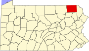 | |
| Townships | ||
| Unincorporated communities | ||