
uMgungundlovu
Indlovu District | |
|---|---|
 Seal | |
 Location in South Africa | |
| Coordinates: 29°35′S 30°22′E / 29.583°S 30.367°E | |
| Country | South Africa |
| Province | KwaZulu-Natal |
| Seat | Pietermaritzburg |
| Local municipalities | |
| Government | |
| • Type | Municipal council |
| • Mayor | Thobekile Maphumulo |
| Area | |
| • Total | 9,513 km2 (3,673 sq mi) |
| Population (2011)[2] | |
| • Total | 1,017,763 |
| • Density | 110/km2 (280/sq mi) |
| Racial makeup (2011) | |
| • Black African | 84.7% |
| • Coloured | 2.0% |
| • Indian/Asian | 6.7% |
| • White | 6.3% |
| First languages (2011) | |
| • Zulu | 76.4% |
| • English | 15.3% |
| • Xhosa | 1.9% |
| • Sotho | 1.7% |
| • Other | 4.7% |
| Time zone | UTC+2 (SAST) |
| Municipal code | DC22 |
uMgungundlovu is one of the 11 district municipalities ("districts") of KwaZulu-Natal province. The seat of uMgungundlovu is Pietermaritzburg. The majority of its 1 million+ residents speak Zulu (2001 Census). The district code is DC22
YouTube Encyclopedic
-
1/2Views:2 5361 674
-
Pietermaritzburg-uMgungundlovu District Municipality
-
Dundee-Umzinyathi District Municipality
Transcription
Geography
Neighbours
uMgungundlovu is surrounded by:
- eThekwini to the southeast (Durban)
- iLembe to the east (DC29)
- Sisonke to the southwest (DC43)
- Ugu to the south (DC21)
- Umzinyathi to the north (DC24)
- Uthukela to the northwest (DC23)
Local municipalities
The district contains the following local municipalities:
| Local municipality | Population | % |
|---|---|---|
| Msunduzi | 618,536 | 60.77% |
| uMshwathi | 106,374 | 10.46% |
| uMngeni | 92,710 | 9.11% |
| Richmond | 65,793 | 6.46% |
| Mkhambathini | 63,142 | 6.20% |
| Mpofana | 38,103 | 3.75% |
| Impendle | 33,105 | 3.25% |
Demographics
The following statistics are from the 2011 census.
| Language | Population | % |
|---|---|---|
| Zulu | 762,751 | 76.4% |
| English | 152,981 | 15.3% |
| Xhosa | 18,906 | 1.9% |
| Sotho | 17,344 | 1.7% |
| Afrikaans | 15,729 | 1.6% |
| Ndebele | 10,051 | 1.0% |
| Other | 7,764 | 0.8% |
| Tswana | 4,521 | 0.45% |
| Northern Sotho | 1,904 | 0.2% |
| Swati | 482 | 0.05% |
| Tsonga | 470 | 0.05% |
| Venda | 342 | 0.03% |
Gender
| Gender | Population | % |
|---|---|---|
| Female | 531,843 | 52.26% |
| Male | 485,920 | 47.74% |
Ethnic group
| Ethnic group | Population | % |
|---|---|---|
| Black African | 862,543 | 84.75% |
| Indian/Asian | 68,029 | 6.68% |
| White | 63,935 | 6.28% |
| Coloured | 20,538 | 2.02% |
Age
| Age | Population | % |
|---|---|---|
| 000 - 004 | 87 368 | 9.42% |
| 005 - 009 | 98 509 | 10.62% |
| 010 - 014 | 102 973 | 11.10% |
| 015 - 019 | 104 574 | 11.27% |
| 020 - 024 | 92 140 | 9.93% |
| 025 - 029 | 87 922 | 9.48% |
| 030 - 034 | 68 334 | 7.36% |
| 035 - 039 | 61 487 | 6.63% |
| 040 - 044 | 50 672 | 5.46% |
| 045 - 049 | 43 148 | 4.65% |
| 050 - 054 | 36 157 | 3.90% |
| 055 - 059 | 25 434 | 2.74% |
| 060 - 064 | 22 412 | 2.42% |
| 065 - 069 | 15 980 | 1.72% |
| 070 - 074 | 13 792 | 1.49% |
| 075 - 079 | 8 079 | 0.87% |
| 080 - 084 | 5 769 | 0.62% |
| 085 - 089 | 1 834 | 0.20% |
| 090 - 094 | 798 | 0.09% |
| 095 - 099 | 321 | 0.03% |
| 100 plus | 131 | 0.01% |
Politics
Election results
Election results for Umgungundlovu in the South African general election, 2004.
- Population 18 and over: 575 772 [62.06% of total population]
- Total votes: 280 991 [30.28% of total population]
- Voting % estimate: 48.80% votes as a % of population 18 and over
| Party | Votes | % |
|---|---|---|
| African National Congress | 181 753 | 64.68% |
| Inkhata Freedom Party | 46 687 | 16.62% |
| Democratic Alliance | 30 910 | 11.00% |
| African Christian Democratic Party | 6 085 | 2.17% |
| United Democratic Movement | 3 531 | 1.26% |
| Independent Democrats | 3 450 | 1.23% |
| Minority Front | 2 106 | 0.75% |
| New National Party | 1 723 | 0.61% |
| Freedom Front Plus | 848 | 0.30% |
| Pan African Congress | 673 | 0.24% |
| Azanian People's Organisation | 627 | 0.22% |
| United Christian Democratic Party | 530 | 0.19% |
| SOPA | 363 | 0.13% |
| CDP | 362 | 0.13% |
| UF | 286 | 0.10% |
| NA | 214 | 0.08% |
| EMSA | 209 | 0.07% |
| TOP | 206 | 0.07% |
| PJC | 200 | 0.07% |
| KISS | 154 | 0.05% |
| NLP | 74 | 0.03% |
| Total | 280 991 | 100.00% |
See also
References
- ^ "Contact list: Executive Mayors". Government Communication & Information System. Archived from the original on 14 July 2010. Retrieved 22 February 2012.
- ^ a b "Statistics by place". Statistics South Africa. Retrieved 27 September 2015.
- ^ "Statistics by place". Statistics South Africa. Retrieved 27 September 2015.
External links
| Metropolitan |  | ||||||||||||||||||||
|---|---|---|---|---|---|---|---|---|---|---|---|---|---|---|---|---|---|---|---|---|---|
| District and local |
| ||||||||||||||||||||
Municipalities and communities of uMgungundlovu District Municipality, KwaZulu-Natal | ||
|---|---|---|
District seat: Pietermaritzburg | ||
| uMshwathi | 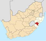 | |
| uMngeni | ||
| Mpofana | ||
| Impendle | ||
| Msunduzi | ||
| Mkhambathini | ||
| Richmond | ||