
Ullensvang Municipality
Ullensvang kommune | |
|---|---|
| Ullensvang herad (historic name) | |
 View of Utne in Ullensvang | |
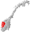 Vestland within Norway | |
 Ullensvang within Vestland | |
| Coordinates: 60°18′42″N 06°48′53″E / 60.31167°N 6.81472°E | |
| Country | Norway |
| County | Vestland |
| District | Hardanger |
| Established | 1 Jan 1838 |
| • Created as | Formannskapsdistrikt |
| Administrative centre | Odda |
| Government | |
| • Mayor (2019) | Roald Aga Haug (Ap) |
| Area | |
| • Total | 3,229.90 km2 (1,247.07 sq mi) |
| • Land | 2,963.56 km2 (1,144.24 sq mi) |
| • Water | 266.34 km2 (102.83 sq mi) 8.2% |
| • Rank | #12 in Norway |
| Population (2023) | |
| • Total | 11,148 |
| • Rank | #104 in Norway |
| • Density | 3.8/km2 (10/sq mi) |
| • Change (10 years) | |
| Demonyms | Sørfjøre Sørfjording[1] |
| Official language | |
| • Norwegian form | Nynorsk |
| Time zone | UTC+01:00 (CET) |
| • Summer (DST) | UTC+02:00 (CEST) |
| ISO 3166 code | NO-4618[3] |
| Website | Official website |

Ullensvang is a municipality in Vestland county, Norway. It is located in the traditional district of Hardanger. The administrative centre is the town of Odda. Some of the notable villages in the municipality include Lofthus, Utne, Vikebygd, Alsåker, Botnen, Eitrheim, Håra, Røldal, Seljestad, Skare, Tyssedal, Jondal, Herand, Kysnesstranda, and Torsnes.
The main inhabited part of Ullensvang municipality lies just to the west of Hardangervidda National Park, which covers most of the Hardangervidda plateau, Europe's largest mountain plateau. Most inhabitants live in the narrow coastal mountainsides and valleys along the Hardangerfjorden and Sørfjorden. The largest urban areas in Ullensvang are Odda, Kinsarvik, Jondal, and Lofthus. The Norwegian National Road 13 and the European route E134 are the two main roads through the municipality. National road 13 crosses the Hardangerfjorden via the Hardanger Bridge in the far northern part of the municipality.
The 3,230-square-kilometre (1,250 sq mi) municipality is the 12th largest by area out of the 356 municipalities in Norway. Ullensvang is the 104th most populous municipality in Norway with a population of 11,148. The municipality's population density is 3.8 inhabitants per square kilometre (9.8/sq mi) and its population has decreased by 2.5% over the previous 10-year period.[4][5] The number of inhabitants has shown a decrease of several hundred people since 1980. This development can be seen in light of the general depopulation of rural Norway.
In 2016, the chief of police for Vestlandet formally suggested a reconfiguration of police districts and stations. He proposed that the police station for Ullensvang og Eidfjord be closed.[6]
General information

Name
The municipality (originally the parish) is named after the old Ullensvang farm (Old Norse: Ullinsvangr) since the first Ullensvang Church was built there. The first element is the genitive case of the name of the Norse god Ullin (an alternate form of the name Ullr). The last element is vangr which means "field" or "meadow".[7] Prior to the 2020 municipal merger, this municipality was called Ullensvang herad, but after the merger it was called Ullensvang kommune.
Coat of arms


The original coat of arms was granted on 8 November 1979 and it was in use until 1 January 2020 when a new version of the arms was put into use. The official blazon was "Gules, a bar Or between three fleur-de-lis of the same" (Norwegian: I raudt ein gull bjelke følgd av tre gull liljer, to over og ei under bjelken). This means the arms have a red field (background) and the charge is a horizontal stripe across the middle, with three fleur-de-lis designs (two above the stripe, one below). The charge has a tincture of Or which means it is commonly colored yellow, but if it is made out of metal, then gold is used. The design of the arms was derived from the arms of Sigurd Brynjulvsson Galte, a medieval nobleman from the area. They can be seen on his gravestone from 1302 at the local church. As it is the oldest gravestone in the church, the arms were well known in the village, hence the choice for the arms of this knight as municipal arms. The arms were designed by Magnus Hardeland. The municipal flag has the same design as the coat of arms.[8][9]
A new coat of arms was granted in 2019 for use starting on 1 January 2020 after Odda and Jondal municipalities were merged with Ullensvang. The new arms were the same design as the previous arms, but they incorporated the colors from the old arms of Odda Municipality (blue and white instead of red and gold). The official blazon for the new arms is "Azure, a bar argent between three fleur-de-lis of the same" (Norwegian: I blå ein sølv bjelke følgd av tre sølv liljer, to over og ei under bjelken).[8][10]
Churches
The Church of Norway has eight parishes (sokn) within the municipality of Ullensvang. It is part of the Hardanger og Voss prosti (deanery) in the Diocese of Bjørgvin.
| Parish (sokn) | Church name | Location of the church | Year built |
|---|---|---|---|
| Jondal | Jondal Church | Jondal | 1888 |
| Kinsarvik | Kinsarvik Church | Kinsarvik | 1150 |
| Odda | Odda Church | Odda | 1870 |
| Røldal | Røldal Stave Church | Røldal | c. 1250 |
| Skare | Skare Church | Skare | 1926 |
| Tyssedal | Tyssedal Church | Tyssedal | 1965 |
| Ullensvang | Ullensvang Church | Lofthus | 1250 |
| Utne | Utne Church | Utne | 1895 |
History

On 1 January 1838, the large parish of Kinsarvik was established as a municipality (see formannskapsdistrikt law). The large parish was made up of the main parish and the annex of Ullensvang. On 1 January 1869, Ullensvang became the main parish and Kinsarvik became an annex to Ullensvang. At this time the municipality changed its name to Ullensvang. On 1 January 1882, a small area of Ullensvang (population: 22) was transferred to the neighboring municipality of Vikør. On 1 July 1913, the municipality of Ullensvang was divided into three parts: the northwestern part became Kinsarvik Municipality, the southern part became Odda Municipality, and the rest remained as Ullensvang Municipality, albeit much smaller. This left Ullensvang with 1,941 residents.[11]
During the 1960s, there were many municipal mergers across Norway due to the work of the Schei Committee. On 1 January 1964, the following areas were merged into one large municipality: all of Ullensvang Municipality, all of Eidfjord Municipality, and most of Kinsarvik Municipality (except for the Lussand-Kvanndal area which went to Granvin Municipality). The newly enlarged municipality was named Ullensvang. On 1 January 1965, the Åsgrenda area of Kvam Municipality (population: 61) was transferred to Ullensvang. This new, large municipality of Ullensvang that was created in 1964-1965 was not long-lived. On 1 January 1977, the area that once was Eidfjord Municipality became its own municipality once again. This left Ullensvang with 3,937 residents.[11]
On 1 January 2020, the three neighboring municipalities of Jondal, Odda, and Ullensvang were merged into a new, larger Ullensvang Municipality. At that time, the administrative centre was moved from the village of Kinsarvik to the larger town of Odda.[12] On 1 January 2022, the Ytre Bu area of Ullensvang (population: 24) was transferred to the neighboring Eidfjord Municipality.[13][14]
Population
|
|
| |||||||||||||||||||||||||||||||||||||||||||||||||||||||||||||||
| Note: The municipal borders were changed in 1913, 1964, 1977, and 2020, causing a significant change in the population. Source: Statistics Norway[4][15][16][17] and Norwegian Historical Data Centre[18] | |||||||||||||||||||||||||||||||||||||||||||||||||||||||||||||||||
Geography

The municipality of Ullensvang is located on the shores of the Hardangerfjorden and the Sørfjorden and it stretches all the way up to the Folgefonna glacier inside Folgefonna National Park on the Folgefonna peninsula in the western part of the municipality. It continues up to the vast Hardangervidda plateau in the east, including part of the Hardangervidda National Park. The lakes Kvensjøen and Veivatnet as well as the mountain Hårteigen are all located in Ullensvang on the plateau.[19]
Climate
The lowland areas of Ullensvang near the Hardanger fjord has a temperate oceanic climate (marine west coast climate, Cfb in the Köppen climate classification). The average daily high range from 3.0 °C (37.4 °F) in January and February to 20.0 °C (68.0 °F) in July. The driest season is April - August, while the wettest is October - March. The all-time high temperature is 33.5 °C (92.3 °F) recorded 28 July 2019; the all-time low is −14.5 °C (5.9 °F) recorded 9 February 1966. The weather station Ullensvang Forsøksgard has been recording temperature since 1865.
| Climate data for Ullensvang Forsøksgard 1991-2020 (12 m, extremes 1962-2020) | |||||||||||||
|---|---|---|---|---|---|---|---|---|---|---|---|---|---|
| Month | Jan | Feb | Mar | Apr | May | Jun | Jul | Aug | Sep | Oct | Nov | Dec | Year |
| Record high °C (°F) | 13 (55) |
12.6 (54.7) |
15.5 (59.9) |
20.9 (69.6) |
30.3 (86.5) |
30.7 (87.3) |
33.5 (92.3) |
29.4 (84.9) |
24.8 (76.6) |
20.5 (68.9) |
15.8 (60.4) |
13.8 (56.8) |
33.5 (92.3) |
| Daily mean °C (°F) | 1.3 (34.3) |
0.7 (33.3) |
2.9 (37.2) |
6.3 (43.3) |
10.4 (50.7) |
13.9 (57.0) |
16.1 (61.0) |
15 (59) |
11.4 (52.5) |
7.1 (44.8) |
3.9 (39.0) |
1.7 (35.1) |
7.6 (45.6) |
| Record low °C (°F) | −13.8 (7.2) |
−14.5 (5.9) |
−11.7 (10.9) |
−5.6 (21.9) |
0.1 (32.2) |
1.4 (34.5) |
6 (43) |
5.5 (41.9) |
1.9 (35.4) |
−4.1 (24.6) |
−11.6 (11.1) |
−11.4 (11.5) |
−14.5 (5.9) |
| Average precipitation mm (inches) | 222 (8.7) |
159 (6.3) |
169 (6.7) |
87 (3.4) |
78 (3.1) |
75 (3.0) |
77 (3.0) |
91 (3.6) |
138 (5.4) |
179 (7.0) |
187 (7.4) |
243 (9.6) |
1,705 (67.2) |
| Source 1: eklima/Norwegian Meteorological Institute[20] | |||||||||||||
| Source 2: yr.no Ullensvang [21] | |||||||||||||
Government
Ullensvang Municipality is responsible for primary education (through 10th grade), outpatient health services, senior citizen services, welfare and other social services, zoning, economic development, and municipal roads and utilities. The municipality is governed by a municipal council of directly elected representatives. The mayor is indirectly elected by a vote of the municipal council.[22] The municipality is under the jurisdiction of the Hordaland District Court and the Gulating Court of Appeal.
Municipal council
The municipal council (Kommunestyre) of Ullensvang is made up of 33 representatives that are elected to four year terms. The tables below show the current and historical composition of the council by political party.
| Party name (in Nynorsk) | Number of representatives | |
|---|---|---|
| Labour Party (Arbeidarpartiet) | 11 | |
| Conservative Party (Høgre) | 3 | |
| Industry and Business Party (Industri- og Næringspartiet) | 3 | |
| Christian Democratic Party (Kristeleg Folkeparti) | 1 | |
| Red Party (Raudt) | 2 | |
| Centre Party (Senterpartiet) | 12 | |
| Socialist Left Party (Sosialistisk Venstreparti) | 1 | |
| Total number of members: | 33 | |
| Party name (in Nynorsk) | Number of representatives | |
|---|---|---|
| Labour Party (Arbeidarpartiet) | 14 | |
| Progress Party (Framstegspartiet) | 1 | |
| Conservative Party (Høgre) | 4 | |
| Christian Democratic Party (Kristeleg Folkeparti) | 1 | |
| Red Party (Raudt) | 2 | |
| Centre Party (Senterpartiet) | 9 | |
| Socialist Left Party (Sosialistisk Venstreparti) | 1 | |
| Liberal Party (Venstre) | 1 | |
| Total number of members: | 33 | |
| Note: In 2020, Jondal and Odda municipalities became part of Ullensvang. | ||
| Party name (in Nynorsk) | Number of representatives | |
|---|---|---|
| Labour Party (Arbeidarpartiet) | 3 | |
| Conservative Party (Høgre) | 3 | |
| Christian Democratic Party (Kristeleg Folkeparti) | 1 | |
| Centre Party (Senterpartiet) | 9 | |
| Socialist Left Party (Sosialistisk Venstreparti) | 3 | |
| Liberal Party (Venstre) | 2 | |
| Total number of members: | 21 | |
| Party name (in Nynorsk) | Number of representatives | |
|---|---|---|
| Labour Party (Arbeidarpartiet) | 2 | |
| Conservative Party (Høgre) | 4 | |
| Christian Democratic Party (Kristeleg Folkeparti) | 1 | |
| Centre Party (Senterpartiet) | 8 | |
| Socialist Left Party (Sosialistisk Venstreparti) | 1 | |
| Liberal Party (Venstre) | 5 | |
| Total number of members: | 21 | |
| Party name (in Nynorsk) | Number of representatives | |
|---|---|---|
| Labour Party (Arbeidarpartiet) | 3 | |
| Conservative Party (Høgre) | 4 | |
| Christian Democratic Party (Kristeleg Folkeparti) | 1 | |
| Centre Party (Senterpartiet) | 9 | |
| Socialist Left Party (Sosialistisk Venstreparti) | 2 | |
| Liberal Party (Venstre) | 2 | |
| Total number of members: | 21 | |
| Party name (in Nynorsk) | Number of representatives | |
|---|---|---|
| Labour Party (Arbeidarpartiet) | 3 | |
| Conservative Party (Høgre) | 6 | |
| Christian Democratic Party (Kristeleg Folkeparti) | 1 | |
| Centre Party (Senterpartiet) | 7 | |
| Socialist Left Party (Sosialistisk Venstreparti) | 3 | |
| Liberal Party (Venstre) | 1 | |
| Total number of members: | 21 | |
| Party name (in Nynorsk) | Number of representatives | |
|---|---|---|
| Labour Party (Arbeidarpartiet) | 3 | |
| Conservative Party (Høgre) | 7 | |
| Christian Democratic Party (Kristeleg Folkeparti) | 1 | |
| Centre Party (Senterpartiet) | 6 | |
| Socialist Left Party (Sosialistisk Venstreparti) | 2 | |
| Liberal Party (Venstre) | 2 | |
| Total number of members: | 21 | |
| Party name (in Nynorsk) | Number of representatives | |
|---|---|---|
| Labour Party (Arbeidarpartiet) | 6 | |
| Conservative Party (Høgre) | 4 | |
| Christian Democratic Party (Kristeleg Folkeparti) | 1 | |
| Centre Party (Senterpartiet) | 10 | |
| Socialist Left Party (Sosialistisk Venstreparti) | 2 | |
| Liberal Party (Venstre) | 2 | |
| Total number of members: | 25 | |
| Party name (in Nynorsk) | Number of representatives | |
|---|---|---|
| Labour Party (Arbeidarpartiet) | 4 | |
| Conservative Party (Høgre) | 6 | |
| Christian Democratic Party (Kristeleg Folkeparti) | 1 | |
| Centre Party (Senterpartiet) | 9 | |
| Socialist Left Party (Sosialistisk Venstreparti) | 3 | |
| Liberal Party (Venstre) | 2 | |
| Total number of members: | 25 | |
| Party name (in Nynorsk) | Number of representatives | |
|---|---|---|
| Labour Party (Arbeidarpartiet) | 6 | |
| Conservative Party (Høgre) | 5 | |
| Christian Democratic Party (Kristeleg Folkeparti) | 1 | |
| Centre Party (Senterpartiet) | 8 | |
| Socialist Left Party (Sosialistisk Venstreparti) | 2 | |
| Liberal Party (Venstre) | 2 | |
| Non-party list (Upolitisk liste) | 1 | |
| Total number of members: | 25 | |
| Party name (in Nynorsk) | Number of representatives | |
|---|---|---|
| Labour Party (Arbeidarpartiet) | 5 | |
| Progress Party (Framstegspartiet) | 1 | |
| Conservative Party (Høgre) | 5 | |
| Christian Democratic Party (Kristeleg Folkeparti) | 2 | |
| Centre Party (Senterpartiet) | 9 | |
| Socialist Left Party (Sosialistisk Venstreparti) | 1 | |
| Liberal Party (Venstre) | 2 | |
| Total number of members: | 25 | |
| Party name (in Nynorsk) | Number of representatives | |
|---|---|---|
| Labour Party (Arbeidarpartiet) | 6 | |
| Conservative Party (Høgre) | 7 | |
| Christian Democratic Party (Kristeleg Folkeparti) | 2 | |
| Centre Party (Senterpartiet) | 8 | |
| Liberal Party (Venstre) | 2 | |
| Total number of members: | 25 | |
| Party name (in Nynorsk) | Number of representatives | |
|---|---|---|
| Labour Party (Arbeidarpartiet) | 9 | |
| Conservative Party (Høgre) | 4 | |
| Christian Democratic Party (Kristeleg Folkeparti) | 2 | |
| Centre Party (Senterpartiet) | 11 | |
| Liberal Party (Venstre) | 2 | |
| Local list (Bygdelista) | 1 | |
| Total number of members: | 29 | |
| Note: In 1977, Eidfjord municipality was split off from Ullensvang. | ||
| Party name (in Nynorsk) | Number of representatives | |
|---|---|---|
| Labour Party (Arbeidarpartiet) | 8 | |
| Centre Party (Senterpartiet) | 10 | |
| Joint List(s) of Non-Socialist Parties (Borgarlege Felleslister) | 9 | |
| Local List(s) (Lokale lister) | 2 | |
| Total number of members: | 29 | |
| Party name (in Nynorsk) | Number of representatives | |
|---|---|---|
| Labour Party (Arbeidarpartiet) | 8 | |
| Conservative Party (Høgre) | 4 | |
| Christian Democratic Party (Kristeleg Folkeparti) | 2 | |
| Centre Party (Senterpartiet) | 10 | |
| Liberal Party (Venstre) | 5 | |
| Total number of members: | 29 | |
| Party name (in Nynorsk) | Number of representatives | |
|---|---|---|
| Labour Party (Arbeidarpartiet) | 8 | |
| Conservative Party (Høgre) | 4 | |
| Christian Democratic Party (Kristeleg Folkeparti) | 1 | |
| Centre Party (Senterpartiet) | 10 | |
| Liberal Party (Venstre) | 6 | |
| Total number of members: | 29 | |
| Note: In 1964, Eidfjord and Kinsarvik municipalities became part of Ullensvang. | ||
| Party name (in Nynorsk) | Number of representatives | |
|---|---|---|
| Labour Party (Arbeidarpartiet) | 3 | |
| Conservative Party (Høgre) | 1 | |
| Centre Party (Senterpartiet) | 5 | |
| Liberal Party (Venstre) | 4 | |
| Total number of members: | 13 | |
| Party name (in Nynorsk) | Number of representatives | |
|---|---|---|
| Labour Party (Arbeidarpartiet) | 4 | |
| Local List(s) (Lokale lister) | 9 | |
| Total number of members: | 13 | |
| Party name (in Nynorsk) | Number of representatives | |
|---|---|---|
| Labour Party (Arbeidarpartiet) | 3 | |
| Liberal Party (Venstre) | 6 | |
| Joint List(s) of Non-Socialist Parties (Borgarlege Felleslister) | 3 | |
| Total number of members: | 12 | |
| Party name (in Nynorsk) | Number of representatives | |
|---|---|---|
| Labour Party (Arbeidarpartiet) | 3 | |
| Joint List(s) of Non-Socialist Parties (Borgarlege Felleslister) | 9 | |
| Total number of members: | 12 | |
| Party name (in Nynorsk) | Number of representatives | |
|---|---|---|
| Labour Party (Arbeidarpartiet) | 5 | |
| Local List(s) (Lokale lister) | 7 | |
| Total number of members: | 12 | |
| Party name (in Nynorsk) | Number of representatives | |
|---|---|---|
| Labour Party (Arbeidarpartiet) | 2 | |
| Joint List(s) of Non-Socialist Parties (Borgarlege Felleslister) | 10 | |
| Total number of members: | 12 | |
| Note: Due to the German occupation of Norway during World War II, no elections were held for new municipal councils until after the war ended in 1945. | ||
Mayors
The mayors (Nynorsk: ordførar) of Ullensvang:[42]
- 1838–1841: Nils Koren
- 1842–1842: Guttorm K. Rogdeberg
- 1844–1871: Johannes Johannesen Aga
- 1872–1873: Hans H. Utne
- 1874–1879: Johannes Johannesen Aga
- 1880–1895: Johannes Helleland
- 1896–1897: Torstein Hus
- 1898–1905: Johannes Helleland
- 1905–1910: Torstein Hus
- 1911–1919: Halldor Eidnes
- 1920–1945: Thorvald H. Utne
- 1946–1951: Oddmund A. Aarhus
- 1952–1955: Knut L. Måge
- 1956–1959: Lars Bergo
- 1959–1963: Knut L. Måge (V)
- 1964–1968: Jakob D. Hus
- 1968–1973: Torgils Lægreid
- 1974–1976: Tomas Sekse (Sp)
- 1976–1991: Torolv Hesthamar (Sp)
- 1991–1995: Lars Haustveit (Sp)
- 1995–1999: Torgils L. Jåstad (Sp)
- 1999–2003: Einar Lutro (H)
- 2003–2019: Solfrid Borge (Sp)
- 2019–present: Roald Aga Haug (Ap)
Notable people
Public service


- Nils Christian Egede Hertzberg (1827 in Ullensvang – 1911), a theologian, educator, and politician
- Knud Knudsen (1832 in Odda – 1915), one of Norway's first professional photographers
- Halldor O. Opedal (1895 in Lofthus – 1986), a Norwegian teacher and folklorist
- Eiliv Austlid (1899 in Ullensvang – 1940), a Norwegian farmer and army officer
- Torbjørn Mork (1928 in Odda – 1992), a Norwegian physician and civil servant
The Arts
- Nils Tjoflot (1865 in Tjoflot – 1898), a Norwegian violinist
- Georg Brochmann (1894 in Ullensvang – 1952), a journalist, writer and playwright
- Zinken Hopp (1905 in Ullensvang – 1987), a Norwegian author, poet and playwright
- Claes Gill (1910 in Odda - 1973), a Norwegian author, poet, and actor [43]
- Anne B. Ragde (born 1957 in Odda), a Norwegian novelist[44]
- Frode Grytten (born 1960), a Norwegian writer and journalist who grew up in Odda
- Knut Olav Åmås (born 1968 in Odda), a Norwegian writer, editor, and politician
- Svein Olav Herstad (born 1969 in Odda), a jazz pianist
- Leif Einar Lothe (born 1969 in Odda), a Norwegian TV personality who uses the stage name Lothepus
- Marit Eikemo (born 1971 in Odda), an essayist, novelist, journalist, and magazine editor
- Rannveig Djønne (born 1974 in Djønno), a Norwegian folk musician
Sport
- Roger Albertsen (1957–2003), a football midfielder with over 300 club caps and 25 for Norway
- Håkon Opdal (born 1982 in Odda), a footballer with over 350 club caps and 12 for Norway
Attractions

Ullensvang is Norway's biggest supplier of fruit, especially sweet cherries and apples. Every summer a cherry festival is held at Lofthus, where the Norwegian championship of cherry stone spitting is held. The record is 14.24 metres (46.7 ft) by S. Kleivkaas. Each May, a musical festival is held at Ullensvang Hotel (built in 1846), when musicians from all of Norway come to the village. The famous composer Edvard Grieg spent many summers at Lofthus, and the festival is held in his honor. During the summer, the population is doubled due to tourism. Attractions in addition to the previous mentioned, are the medieval Ullensvang Church at Lofthus (built around 1250) and Kinsarvik Church (built around 1150), several waterfalls such as the Skrikjofossen, the flowering season in May, and museums at Aga, Utne, and Skredhaugen.
References
- ^ "Navn på steder og personer: Innbyggjarnamn" (in Norwegian). Språkrådet.
- ^ "Forskrift om målvedtak i kommunar og fylkeskommunar" (in Norwegian). Lovdata.no.
- ^ Bolstad, Erik; Thorsnæs, Geir, eds. (26 January 2023). "Kommunenummer". Store norske leksikon (in Norwegian). Kunnskapsforlaget.
- ^ a b Statistisk sentralbyrå. "Table: 06913: Population 1 January and population changes during the calendar year (M)" (in Norwegian).
- ^ Statistisk sentralbyrå. "09280: Area of land and fresh water (km²) (M)" (in Norwegian).
- ^ Fjelltveit, Ingvild; Raunholm, Per Vidar (20 December 2016). "Foreslår å legge ned 17 lensmannskontor i Vest politidistrikt". NRK Hordaland (in Norwegian). Retrieved 20 October 2017.
- ^ Rygh, Oluf (1910). Norske gaardnavne: Søndre Bergenhus amt (in Norwegian) (11 ed.). Kristiania, Norge: W. C. Fabritius & sønners bogtrikkeri. p. 449.
- ^ a b "Civic heraldry of Norway - Norske Kommunevåpen". Heraldry of the World. Retrieved 20 May 2023.
- ^ "Ullensvang, Hordaland". Flags of the World. Retrieved 20 May 2023.
- ^ "Ullensvang kommune, våpen". Digitalarkivet (in Norwegian). Arkivverket. Retrieved 21 May 2023.
- ^ a b Jukvam, Dag (1999). Historisk oversikt over endringer i kommune- og fylkesinndelingen (PDF) (in Norwegian). Statistisk sentralbyrå. ISBN 9788253746845.
- ^ "Ullensvang kommune - den nye kommune i Hardanger" (in Norwegian). Retrieved 24 October 2017.
- ^ "Eidfjord kommune vert større!" (in Norwegian). Eidfjord kommune. 11 September 2020. Retrieved 31 December 2021.
- ^ Lund, Eli (29 April 2019). "Fylkesmannen er positiv til grensejustering - sender forslag på høyring". Hardanger Folkeblad (in Norwegian). Retrieved 31 December 2021.
- ^ Statistisk sentralbyrå. "Folketellingen 1960 Ullensvang" (PDF) (in Norwegian).
- ^ Statistisk sentralbyrå. "Folketellingen 1960 Kinsarvik" (PDF) (in Norwegian).
- ^ Statistisk sentralbyrå. "Folketellingen 1960 Odda" (PDF) (in Norwegian).
- ^ Universitetet i Tromsø – Norges arktiske universitet. "Censuses in the Norwegian Historical Data Archive (NHDC)".
- ^ Store norske leksikon. "Ullensvang" (in Norwegian). Retrieved 5 June 2014.
- ^ "eklima". Norwegian Meteorological Institute. Archived from the original on 14 June 2004.
- ^ "yr.no Ullensvang statistics".
- ^ Hansen, Tore; Vabo, Signy Irene, eds. (20 September 2022). "kommunestyre". Store norske leksikon (in Norwegian). Kunnskapsforlaget. Retrieved 14 October 2022.
- ^ "Kommunestyrevalg 2023 - Vestland". Valgdirektoratet. Retrieved 21 January 2024.
- ^ "Kommunestyrevalg 2019 – Vestland". Valgdirektoratet. Retrieved 2 February 2020.
- ^ a b c d "Table: 04813: Members of the local councils, by party/electoral list at the Municipal Council election (M)" (in Norwegian). Statistics Norway.
- ^ "Kommunestyrevalg 2011 – Hordaland". Valgdirektoratet. Retrieved 2 February 2020.
- ^ "Kommunestyrevalget 1995" (PDF) (in Norwegian). Oslo-Kongsvinger: Statistisk sentralbyrå. 1996. Retrieved 20 February 2020.
- ^ "Kommunestyrevalget 1991" (PDF) (in Norwegian). Oslo-Kongsvinger: Statistisk sentralbyrå. 1993. Retrieved 20 February 2020.
- ^ "Kommunestyrevalget 1987" (PDF) (in Norwegian). Oslo-Kongsvinger: Statistisk sentralbyrå. 1988. Retrieved 20 February 2020.
- ^ "Kommunestyrevalget 1983" (PDF) (in Norwegian). Oslo-Kongsvinger: Statistisk sentralbyrå. 1984. Retrieved 20 February 2020.
- ^ "Kommunestyrevalget 1979" (PDF) (in Norwegian). Oslo: Statistisk sentralbyrå. 1979. Retrieved 20 February 2020.
- ^ "Kommunevalgene 1975" (PDF) (in Norwegian). Oslo: Statistisk sentralbyrå. 1977. Retrieved 10 May 2020.
- ^ "Kommunevalgene 1972" (PDF) (in Norwegian). Oslo: Statistisk sentralbyrå. 1973. Retrieved 10 May 2020.
- ^ "Kommunevalgene 1967" (PDF) (in Norwegian). Oslo: Statistisk sentralbyrå. 1967. Retrieved 10 May 2020.
- ^ "Kommunevalgene 1963" (PDF) (in Norwegian). Oslo: Statistisk sentralbyrå. 1964. Retrieved 10 May 2020.
- ^ "Kommunevalgene og Ordførervalgene 1959" (PDF) (in Norwegian). Oslo: Statistisk sentralbyrå. 1960. Retrieved 10 May 2020.
- ^ "Kommunevalgene og Ordførervalgene 1955" (PDF) (in Norwegian). Oslo: Statistisk sentralbyrå. 1957. Retrieved 10 May 2020.
- ^ "Kommunevalgene og Ordførervalgene 1951" (PDF) (in Norwegian). Oslo: Statistisk sentralbyrå. 1952. Retrieved 10 May 2020.
- ^ "Kommunevalgene og Ordførervalgene 1947" (PDF) (in Norwegian). Oslo: Statistisk sentralbyrå. 1948. Retrieved 10 May 2020.
- ^ "Kommunevalgene og Ordførervalgene 1945" (PDF) (in Norwegian). Oslo: Statistisk sentralbyrå. 1947. Retrieved 10 May 2020.
- ^ "Kommunevalgene og Ordførervalgene 1937" (PDF) (in Norwegian). Oslo: Statistisk sentralbyrå. 1938. Retrieved 10 May 2020.
- ^ "Politiske organisering". arkivplan.no (in Norwegian). Retrieved 21 May 2023.
- ^ Claes Gill at IMDb. Retrieved 23 August 2020.
- ^ Anne B. Ragde at IMDb. Retrieved 23 August 2020.
External links
- Municipal fact sheet from Statistics Norway (in Norwegian)
| |||||||||||||
 | Towns and cities | ||||||||||||
| Municipalities |
| ||||||||||||
| |||||||||||||