
Tzur Hadassah
צוּר הֲדַסָּה تسور هداسا | |
|---|---|
 | |
 Tzur Hadassah | |
| Coordinates: 31°43′3″N 35°5′38″E / 31.71750°N 35.09389°E | |
| Country | Israel |
| District | Jerusalem |
| Founded | 1960 |
| Population (2022)[1] | 12,142 |
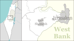
Tzur Hadassah (Hebrew: צוּר הֲדַסָּה, lit. Rock of Hadassah) is a local council located in the Jerusalem Corridor, located 12 kilometres (7.5 mi) southwest of Jerusalem, at an altitude of 755 meters above sea level, located on Route 375 west of Betar Ilit, about one kilometer west of the Green Line, adjacent to the Palestinian village of Wadi Fukin. In 2022 it had a population of 12,142.[1] In 2023 it was awarded Local council (Israel) status.[2]
YouTube Encyclopedic
-
1/3Views:16 100425789
-
Jerusalem Ein Karem Tzur Hadassah ISRAEL Drive 4k ירושלים עין כרם הרי ירושלים צור הדסה כביש 386
-
Tsur hadassah
-
DRIVING IN THE Complete ROAD 386-In the Judaean mountains of Jerusalem Israel כביש 386 השלם
Transcription
History
Tzur Hadassah was established in 1956 as a regional centre for nearby moshavim such as (Bar Giora, Mata, Mevo Beitar and Nes Harim) on land that had belonged to the depopulated Palestinian village of Ras Abu 'Ammar.[3] It was named for the Hadassah organization.
The town has four neighborhoods: The "Vatika" (Old Tzur Hadassah and Shehunat HaMeah); New Tzur Hadassah (Shehunat HaEmek); Sansan (Sansan Mt.); and Har Kitron (Kitron Mt.) which forms the second half of the horseshoe topography of Tzur Hadassah.[4] In 2016, plans for expansion were approved to add 15,000 new residents within 5 years.[5]
In 2023, Tzur Hadassah became a local council and Tomer Moskowitz was appointed mayor.[2]
Schools and synagogues
Tzur Hadassah is home to 4 primary schools, 1 religious, 1 mixed, and 2 secular. The religious school is called Lavi, the mixed (both religious and secular) is Maayanot, and the secular primary schools are Hadassim and Tzurim. Hadassa is home to Kehilat Shir Chadash (formally Kehilat Tzur Hadassah).
The Kehila has an active chapter of the Israeli Reform Youth Movement Noar Telem. The congregation plays a leading role in the town’s social and cultural life. Between 2006-2014 rabbi Ofer Beit-Halachmi got the congregation into a new building and created a moving voice in the community, leading in projects such as environmental programs, teen programs, and civic engagement such as volunteering in immigrant communities.[citation needed]
Landmarks
The Harei Yehuda riding stable is located in Tzur Hadassah, at the edge of the Sansan nature reserve. It was established in 1991 in the old part of Tzur Hadassah and moved to new facilities in 2004.[6] The Israel National Trail, marked with orange, blue, and white stripes, reaches Tzur Hadassah on its way westward.[7] In 2014, construction workers discovered a large stalactite cave located beneath parts of Tzur Hadassah, the Parks Service sealed off entrance to the cave system.[8]
Archeology

Just west of the settlement are the ruins of the ancient village of Hurvat Geres identified by Archeologist Boaz Zissu as Gerasa, an ancient Jewish town mentioned by the historian Josephus. At the site 3-4 Mik'vaot were found, a hiding system and rock-cut tombs.
Gallery
-
 Tzur Hadassah as seen from Khirbet Jurish
 -
 Tzur Hadassa (from Kh. Jurish)
References
- ^ a b "Regional Statistics". Israel Central Bureau of Statistics. Retrieved 21 March 2024.
- ^ a b "תומר מוסקוביץ מונה לראש המועצה המקומית צור הדסה". ערוץ 7 (in Hebrew). Arutz 7. 12 June 2023. Retrieved 18 June 2023.
- ^ Khalidi, Walid (1992). All That Remains: The Palestinian Villages Occupied and Depopulated by Israel in 1948. Washington D.C.: Institute for Palestine Studies. p. 312. ISBN 0-88728-224-5.
- ^ "Communities & Housing in Israel".
- ^ "אוכלוסיית צור הדסה תוכפל ב־5 שנים בזכות שכונה חדשה". ynet (in Hebrew). 2016-04-14. Retrieved 2020-04-04.
- ^ "Harei Yehuda - Stable Tsur Hadassah". www.hyr.co.il.
- ^ "ERETZ Magazine". www.eretz.com.
- ^ Ben-Gedalyahu, Tzvi. "Huge Stalactite Cave Discovered Near Gush Etzion".
External links
- Official website (in Hebrew)
| Cities |  | |
|---|---|---|
| Local councils | ||
| Regional councils | ||
| See also: | ||
| ||
| Authority control databases: National |
|---|