
Twin Hills, Alaska
Ingricuar | |
|---|---|
 Location of Twin Hills, Alaska | |
| Coordinates: 59°4′41″N 160°17′4″W / 59.07806°N 160.28444°W | |
| Country | United States |
| State | Alaska |
| Census Area | Dillingham |
| Government | |
| • State senator | Lyman Hoffman (D) |
| • State rep. | Bryce Edgmon (I) |
| Area | |
| • Total | 23.04 sq mi (59.67 km2) |
| • Land | 22.90 sq mi (59.32 km2) |
| • Water | 0.14 sq mi (0.35 km2) |
| Elevation | 10 ft (3 m) |
| Population (2020) | |
| • Total | 103 |
| • Density | 4.50/sq mi (1.74/km2) |
| Time zone | UTC-9 (Alaska (AKST)) |
| • Summer (DST) | UTC-8 (AKDT) |
| ZIP code | 99576[2] |
| Area code | 907 |
| FIPS code | 02-79780 |
Twin Hills (Central Yupik: Ingricuar) is a census-designated place (CDP) in Dillingham Census Area, Alaska, United States. The population was 74 at the 2010 census,[3] up from 69 in 2000.
Although Twin Hills wasn't settled until 1965,[4] the present CDP encompasses the original settlement of Togiak (then Togiagamute) on the northeast side of Togiak Bay. In the early 20th century, many residents removed to the northwest side of the bay to establish the "new" Togiak.[5]
YouTube Encyclopedic
-
1/3Views:866 8493 51534 401
-
Seattle to Alaska / Honda Africa Twin / @MotoGeo Adventures
-
"Miasteczko Twin Peaks" i "Przystanek Alaska" - miejsca z seriali po latach
-
THE DALTON HIGHWAY [4k]
Transcription
Geography
Twin Hills is located at 59°4′41″N 160°17′4″W / 59.07806°N 160.28444°W (59.077924, -160.284513),[6] at the northeast end of Togiak Bay and adjacent to the city of Togiak.
According to the United States Census Bureau, the CDP has a total area of 23.1 square miles (59.7 km2), of which 22.8 square miles (59.0 km2) is land and 0.3 square miles (0.7 km2), or 1.15%, is water.[3]
Demographics
| Census | Pop. | Note | %± |
|---|---|---|---|
| 1880 | 276 | — | |
| 1890 | 94 | −65.9% | |
| 1970 | 67 | — | |
| 1980 | 70 | 4.5% | |
| 1990 | 66 | −5.7% | |
| 2000 | 69 | 4.5% | |
| 2010 | 74 | 7.2% | |
| 2020 | 103 | 39.2% | |
| U.S. Decennial Census[7] | |||
Twin Hills's predecessor village of Togiagamute first appeared on the 1880 U.S. Census as an unincorporated Inuit village (all residents were Inuit).[8] It returned in 1890 as "Togiagamiut" (all 94 residents were Native).[9] With the removal of most of its residents to the "new" Togiak on the opposite side of Togiak Bay, it did not report again until 1970 when the new unincorporated settlement of Twin Hills was established to the north of the original townsite. In 1980, it was made a census-designated place.
As of the census[10] of 2000, there were 69 people, 24 households, and 18 families residing in the CDP. The population density was 3.2 inhabitants per square mile (1.2/km2). There were 33 housing units at an average density of 1.5 per square mile (0.58/km2). The racial makeup of the CDP was 5.80% White, 84.06% Native American, and 10.14% from two or more races.
There were 24 households, out of which 37.5% had children under the age of 18 living with them, 29.2% were married couples living together, 20.8% had a female householder with no husband present, and 25.0% were non-families. 16.7% of all households were made up of individuals, and 12.5% had someone living alone who was 65 years of age or older. The average household size was 2.88 and the average family size was 2.94.
In the CDP, the population was spread out, with 36.2% under the age of 18, 2.9% from 18 to 24, 21.7% from 25 to 44, 27.5% from 45 to 64, and 11.6% who were 65 years of age or older. The median age was 38 years. For every 100 females, there were 81.6 males. For every 100 females age 18 and over, there were 100.0 males.
The median income for a household in the CDP was $29,375, and the median income for a family was $20,625. Males had a median income of $0 versus $0 for females. The per capita income for the CDP was $16,856. There were 22.2% of families and 27.9% of the population living below the poverty line, including 61.5% of under eighteens and none of those over 64. The median home value is $108,300.
Education
It is served by the Twin Hills School of the Southwest Region School District.[11]
References
- ^ "2020 U.S. Gazetteer Files". United States Census Bureau. Retrieved October 29, 2021.
- ^ "Twin Hills ZIP Code". zipdatamaps.com. 2023. Retrieved January 12, 2023.
- ^ a b "Geographic Identifiers: 2010 Demographic Profile Data (G001): Twin Hills CDP, Alaska". U.S. Census Bureau, American Factfinder. Retrieved October 9, 2015.[dead link]
- ^ "The History of Twin Hills, Alaska - ExploreNorth".
- ^ "The History of Togiak, Alaska - ExploreNorth".
- ^ "US Gazetteer files: 2010, 2000, and 1990". United States Census Bureau. February 12, 2011. Retrieved April 23, 2011.
- ^ "U.S. Decennial Census". Census.gov. Retrieved June 6, 2013.
- ^ "Statistics of the Population of Alaska" (PDF). United States Census Bureau. 1880.
- ^ "Report on Population and Resources of Alaska at the Eleventh Census: 1890" (PDF). United States Census Bureau. Government Printing Office.
- ^ "U.S. Census website". United States Census Bureau. Retrieved January 31, 2008.
- ^ "Twin Hills." Southwest Region School District. Retrieved on March 26, 2017.
59°04′41″N 160°17′04″W / 59.077924°N 160.284513°W
Municipalities and communities of Dillingham Census Area, Alaska, United States | ||
|---|---|---|
| Cities | 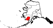 | |
| CDPs | ||
| Unincorporated communities | ||
| Ghost towns | ||