
Tuyên Hóa district
Huyện Tuyên Hóa | |
|---|---|
 View of Gianh River | |
| Country | |
| Region | North Central Coast |
| Province | Quảng Bình |
| Capital | Đồng Lê |
| Area | |
| • Total | 444 sq mi (1,149 km2) |
| Population (2003) | |
| • Total | 78,933 |
| Time zone | UTC+7 (Indochina Time) |
Tuyên Hóa (ⓘ) is a rural district of Quảng Bình province in the North Central Coast region of Vietnam. Its seat is the town of Đồng Lê. Speakers of the Nguồn language (which is related to Mường) are mostly located near Đồng Lê. As of 2003, the district had a population of 78,933.[1] The district covers an area of 1,149 km2. The district capital lies at Đồng Lê.[1]
Administrative divisions
The district is divided into one township, Đồng Lê, and 19 communes: Lâm Hóa, Hương Hóa, Thanh Hóa, Thanh Thạch, Kim Hóa, Sơn Hóa, Lê Hóa, Thuận Hóa, Đồng Hóa, Thạch Hóa, Nam Hóa, Đức Hóa, Phong Hóa, Mai Hóa, Ngư Hóa, Tiến Hóa, Châu Hóa, Cao Quảng and Văn Hóa.
Climate
| Climate data for Tuyên Hóa | |||||||||||||
|---|---|---|---|---|---|---|---|---|---|---|---|---|---|
| Month | Jan | Feb | Mar | Apr | May | Jun | Jul | Aug | Sep | Oct | Nov | Dec | Year |
| Mean daily maximum °C (°F) | 21.8 (71.2) |
23.1 (73.6) |
26.4 (79.5) |
31.0 (87.8) |
33.8 (92.8) |
34.2 (93.6) |
34.2 (93.6) |
33.3 (91.9) |
31.2 (88.2) |
28.1 (82.6) |
25.0 (77.0) |
22.0 (71.6) |
28.7 (83.7) |
| Daily mean °C (°F) | 17.9 (64.2) |
19.2 (66.6) |
21.7 (71.1) |
25.2 (77.4) |
27.8 (82.0) |
29.2 (84.6) |
29.2 (84.6) |
28.2 (82.8) |
26.3 (79.3) |
23.9 (75.0) |
21.3 (70.3) |
18.5 (65.3) |
24.0 (75.2) |
| Mean daily minimum °C (°F) | 15.7 (60.3) |
17.0 (62.6) |
18.9 (66.0) |
21.8 (71.2) |
24.1 (75.4) |
25.6 (78.1) |
25.5 (77.9) |
24.8 (76.6) |
23.5 (74.3) |
21.6 (70.9) |
19.0 (66.2) |
16.3 (61.3) |
21.2 (70.2) |
| Average precipitation mm (inches) | 47.1 (1.85) |
39.6 (1.56) |
51.9 (2.04) |
75.0 (2.95) |
154.6 (6.09) |
130.2 (5.13) |
142.7 (5.62) |
267.3 (10.52) |
501.2 (19.73) |
654.6 (25.77) |
223.7 (8.81) |
83.6 (3.29) |
2,365.5 (93.13) |
| Average rainy days | 14.6 | 13.1 | 12.8 | 10.9 | 12.1 | 9.5 | 9.9 | 14.5 | 17.4 | 19.8 | 17.2 | 14.8 | 166.5 |
| Average relative humidity (%) | 90.3 | 90.1 | 88.3 | 84.9 | 80.3 | 75.2 | 74.1 | 80.0 | 87.2 | 89.9 | 89.6 | 89.6 | 84.9 |
| Mean monthly sunshine hours | 64.2 | 62.9 | 97.8 | 141.5 | 196.9 | 204.2 | 209.1 | 172.6 | 123.1 | 97.1 | 71.4 | 54.4 | 1,483.9 |
| Source: Vietnam Institute for Building Science and Technology[2] | |||||||||||||
References
- ^ a b "Districts of Vietnam". Statoids. Retrieved 20 March 2009.
- ^ "Vietnam Institute for Building Science and Technology" (PDF) (in Vietnamese). Retrieved 30 November 2023.
17°55′01″N 106°00′00″E / 17.917°N 106.000°E
| Thanh Hóa province | 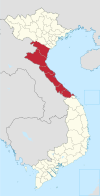 | |
|---|---|---|
| Nghệ An province | ||
| Hà Tĩnh province | ||
| Quảng Bình province |
| |
| Quảng Trị province | ||
| Thừa Thiên Huế province |
| |
※ denotes provincial seat. | ||
This article about a location in Quảng Bình province, Vietnam is a stub. You can help Wikipedia by expanding it. |