
Turrubares | |
|---|---|
 Flag  Seal | |
 Turrubares canton | |
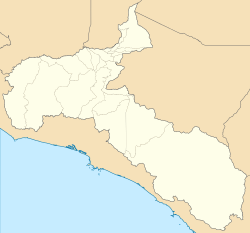 Turrubares Turrubares canton location in San José Province  Turrubares Turrubares canton location in Costa Rica | |
| Coordinates: 9°44′51″N 84°29′51″W / 9.7474683°N 84.4975157°W | |
| Country | |
| Province | San José |
| Creation | 30 July 1920[1] |
| Head city | San Pablo |
| Districts | |
| Government | |
| • Type | Municipality |
| • Body | Municipalidad de Turrubares |
| Area | |
| • Total | 415.29 km2 (160.34 sq mi) |
| Elevation | 313 m (1,027 ft) |
| Population (2011) | |
| • Total | 5,512 |
| • Density | 13/km2 (34/sq mi) |
| Time zone | UTC−06:00 |
| Canton code | 116 |
| Website | sitioweb |
Turrubares is a canton in the San José province of Costa Rica.[2][3]
YouTube Encyclopedic
-
1/3Views:4325965 208
-
VIDA MUNICIPAL- Programa 34- Cantón de Turrubares
-
How to find Costa Rica Land Valuation Maps
-
Un día en el río: Rio Picagres - San José ,Costa Rica
Transcription
History
Turrubares was created on 30 July 1920 by decree 56.[3]
Geography
Turrubares has an area of 415.29 km²[4] and a mean elevation of 313 metres.[2]
The Grande de Tárcoles River delineates the north and northwest boundaries of the canton. The Carara River, Camaronal River and the Fila Negra (Black Mountains) establish the boundary on the west. The south and southwest is marked by the Tulin River, and the Galán River and Azul Creek delineate portions of the canton's border on the east.
Districts
The canton of Turrubares is subdivided into the following districts:
Demographics
| Historical population | |||
|---|---|---|---|
| Census | Pop. | %± | |
| 1927 | 2,742 | — | |
| 1950 | 5,937 | 116.5% | |
| 1963 | 5,496 | −7.4% | |
| 1973 | 4,709 | −14.3% | |
| 1984 | 4,471 | −5.1% | |
| 2000 | 4,877 | 9.1% | |
| 2011 | 5,512 | 13.0% | |
|
Instituto Nacional de Estadística y Censos[5] |
|||
For the 2011 census, Turrubares had a population of 5,512 inhabitants, the least populated of the 82 cantons in Costa Rica.[7]
Transportation
Road transportation
The canton is covered by the following road routes:
References
- ^ Hernández, Hermógenes (1985). Costa Rica: evolución territorial y principales censos de población 1502 - 1984 (in Spanish) (1 ed.). San José: Editorial Universidad Estatal a Distancia. pp. 164–173. ISBN 9977-64-243-5. Retrieved 5 October 2020.
- ^ a b "Declara oficial para efectos administrativos, la aprobación de la División Territorial Administrativa de la República N°41548-MGP". Sistema Costarricense de Información Jurídica (in Spanish). 19 March 2019. Retrieved 26 September 2020.
- ^ a b División Territorial Administrativa de la República de Costa Rica (PDF) (in Spanish). Editorial Digital de la Imprenta Nacional. 8 March 2017. ISBN 978-9977-58-477-5.
- ^ "Área en kilómetros cuadrados, según provincia, cantón y distrito administrativo". Instituto Nacional de Estadística y Censos (in Spanish). Retrieved 26 September 2020.
- ^ "Instituto Nacional de Estadística y Censos" (in Spanish).
- ^ "Sistema de Consulta de a Bases de Datos Estadísticas". Centro Centroamericano de Población (in Spanish).
- ^ "Censo. 2011. Población total por zona y sexo, según provincia, cantón y distrito". Instituto Nacional de Estadística y Censos (in Spanish). Retrieved 26 September 2020.
| International | |
|---|---|
| National | |
This Costa Rican location article is a stub. You can help Wikipedia by expanding it. |