
| Tumblebug Complex Fire | |
|---|---|
 | |
| Date(s) | September 12, 2009 – October 2009 |
| Location | Willamette National Forest, Oregon |
| Coordinates | 43°25′55″N 122°14′28″W / 43.432°N 122.241°W |
| Statistics[1][2][3] | |
| Burned area | 14,560 acres (59 km2) |
| Land use | National Forest |
| Impacts | |
| Non-fatal injuries | 2 |
| Ignition | |
| Cause | Lightning |
| Map | |
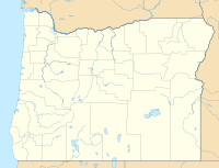 | |
The Tumblebug Complex Fire burned 14,570 acres (5,900 ha) of Willamette National Forest land in Lane County, Oregon, United States, from September 12, 2009 to October 2009.[2][4] The fire was located about 23 miles (37 km) southeast of Oakridge, Oregon, and roughly 5 miles (8.0 km) southwest of Crescent Lake.[2][3]
YouTube Encyclopedic
-
1/3Views:778578486
-
Fire Regimes of Southwest Oregon
-
Grass Fire 5600 W I-80 09-08-09
-
Siskiyou Blvd Fire - Ashland
Transcription
Growth and containment
Fed by wind gusts of up to 35 miles per hour (56 km/h) and extremely dry conditions, 25 small fires caused by lightning strikes grew and spread quickly, combining to form larger fires. Firefighters had difficulty fighting them due to the remote location and the rugged terrain, such as basalt cliffs.[3] The fires primarily burned trees ranging from 10 to 45 years old.[4][5]
By September 16, the fires had combined into three fires that were about 30 acres (12 ha) each in size. At that time, there were already 255 firefighters working to control the fires and the Willamette National Forest was forced to close several United States Forest Service roads.[6]
Nearly 600 firefighters were working to contain the fire by September 21, as the air became drier.[7] Two days later, on September 23, the Lane Regional Air Protection Agency rated the air quality in the "unhealthy" category for Eugene, and reported that the air quality was better in Oakridge. NASA satellite images showed that the smoke was being blown into British Columbia.[8]
The fire grew in size to 7,700 acres (3,100 ha) by September 24,[9] and had burned 9,228 acres (3,734 ha) by September 25.[10] The wind blew the smoke to the north, and created a hazy sky in Bend.[5]
Firefighters had contained five percent of the fire by September 26, although it had spread to about 10,500 acres (4,200 ha).[11] The fire continued growing, spreading to 11,100 acres (4,500 ha) by September 27. The 1,275 firefighters then working to put out the fire had it 12 percent contained, but predicted that it would continue burning until mid-October.[12] Two firefighters were injured as well.[1]
By September 28, the fire had spread to 12,000 acres (4,900 ha) and was 18 percent contained.[1] While wetter and cooler weather was forecasted, the fire continued to expand.[13] It was finally brought under control in October after burning a total of 14,570 acres (5,900 ha).[4]

References
- ^ a b c "Two firefighters injured fighting Tumblebug". KVAL News. Eugene, Ore. September 28, 2009. Archived from the original on October 2, 2011.
- ^ a b c Barnack, Anthony (July 1, 2011). "2009 Oregon Forest Fire Smoke Exceptional Event: Concurrence Request" (PDF). Oregon Department of Environmental Quality. Retrieved July 20, 2011.
- ^ a b c "InciWeb: Tumblebug Complex". inciweb.nwcg.gov. Retrieved 20 October 2016.
- ^ a b c Bailey, Tim (December 2009). "Tumblebug Complex Fire mortality assessment" (PDF). Middle Fork Ranger District. Archived from the original (PDF) on October 4, 2011.
- ^ a b Ramsayer, Kate (September 25, 2009). "Smoke from wildfires to mar our skies awhile". The Bulletin. Bend, Ore. Archived from the original on March 28, 2012.
- ^ "Trio of forest fires burning south of Oakridge". KPIC. Roseburg, Ore. September 16, 2009. Archived from the original on September 30, 2011.
- ^ "Hot, dry weather fuels fires SE of Oakridge". KVAL News. Eugene, Ore. September 21, 2009. Archived from the original on October 2, 2011.
- ^ Adams, Tom (September 23, 2009). "The smoke is making it … all the way to Canada". KVAL News. Eugene, Ore. Archived from the original on October 2, 2011.
- ^ "Weather helps slow Oregon wildfires". The Corvallis Gazette-Times. Corvallis, Ore. Associated Press. September 24, 2009. Archived from the original on September 27, 2009.
- ^ Guzik, Hannah (September 25, 2009). "Smoke expected to linger". The Ashland Daily Tidings. Ashland, Ore. Archived from the original on March 23, 2012.
- ^ Darling, Dylan (September 26, 2009). "North state haze caused by Oregon wildfires". The Redding Record Searchlight. Redding, Cal. Archived from the original on April 13, 2010.
- ^ "Drier conditions won't help battle against Tumblebug fire". The Register-Guard. Eugene, Ore. September 27, 2009. p. B1. Archived from the original on October 8, 2011.
- ^ "Two Oregon fires now partially contained". The Oregonian. Portland, Ore. Associated Press. September 29, 2009. Archived from the original on October 14, 2012.
External links
- Slideshow of photos of the fire from The Register-Guard
- Videos related to the fire from Google Videos