
West Tulang Bawang Regency
(Kabupaten Tulang Bawang Barat) | |
|---|---|
 | |
 Coat of arms | |
| Motto(s): Ragem Pai Mangi Wawai (Achieve the betterment by consensus) | |
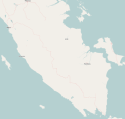
 Location within Lampung | |
| Coordinates: 4°26′23″S 105°02′40″E / 4.4398°S 105.0444°E | |
| Country | Indonesia |
| Province | Lampung |
| Regency seat | Panaragan Jaya |
| Government | |
| • Regent | Umar Ahmad |
| • Vice Regent | Fauzi Hasan |
| Area | |
| • Total | 1,201.15 km2 (463.77 sq mi) |
| Population (mid 2023 estimate)[1] | |
| • Total | 295,481 |
| • Density | 250/km2 (640/sq mi) |
| Time zone | UTC+7 (IWST) |
| Area code | (+62) 726 |
| Website | tulangbawangbaratkab |


West Tulang Bawang Regency (Indonesian: Kabupaten Tulung Bawang Barat) is a regency (kabupaten) of Lampung Province, Sumatra, Indonesia. It was created on 29 October 2008 from what were formerly the western districts of Tulang Bawang Regency. It has an area of 1,201.15 km2 and had a population of 250,707 people at the 2010 Census[2] and 286,162 at the 2020 Census;[3] the official estimate as at mid 2023 was 295,481 (comprising 150,600 males and 144,881 females).[1] The regency seat is the town of Panaragan Jaya.
YouTube Encyclopedic
-
1/3Views:1 0122 03216 658
-
Tornado damaged hundreds of homes in Indonesia
-
Craziest Tornado in China. Big tornado 2020
-
Category 2 Cyclone Amphan Hits India & Bangladesh - May 20 / May 21, 2020
Transcription
Administrative districts
At the time of the 2010 Census the Regency comprised eight districts (kecamatan), but subsequently a ninth district - Batu Putih - was created from the southwest part of Gunung Terang District. The first three districts listed below lie south of the Tulang Bawang River (although Tulang Bawang Udik District straddles the river in the west), while the other six districts lie north of the river. The districts are listed below with their areas and their populations at the 2010 Census[2] and the 2020 Census,[3] together with the official estimates as at mid 2023.[1] The table also includes the locations of the district administrative centres, the number of administrative villages in each district (totalling 93 rural desa and 3 urban kelurahan), and its post code.
| Kode Wilayah |
Name of District (kecamatan) |
Area in km2 |
Pop'n 2010 Census |
Pop'n 2020 Census |
Pop'n mid 2023 Estimate |
Admin centre |
No. of villages |
Post code |
|---|---|---|---|---|---|---|---|---|
| 18.12.03 | Tulang Bawang Udik | 237.50 | 29,969 | 33,231 | 33,980 | Karta | 9 | 34791 |
| 18.12.02 | Tumijajar | 133.22 | 40,547 | 44,658 | 45,560 | Dayamurni | 10 (a) | 34794 |
| 18.12.01 | Tulang Bawang Tengah (Central Tulang Bawang) |
274.93 | 76,559 | 86,351 | 88,790 | Panaragan Jaya | 19 (b) | 34793 |
| 18.12.08 | Pagar Dewa | 99.65 | 5,131 | 6,781 | 7,000 | Pagar Dewa | 6 | 34792 |
| 18.12.07 | Lambu Kibang | 109.82 | 21,831 | 23,278 | 24,210 | Kibang Budi Jaya | 10 | 34787 |
| 18.12.04 | Gunung Terang | 72.90 | 30,228 | 19,472 | 19,990 | Gunung Terang | 10 | 34784 |
| 18.12.09 | Batu Putih | 69.01 | (c) | 16,655 | 17,520 | Margo Mulyo | 10 | 34785 |
| 18.12.05 | Gunung Agung | 127.64 | 28,057 | 33,079 | 34,510 | Tunas Jaya | 13 | 34783 |
| 18.12.06 | Way Kenanga | 76.48 | 18,385 | 22,657 | 23,910 | Balam Jaya | 9 | 34788 |
| Totals | 1,201.15 | 250,707 | 286,162 | 295,481 | Panaragan Jaya | 96 |
Notes: (a) including kelurahan of Sumber Rejo. (b) including the two kelurahan of Panaragan Jaya and Mulyo Asri.
(c) the 2010 population of Batu Putih District was included in the figure for Gunung Terang District, from which it was subsequently cut out.[2]
References
Regencies and cities of Lampung | ||
|---|---|---|
Capital: Bandar Lampung | ||
| Regencies | ||
| Cities | ||
4°26′23″S 105°02′40″E / 4.4398°S 105.0444°E