
Tufanbeyli | |
|---|---|
District and municipality | |
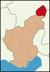 Map showing Tufanbeyli District in Adana Province | |
 Tufanbeyli Location in Turkey | |
| Coordinates: 38°15′53″N 36°13′21″E / 38.26472°N 36.22250°E | |
| Country | Turkey |
| Province | Adana |
| Government | |
| • Mayor | Ahmet Aktürk (CHP) |
| Area | 851 km2 (329 sq mi) |
| Elevation | 1,450 m (4,760 ft) |
| Population (2022)[1] | 16,400 |
| • Density | 19/km2 (50/sq mi) |
| Time zone | UTC+3 (TRT) |
| Postal code | 01640 |
| Area code | 0322 |
| Website | www |
Tufanbeyli is municipality and district of Adana Province, Turkey.[2] Its area is 851 km2,[3] and its population is 16,400 (2022).[1] It is 196 km north-east of the city of Adana, on an uneven, sloping plateau high in the Tahtalı range of the Taurus Mountains. It has been bounded economically to Kayseri, 178 km far. Its neighbors are Sarız from North, Göksun from east, Saimbeyli from south, Develi from south-west and Tomarza from west.[citation needed]
Tufanbeyli is reached by crossing one of three high mountain passes. It's a struggle to reach but the views are incredible. The river Göksu, a tributary of the Seyhan runs across the plateau. The climate is hot dry summers and cold winters. The mountains are forested but these are steadily being consumed by the local people.[citation needed]
YouTube Encyclopedic
-
1/1Views:6 389
-
Adana'nın Bilinmeyen ve Gizli Tutulan Kenti; Şar (Comana) Antik Kenti / Tufanbeyli
Transcription
History
During the Bronze Age, the area was part of the kingdom of Kizzuwatna. In classical antiquity, the region of Tufanbeyli was in the southwestern corner of Cappadocia (while the parts of the Adana region south of Tufanbeyli were in Cilicia). The city of Comana was situated near Şarköy, some kilometers north of Tufanbeyli.[4]
The area is now settled by descendants of Turks from the Caucasus and the Avşar (Afshar tribe; the former having come to Anatolia as a result of the Russian influx into the Caucasus in the 18th and 19th centuries. The latter being one of the group of Turkish migrants from Asia that have preserved their clan identity in Anatolia. The Avşar played a key role in the Turkish conquest of the Çukurova region and remained a local authority right up until the 19th century, especially in mountain strongholds like Tufanbeyli. Its former names were Höketçe before 1923 and Mağara between 1923 and 1967. It became a district in 1958 by separating from Saimbeyli.
Composition
There are 35 neighbourhoods in Tufanbeyli District:[5]
- Akçal
- Akpınar
- Ayvat
- Bozgüney
- Çatalçam
- Çukurkışla
- Cumhuriyet
- Damlalı
- Demiroluk
- Doğanbeyli
- Doğanlı
- Elemanlı
- Evci
- Fatih
- Fatmakuyu
- Güzelim
- Hanyeri
- İğdebel
- İstiklal
- Karsavuran
- Kayapınar
- Kayırcık
- Kirazlıyurt
- Koçcağız
- Mehmet Akif Ersoy
- Ortaköy
- Pekmezli
- Pınarlar
- Polatpınarı
- Şarköy
- Taşpınar
- Tozlu
- Yamanlı
- Yenicami
- Yeşilova
Power station
Mercury air pollution from the coal-fired power station has been estimated at over 500 kg/year. [6]
References
- ^ a b "Address-based population registration system (ADNKS) results dated 31 December 2022, Favorite Reports" (XLS). TÜİK. Retrieved 12 July 2023.
- ^ Büyükşehir İlçe Belediyesi, Turkey Civil Administration Departments Inventory. Retrieved 12 July 2023.
- ^ "İl ve İlçe Yüz ölçümleri". General Directorate of Mapping. Retrieved 12 July 2023.
- ^ Stillwell, Richard; MacDonald, William L.; McAllister, Marian Holland, eds. (1976). "Comana Cappadociae". The Princeton Encyclopedia of Classical Sites. Princeton University Press.
- ^ Mahalle, Turkey Civil Administration Departments Inventory. Retrieved 12 July 2023.
- ^ Myllyvirta, Lauri (2020). Air Quality and Health Impacts of the Proposed EMBA Hunutlu Coal Power Project (PDF) (Report).
External links
- Tufanbeyli District GovernorshipArchived 13 April 2009 at the Wayback Machine
- Tufanbeyli Municipality
- Short introduction to the area
- Website about the Avşar culture
Tufanbeyli in Adana Province of Turkey | |||||||||||||||||||||||||||
|---|---|---|---|---|---|---|---|---|---|---|---|---|---|---|---|---|---|---|---|---|---|---|---|---|---|---|---|
| Districts |   | ||||||||||||||||||||||||||
|
Metropolitan municipalities are bolded. | |||||||||||||||||||||||||||