
Tswaing | |
|---|---|
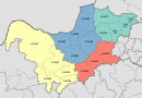
 Location in the North West | |
| Country | South Africa |
| Province | North West |
| District | Ngaka Modiri Molema |
| Seat | Delareyville |
| Wards | 15 |
| Government | |
| • Type | Municipal council |
| • Mayor | Manketse Tlhape |
| Area | |
| • Total | 5,966 km2 (2,303 sq mi) |
| Population (2011)[2] | |
| • Total | 124,218 |
| • Density | 21/km2 (54/sq mi) |
| Racial makeup (2011) | |
| • Black African | 92.4% |
| • Coloured | 1.4% |
| • Indian/Asian | 0.3% |
| • White | 5.6% |
| First languages (2011) | |
| • Tswana | 83.5% |
| • Afrikaans | 6.8% |
| • Sotho | 2.5% |
| • Xhosa | 2.2% |
| • Other | 5% |
| Time zone | UTC+2 (SAST) |
| Municipal code | NW382 |
Tswaing Municipality (Tswana: Mmasepala wa Tswaing) is a local municipality within the Ngaka Modiri Molema District Municipality, in the North West province of South Africa. It consists of the towns of Delareyville, Sannieshof and Ottosdal.
YouTube Encyclopedic
-
1/1Views:468
-
Tswaing crater - Video Learning - WizScience.com
Transcription
Main places
The 2011 census divided the municipality into the following main places:[4]
| Place | Code | Area (km2) | Population | Most spoken language |
|---|---|---|---|---|
| Atamelang | 666020 | 2.00 | 5.189 | Tswana |
| Deelpan | 666001 | 5.37 | 4,822 | Tswana |
| Delareyville | 666024 | 36.53 | 10,630 | Tswana |
| Diretsane | 666010 | 2.21 | 1,434 | Tswana |
| Doomlagte | 666006 | 1.96 | 572 | Tswana |
| Ganalaagte | 666014 | 2.92 | 2,830 | Tswana |
| Geluk | 666012 | 0.60 | 353 | Tswana |
| Geysdorp | 666022 | 3.58 | 1,365 | Tswana |
| Khunwana | 666004 | 17.92 | 7,651 | Tswana |
| Kopela | 666009 | 5.25 | 5,187 | Tswana |
| Letsopa | 666025 | 2.58 | 17,488 | Tswana |
| Majaneng | 666017 | 1.01 | 709 | Tswana |
| Majeng | 666013 | 2.43 | 1,501 | Tswana |
| Manamolele | 666021 | 2.96 | 7,695 | Tswana |
| Mandela Park | 666016 | 0.32 | 829 | Tswana |
| Manonyane | 666019 | 0.85 | 573 | Tswana |
| Mofufutso | 666008 | 4.52 | 2,467 | Tswana |
| Mokope | 666018 | 1.16 | 717 | Tswana |
| Ottosdal | 666026 | 5.15 | 884 | Afrikaans |
| Rakgwedi | 666015 | 1.55 | 3,021 | Tswana |
| Saleng | 666011 | 2.53 | 1,262 | Tswana |
| Sannieshof | 666023 | 5.42 | 11,016 | Tswana |
| Thaba Sione | 666003 | 3.00 | 1,195 | Tswana |
| Thawane | 666005 | 0.66 | 316 | Tswana |
| Witpan | 666007 | 2.38 | 1,148 | Tswana |
| Remainder of the municipality | 666002 | 5,851.41 | 36,379 | Tswana |
Politics
The municipal council consists of twenty-eight members elected by mixed-member proportional representation. Fourteen councillors are elected by first-past-the-post voting in fourteen wards, while the remaining fourteen are chosen from party lists so that the total number of party representatives is proportional to the number of votes received. In the election of 1 November 2021 the African National Congress (ANC) won a majority of nineteen seats on the council.
The following table shows the results of the election.[5]
| Party | Ward | List | Total seats | |||||
|---|---|---|---|---|---|---|---|---|
| Votes | % | Seats | Votes | % | Seats | |||
| African National Congress | 13,205 | 64.41 | 14 | 13,140 | 65.51 | 5 | 19 | |
| Economic Freedom Fighters | 2,600 | 12.68 | 0 | 2,810 | 14.01 | 4 | 4 | |
| Democratic Alliance | 2,585 | 12.61 | 0 | 2,549 | 12.71 | 4 | 4 | |
| Freedom Front Plus | 574 | 2.80 | 0 | 608 | 3.03 | 1 | 1 | |
| Independent candidates | 1,082 | 5.28 | 0 | 0 | ||||
| 4 other parties | 455 | 2.22 | 0 | 952 | 4.75 | 0 | 0 | |
| Total | 20,501 | 100.00 | 14 | 20,059 | 100.00 | 14 | 28 | |
| Valid votes | 20,501 | 97.74 | 20,059 | 95.65 | ||||
| Invalid/blank votes | 473 | 2.26 | 913 | 4.35 | ||||
| Total votes | 20,974 | 100.00 | 20,972 | 100.00 | ||||
| Registered voters/turnout | 48,900 | 42.89 | 48,900 | 42.89 | ||||
References
- ^ "Contact list: Executive Mayors". Government Communication & Information System. Archived from the original on 14 July 2010. Retrieved 22 February 2012.
- ^ a b "Statistics by place". Statistics South Africa. Retrieved 27 September 2015.
- ^ "Statistics by place". Statistics South Africa. Retrieved 27 September 2015.
- ^ Lookup Tables - Statistics South Africa
- ^ "Election Result Table for LGE2021 — Tswaing". wikitable.frith.dev. Retrieved 2021-12-04.
26°41′S 25°28′E / 26.683°S 25.467°E
Municipalities of the North West | ||||||||||
|---|---|---|---|---|---|---|---|---|---|---|
| District and local |
|  | ||||||||