
Tsimlyansk
Цимлянск | |
|---|---|
 Tsimlyansk Reservoir | |
 Flag  Coat of arms | |
Location of Tsimlyansk  | |
 Tsimlyansk Location of Tsimlyansk 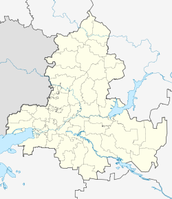 Tsimlyansk Tsimlyansk (Rostov Oblast) | |
| Coordinates: 47°38′52″N 42°05′46″E / 47.64778°N 42.09611°E | |
| Country | Russia |
| Federal subject | Rostov Oblast[1] |
| Administrative district | Tsimlyansky District[1] |
| Urban settlement | Tsimlyanskoye[1] |
| Founded | 1672 |
| Town status since | 1961 |
| Population | |
| • Total | 15,028 |
| • Estimate (2018)[3] | 14,528 (−3.3%) |
| • Capital of | Tsimlyansky District,[1] Tsimlyanskoye Urban Settlement[1] |
| • Municipal district | Tsimlyansky Municipal District[4] |
| • Urban settlement | Tsimlyanskoye Urban Settlement[4] |
| • Capital of | Tsimlyansky Municipal District,[4] Tsimlyanskoye Urban Settlement[4] |
| Time zone | UTC+3 (MSK |
| Postal code(s)[6] | 347320, 347323, 347325 |
| OKTMO ID | 60657101001 |
| Website | tsimlyansk-gorod |
Tsimlyansk (Russian: Цимля́нск) is a town and the administrative center of Tsimlyansky District in Rostov Oblast, Russia, located on the right bank of the Don River, on the coast of Tsimlyansk Reservoir, 236 kilometers (147 mi) northeast of Rostov-on-Don, the administrative center of the oblast. Population: 15,028 (2010 Census);[2] 15,444 (2002 Census);[7] 15,343 (1989 Census).[8]
YouTube Encyclopedic
-
1/1Views:531 137
-
Дон: От истока до устья | Интересные факты про реку Дон
Transcription
History
It was founded in 1672 by the Don Cossacks as Ust-Tsimla (Усть-Цимла).[citation needed] Until 1950, it was known as the stanitsa of Tsimlyanskaya (Цимля́нская).[citation needed] In 1950–1952, the stanitsa was resettled in the new location due to the construction of the Tsimlyansk Reservoir and the Tsimlyansk Hydroelectric Station. It was granted town status in 1961.[citation needed]
Administrative and municipal status
Within the framework of administrative divisions, Tsimlyansk serves as the administrative center of Tsimlyansky District.[1] As an administrative division, it is incorporated within Tsimlyansky District as Tsimlyanskoye Urban Settlement.[1] As a municipal division, this administrative unit also has urban settlement status and is a part of Tsimlyansky Municipal District.[4]
Geography
Climate
| Climate data for Tsimlyansk (extremes 1952-present) | |||||||||||||
|---|---|---|---|---|---|---|---|---|---|---|---|---|---|
| Month | Jan | Feb | Mar | Apr | May | Jun | Jul | Aug | Sep | Oct | Nov | Dec | Year |
| Record high °C (°F) | 15.4 (59.7) |
19.6 (67.3) |
22.4 (72.3) |
31.1 (88.0) |
35.6 (96.1) |
37.6 (99.7) |
40.2 (104.4) |
40.9 (105.6) |
37.3 (99.1) |
30.6 (87.1) |
20.9 (69.6) |
15.1 (59.2) |
40.9 (105.6) |
| Mean daily maximum °C (°F) | −1.1 (30.0) |
0.1 (32.2) |
6.3 (43.3) |
15.5 (59.9) |
22.3 (72.1) |
27.5 (81.5) |
30.1 (86.2) |
29.5 (85.1) |
22.6 (72.7) |
14.8 (58.6) |
6.0 (42.8) |
0.7 (33.3) |
14.5 (58.1) |
| Daily mean °C (°F) | −3.7 (25.3) |
−3.3 (26.1) |
2.1 (35.8) |
10.1 (50.2) |
16.8 (62.2) |
21.9 (71.4) |
24.5 (76.1) |
23.9 (75.0) |
17.5 (63.5) |
10.6 (51.1) |
3.0 (37.4) |
−1.9 (28.6) |
10.1 (50.2) |
| Mean daily minimum °C (°F) | −6.0 (21.2) |
−5.9 (21.4) |
−0.9 (30.4) |
5.8 (42.4) |
12.3 (54.1) |
17.0 (62.6) |
19.6 (67.3) |
18.9 (66.0) |
13.2 (55.8) |
7.2 (45.0) |
0.6 (33.1) |
−4.1 (24.6) |
6.5 (43.7) |
| Record low °C (°F) | −31.4 (−24.5) |
−31.8 (−25.2) |
−23.8 (−10.8) |
−8.5 (16.7) |
−0.7 (30.7) |
3.6 (38.5) |
9.3 (48.7) |
4.8 (40.6) |
−1.2 (29.8) |
−9.7 (14.5) |
−27.0 (−16.6) |
−27.8 (−18.0) |
−31.8 (−25.2) |
| Average precipitation mm (inches) | 43.3 (1.70) |
34.5 (1.36) |
40.5 (1.59) |
27.6 (1.09) |
52.2 (2.06) |
40.3 (1.59) |
42.8 (1.69) |
20.7 (0.81) |
38.2 (1.50) |
42.6 (1.68) |
37.6 (1.48) |
46.2 (1.82) |
466.5 (18.37) |
| Source: pogoda.ru.net[9] | |||||||||||||
References
Notes
- ^ a b c d e f g h Law #340-ZS
- ^ a b Russian Federal State Statistics Service (2011). Всероссийская перепись населения 2010 года. Том 1 [2010 All-Russian Population Census, vol. 1]. Всероссийская перепись населения 2010 года [2010 All-Russia Population Census] (in Russian). Federal State Statistics Service.
- ^ "26. Численность постоянного населения Российской Федерации по муниципальным образованиям на 1 января 2018 года". Federal State Statistics Service. Retrieved January 23, 2019.
- ^ a b c d e Law #254-ZS
- ^ "Об исчислении времени". Официальный интернет-портал правовой информации (in Russian). June 3, 2011. Retrieved January 19, 2019.
- ^ Почта России. Информационно-вычислительный центр ОАСУ РПО. (Russian Post). Поиск объектов почтовой связи (Postal Objects Search) (in Russian)
- ^ Russian Federal State Statistics Service (May 21, 2004). Численность населения России, субъектов Российской Федерации в составе федеральных округов, районов, городских поселений, сельских населённых пунктов – районных центров и сельских населённых пунктов с населением 3 тысячи и более человек [Population of Russia, Its Federal Districts, Federal Subjects, Districts, Urban Localities, Rural Localities—Administrative Centers, and Rural Localities with Population of Over 3,000] (XLS). Всероссийская перепись населения 2002 года [All-Russia Population Census of 2002] (in Russian).
- ^ Всесоюзная перепись населения 1989 г. Численность наличного населения союзных и автономных республик, автономных областей и округов, краёв, областей, районов, городских поселений и сёл-райцентров [All Union Population Census of 1989: Present Population of Union and Autonomous Republics, Autonomous Oblasts and Okrugs, Krais, Oblasts, Districts, Urban Settlements, and Villages Serving as District Administrative Centers]. Всесоюзная перепись населения 1989 года [All-Union Population Census of 1989] (in Russian). Институт демографии Национального исследовательского университета: Высшая школа экономики [Institute of Demography at the National Research University: Higher School of Economics]. 1989 – via Demoscope Weekly.
- ^ "Климат Цимлянска" (in Russian). Retrieved January 1, 2023.
Sources
- Законодательное Собрание Ростовской области. Закон №340-ЗС от 25 июля 2005 г. «Об административно-территориальном устройстве Ростовской области», в ред. Закона №270-ЗС от 27 ноября 2014 г. «О внесении изменений в областной Закон "Об административно-территориальном устройстве Ростовской области"». Вступил в силу со дня официального опубликования. Опубликован: "Наше время", №187–190, 28 июля 2005 г. (Legislative Assembly of Rostov Oblast. Law #340-ZS of July 28, 2005 On the Administrative-Territorial Structure of Rostov Oblast, as amended by the Law #270-ZS of November 27, 2014 On Amending the Oblast Law "On the Administrative-Territorial Structure of Rostov Oblast". Effective as of the official publication date.).
- Законодательное Собрание Ростовской области. Закон №254-ЗС от 27 декабря 2004 г. «Об установлении границ и наделении соответствующим статусом муниципального образования "Цимлянский район" и муниципальных образований в его составе». Вступил в силу с 1 января 2005 г. Опубликован: "Наше время", №339, 29 декабря 2004 г. (Legislative Assembly of Rostov Oblast. Law #254-ZS of December 27, 2004 On Establishing the Borders and Granting an Appropriate Status to the Municipal Formation of "Tsimlyansky District" and to the Municipal Formations It Comprises. Effective as of January 1, 2005.).
| International | |
|---|---|
| National | |