
Tseminyü District | |
|---|---|
| Nickname: Historical District | |
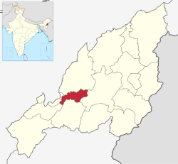 Tseminyü District in Nagaland | |
| Country | |
| State | Nagaland |
| Headquarters | Tseminyü |
| Government | |
| • Lok Sabha Constituency | Nagaland |
| • MP[1] | Tokheho Yepthomi, NDPP |
| • Deputy Commissioner | Zasekuolie Chüsi (IAS) |
| • Assembly constituencies | 1 constituencies |
| Area | |
| • Total | 256 km2 (99 sq mi) |
| Population (2011)[3] | |
| • Total | 63,269 |
| • Density | 250/km2 (640/sq mi) |
| Time zone | UTC+05:30 (IST) |
| Major highways | |
Tseminyü District is the 13th district of the Indian state of Nagaland. It was created on December 18, 2021. The district headquarter is located in the town of Tseminyü. It is home to the Rengma Nagas, with a population of 63,269 (2011) and an area of 256 square kilometres.
YouTube Encyclopedic
-
1/2Views:1 841631
-
Tseminyu district Headquarter "The land of potential" | GeoClub|SS
-
Five New Districts of Nagaland: Noklak, Nuiland, Chümoukedima, Tseminyü and Shamator.
Transcription
History
Tseminyü District was created on December 18, 2021 as the 13th district of Nagaland. The new district has the same boundaries as the former Tseminyü sub-division of Kohima District.[4]
Geography
Tseminyü District covers an area of 256 km. The climate is sub-tropical with a monsoon season.
Administration
The district covers two taluks (administrative circles), which are Tseminyü and Tsogin.
Tseminyü District contains one rural development blocks, which are Tseminyü and Tsogin.
Demographics

According to the 2011 census of India the then Tseminyü circle of Kohima District had a population of 63,629. The majority of the inhabitants are the Rengma Nagas.
The total literacy rate of Niuland is 81.71%. The Child sex ratio is 980 which is greater than the Average Sex Ratio of 1,011.[5]
Religion
Religion in Tseminyü district (2011)
According to the 2011 official census, Christianity is major religion in Tseminyu with small population of other religious minorities.[5]
Towns and villages
As of 2011[update] the 2011 census the erstwhile sub-division held 39 villages, spread over two administrative circles as follows: Tseminyü circle comprises the one town of Tseminyü (6,315), and the thirty-two villages of :
- Tesophenyü (11,116), Kandinu (3,938), Nsünyü (2,868), Tseminyü Vill. (2,863), Zisunyü (2,840), Phenshunyü (2,675), Sishunu (2,236), K. Station (2,169), Chunlikha (1,604), Terogunyü (1,559), Ziphenyü (1,495), Ehunnu (1,139), Kashanyü (833), Tseminyü South (765), Phenwhenyü (729), Rumensinyü (712), Khenyü (569), Sewanu (540), New Tesophenyü (516), Kashanyishi (428), Tsonsa (417), Ngvuphen (379), Gukhanyü (340), Yikhanu (331), Tseminyü Old Town (329), Henbenji (278), New Terogunyü (269), Khonibenzun (242), Likhwenchu (241), Guzinyü (222), Phenda (207), Zunpha Mission Centre (150).
Tsogin circle comprises seven villages :
- Sendenyü (2,548), New Sendenyü (730), Tsosinyü (696), Rengmapani (627), Thongsunyü (464), Longwesunyü (429), Tsogin HQ (31).
Transportation
Air
The nearest airport is Dimapur Airport located about 100 kilometres from the district headquarters at Tseminyü. The currently under construction airport at Kohima Chiethu Airport once completed will serve as the nearest airport to Tseminyü District.
Rail
The nearest railway station is the Chümoukedima Shokhüvi Railway Station located 100 kilometres away from Tseminyü.
Road

The NH 2 passes through the district.
See also
References
- ^ "Lok Sabha Members". Lok Sabha. Retrieved December 18, 2021.
- ^ total area of the 2 circles.
- ^ total population of the 2 circles.
- ^ "Nagaland creates 3 more districts". The Assam Tribune. December 18, 2021. Retrieved December 18, 2021.
- ^ a b "Tseminyu Circle Population, Caste, Religion Data - Kohima district, Nagaland". www.censusindia.in. Retrieved 2022-09-24.
Places adjacent to Tseminyü district | ||||||||||||||||
|---|---|---|---|---|---|---|---|---|---|---|---|---|---|---|---|---|
| ||||||||||||||||
25°55′29″N 94°12′54″E / 25.92469°N 94.21488°E