
Trenton, Michigan | |
|---|---|
| City of Trenton | |
 Trenton City Hall on Third Street | |
 Seal | |
 Location within Wayne County | |
 Trenton Location within the State of Michigan  Trenton Location within the United States | |
| Coordinates: 42°08′22″N 83°10′42″W / 42.13944°N 83.17833°W | |
| Country | |
| State | |
| County | |
| Settled | 1816 |
| Incorporated | 1855 (village) 1957 (city) |
| Government | |
| • Type | Council–manager |
| • Mayor | Steven Rzeppa |
| • Administrator | Dean Creech (Acting) |
| • Clerk | Debra Devitt |
| Area | |
| • City | 7.55 sq mi (19.55 km2) |
| • Land | 7.24 sq mi (18.76 km2) |
| • Water | 0.30 sq mi (0.79 km2) |
| Elevation | 597 ft (182 m) |
| Population (2020) | |
| • City | 18,544 |
| • Density | 2,559.91/sq mi (988.38/km2) |
| • Metro | 4,285,832 (Metro Detroit) |
| Time zone | UTC-5 (EST) |
| • Summer (DST) | UTC-4 (EDT) |
| ZIP code(s) | 48183 |
| Area code | 734 |
| FIPS code | 26-80420[2] |
| GNIS feature ID | 1615062[3] |
| Website | www |
Trenton is a city in Wayne County, Michigan, United States. At the 2010 census, the city population was 18,853.[4]
A Shawnee village was built in the area by war chief Blue Jacket after the 1795 Treaty of Greenville. The area later became the site of the Battle of Monguagon between Americans and a British-Indian coalition during the War of 1812. The battle is commemorated with a Michigan State Historical Site marker in present-day Elizabeth Park, which was the first county park in Michigan when it was established in 1919. Portions of the Detroit River International Wildlife Refuge are within the southern portion of Trenton.
The area was once part of the now-defunct Monguagon Township. Trenton was incorporated as a village in 1855 and again as a city in 1957. The city is part of the Downriver collection of communities south of Detroit on the west bank of the Detroit River. Trenton is known for its waterfront and growing boating community. Major industries include Stellantis-Chrysler's Trenton Engine Plant, Solutia, and the DTE Energy Trenton Channel Power Plant. Beaumont Hospital – Trenton is located within city limits and has 203 beds. The former McLouth Steel plant is also located in the city. The city operates the 21,000-square-foot (2,000 m2) Trenton Veterans Memorial Library and a historical museum.
YouTube Encyclopedic
-
1/2Views:640878
-
Elizabeth Park, Trenton, Michigan, USA
-
Trenton Michigan Did Good
Transcription
History
The founder of Trenton is considered to be Abram Caleb Truax, a member of the territorial militia in attendance when General William Hull surrendered Detroit to the British General Isaac Brock early in the War of 1812. After the war, in 1816, Truax acquired a large tract of land in the Michigan Territory along the Detroit River from the U.S. government and constructed a sawmill, church and store in what is today downtown Trenton. When Territorial Governor Lewis Cass organized Monguagon Township in 1827, Truax became the first township supervisor. He laid out the village of Truaxton in 1834. A post office had been established there named "Monguago" in 1828 with Truax as the first postmaster. The post office name was changed to "Truago" in 1837, and to "Trenton" in 1847, after a type of limestone mined from a local quarry. The village was platted and recorded under the name Trenton in 1850 by Abram Truax's son and daughter George Brigham Truax and Sophia Slocum, the wife of industrialist Giles Slocum.[5][6][7] The Slocum family estate was given to the county, becoming what is known as Elizabeth Park, named after Elizabeth Slocum.
In 1834 an industrialist, Giles Bryan Slocum, constructed a dock, making Trenton a major hub of steamboat traffic.[8] In 1846, Captain Arthur Edwards founded the Detroit & Cleveland Steamboat Company in Trenton. Through the late 1880s Trenton, like several Downriver communities, was known for its extensive shipyards. Sibley, Michigan would not be incorporated into Trenton until 1929.
Trenton was incorporated as a village in 1855.
A Detroit businessman and later Michigan's first U.S. attorney, Solomon Sibley, started a limestone quarry near Trenton, near what is today Fort Street and Sibley Road. Materials from the quarry were used to construct structures in Detroit, most notably Fort Detroit along the Detroit River. The quarry was later sold to Austin Church,[9] who used limestone to make baking soda, which he sold under his family's nameplate, Arm & Hammer. In 1900 the quarry was the site of the Sibley Quarry explosion.
Through the late 1880s and even early 1900s, Trenton prospered because it was roughly a day's journey between Detroit and Monroe, Michigan, which meant people traveling between the two cities would have to stop overnight in Trenton.[10] Painted center lines, an innovation vital to the traffic control of modern road transport, were first implemented in 1911 by legendary road developer Edward N. Hines on River Road (modern West Jefferon Avenue).[11]
Trenton annexed the village of Sibley (along the modern Riverview border) in 1929, extending the city's northern boundary to modern-day Sibley Road. Trenton was incorporated as a city in 1957. In 1920 a small light railroad ran along West Jefferson to Wyandotte. The rail services ended in 1934. The tracks were removed in 1942 for the war effort.
Geography
According to the United States Census Bureau, the city has a total area of 7.51 square miles (19.45 km2), of which 7.28 square miles (18.86 km2) is land and 0.23 square miles (0.60 km2) is water.[12] The city is located between Detroit and Monroe, Michigan, in the southeastern part of the state. The city is located on the western bank of the Detroit River and is bounded by Grosse Ile to the east, Gibraltar to the south, Riverview to the north, Brownstown Township to the west and south and Woodhaven to the west.
Demographics
| Census | Pop. | Note | %± |
|---|---|---|---|
| 1880 | 1,103 | — | |
| 1890 | 789 | −28.5% | |
| 1920 | 1,682 | — | |
| 1930 | 4,022 | 139.1% | |
| 1940 | 5,284 | 31.4% | |
| 1950 | 6,222 | 17.8% | |
| 1960 | 18,439 | 196.4% | |
| 1970 | 24,127 | 30.8% | |
| 1980 | 22,762 | −5.7% | |
| 1990 | 20,586 | −9.6% | |
| 2000 | 19,584 | −4.9% | |
| 2010 | 18,853 | −3.7% | |
| 2020 | 18,544 | −1.6% | |
| U.S. Decennial Census[13] | |||
2010 census
As of the census[14] of 2010, there were 18,853 people, 7,988 households, and 5,159 families residing in the city. The population density was 2,589.7 inhabitants per square mile (999.9/km2). There were 8,539 housing units at an average density of 1,172.9 per square mile (452.9/km2). The racial makeup of the city was 95.5% White, 1.3% African American, 0.5% Native American, 0.7% Asian, 0.5% from other races, and 1.4% from two or more races. Hispanic or Latino of any race were 3.2% of the population.
There were 7,988 households, of which 27.9% had children under the age of 18 living with them, 49.1% were married couples living together, 11.3% had a female householder with no husband present, 4.2% had a male householder with no wife present, and 35.4% were non-families. 32.3% of all households were made up of individuals, and 16.4% had someone living alone who was 65 years of age or older. The average household size was 2.33 and the average family size was 2.95.
The median age in the city was 45 years. 21.3% of residents were under the age of 18; 7.7% were between the ages of 18 and 24; 21% were from 25 to 44; 30.3% were from 45 to 64; and 19.8% were 65 years of age or older. The gender makeup of the city was 48.1% male and 51.9% female.
2000 census
As of the census[2] of 2000, there were 19,584 people, 8,137 households, and 5,590 families residing in the city. The population density was 2,682.8 inhabitants per square mile (1,035.8/km2). There were 8,345 housing units at an average density of 1,143.2 per square mile (441.4/km2). The racial makeup of the city was 96.92% White, 0.37% African American, 0.41% Native American, 0.78% Asian, 0.03% Pacific Islander, 0.23% from other races, and 1.26% from two or more races. Hispanic or Latino of any race were 1.99% of the population.
There were 8,137 households, out of which 29.8% had children under the age of 18 living with them, 55.6% were married couples living together, 10.0% had a female householder with no husband present, and 31.3% were non-families. 28.6% of all households were made up of individuals, and 14.1% had someone living alone who was 65 years of age or older. The average household size was 2.38 and the average family size was 2.93.
In the city, the population was spread out, with 23.3% under the age of 18, 6.0% from 18 to 24, 26.8% from 25 to 44, 24.3% from 45 to 64, and 19.6% who were 65 years of age or older. The median age was 42 years. For every 100 females, there were 90.9 males. For every 100 females age 18 and over, there were 86.3 males.
The median income for a household in the city was $49,566, and the median income for a family was $61,891. Males had a median income of $52,123 versus $31,892 for females. The per capita income for the city was $25,288. About 4.0% of families and 5.1% of the population were below the poverty line, including 6.1% of those under age 18 and 4.1% of those age 65 or over.
Transportation
 M-85: Known locally as Fort Street, it runs north–south through the center of Trenton and connects with Interstate 75 about 3 miles (4.8 km) south of Trenton.
- West Jefferson Avenue runs north–south along the eastern portion of Trenton near the Detroit River.
- Wayne County Bridge connects the city of Trenton to Grosse Ile Township across the Trenton Channel of the Detroit River.
Economy
Trenton has an unemployment rate of 6.5%, higher than the US average of 3.7%. The sales tax rate is 6.0%, below the US average of 6.2%. The income tax rate is 4.3%, below the US average is 4.6%. The recent job growth rates in Trenton is at 0.7%, below the US average of 1.6%. The future job growth rates are estimated to be 35%, above the US average of 33.5%. Per capita income in Flat Rock is at an average rate of $31,870, above the average of $31,177. The average household income is $59,943, above the US average of $57,652. The family median income is $78,100 above the US average of $70,850.[15]
Trenton is home to many large industrial facilities, including Solutia, Chrysler Trenton Engine Plant, the Trenton Channel Power Plant, Kerkstra Precast, and the former Vulcan Mold and McLouth Steel properties.
Trenton Channel Power Plant

The Trenton Channel Power Plant, a coal-burning power station in Trenton, opened on the shoreline of Detroit River in 1924, on the south side of Slocum Island. It is owned by Detroit Edison, a subsidiary of DTE Energy. It had 6 turbine generators with 13 coal-fired boilers when first commissioned. Each unit produced a rated 50 megawatts of electricity. Five short smoke stacks exhausted gases from the boilers. These were the first Detroit Edison units to use pulverized coal rather than the older style stoker-fired beds of coal. They were also the first power plants in the US to use electrostatic precipitators to capture fly ash from the stacks. Electrostatic precipitators, however, were in use in other industries at the time. In 1950, a second plant started up at the same site and adjoined the first plant. It had two turbine generators, #7 and #8, with a rating of 120 megawatts each. Two short smoke stacks released gases from the four boilers. Finally in 1968, Unit #9 was placed in service. It is a 550-megawatt turbine generator fed by a single boiler. It adjoins the high side plant and is located on the south side. One 563-foot-tall smoke stack is used for this unit. Soon afterwards, another stack, identical to the #9 stack, was erected to replace the two short stacks on the high side plant. Both tall stacks remain in service as of 2012.
The characteristic striped smokestacks were constructed with an innovative “smokestack within a smokestack” design to reduce the level of pollutants released. The inner smokestacks were lined with asbestos to achieve this, which ended up later being removed at great cost.[16] The plant strives to keep its area pollutant-free. In 2002, the facility was designated a corporate wildlife habitat by the Wildlife Habitat Council. Because of their efforts, the Trenton Channel Power Plant and Sibley Quarry were co-awarded the Wildlife Habitat Council's Corporate Habitat of the Year award in 2004.[17]
By the mid-1970s, the low side plant was decommissioned and the boiler house was eventually demolished. In the 2010s, all generators except #9 were closed. The power plant is scheduled to close by 2023, because DTE Energy is planning to change to natural gas and renewable energy power plants.[18]
McLouth Steel Trenton Plant

In 1948, McLouth Steel purchased riverfront land along Jefferson Avenue to begin building its second complex. Between the land purchase and the buildout, the project cost more than $100 million [19] and by 1949, the first ingots were poured at the site. By 1954, the Trenton Plant was dedicated and McLouth became able to produce iron as an integrated steel mill.
McLouth, the ninth largest steelmaker in the United States, was known both by the industry and its own slogan as a pioneer. It was the first in the United States to use the basic oxygen process,[20] the first to have online computer control of steelmaking processes, the first to use a continuous caster in the United States,[20] the first to cast 100% of its steel by continuous caster, and the first to use inductive slab heating.[20]
Due to a high dependence on automotive customers, outdated and incorrectly sized equipment, union-management struggles, and economic downturns, McLouth underwent multiple bankruptcies and reorganizations in the 1980s and 1990s. McLouth ultimately shuttered for good in 1996, and with it, the Trenton Plant.
The plant was sold later that year to the Detroit Steel Company. Through the early 2000s, Detroit Steel primarily brought in outside steel, pickled it, and sold it. The plant's many failed startup attempts led to Wayne County's 2017 foreclosure on the site, after owners failed to pay $3.7 million in back taxes.[21] MSC Land Co. purchased the land, entering into an agreement to demolish all buildings and perform some remediation. The proposed use for the land is an intermodal operation utilizing its port, rail lines, and proximity to freeways. The site was put on EPA's Superfund National Priorities List in May 2019.[22]
Demolition and cleanup is currently being led by Crown Enterprises and overseen by the EPA and the Michigan Department of Environment, Great Lakes, and Energy (EGLE). All buildings are scheduled to be demolished by December 2020.[23]
Beaumont Hospital
Seaway Hospital, now called Beaumont Hospital, opened up on Fort Street in 1961 as a community hospital in Trenton. Specialties there include diabetes and endocrinology, gastroenterology and GI surgery, geriatrics, nephrology, neurology and neurosurgery, orthopedics, pulmonology and urology.[24]
Trenton Engine Plant
The Trenton Engine Plant is a Chrysler factory in Trenton, Michigan. The north factory opened in 1952 and underwent major expansion in 1969. Trenton Engine was the site chosen for production of the 2.2 L four-cylinder engine which debuted in 1980 in the K-cars. In 1985, the north factory underwent another expansion, and later in 2005, Daimler Chrysler reportedly invested $297 million in order to expand the Trenton Engine plant to prepare to build a new 4.0 L version of the SOHC V6 and to also revitalize the 3.8 line. The north factory stopped manufacturing engines in May 2011, and Chrysler announced that it would invest $114 million to repurpose one-fifth or nearly 400,000 square feet of the plant for the production of core components for the Pentastar V-6 engine. In November 2012, the company announced that it would invest an additional $40 million to add a flexible production line that can run both the Pentastar engine and the Tigershark (I-4) engine.
The south factory opened in 2010. Its current product is the 3.6L Pentastar V6 engine, and the 2.0L FCA Global Medium Engine L4 engine.
Education
Trenton has four public schools with more than 3,000 students total.
- Anderson Elementary School
- Hedke Elementary school
- Arthurs Middle School (formerly known as Monguagon Middle School)
- Trenton High School
A portion of Trenton, north of King Road, is in the Riverview Community School District.
St. Joseph Catholic School in Trenton opened in February 1948, with the school renovated in 1999.[25]
Defunct school
Slocum Truax Junior High School was a former junior high school that resided in the present-day Slocum Truax Park in a neighborhood nearby downtown Trenton, which ended up closing in July 1979. In October 1980, the city of Trenton made an attempt to auction off the building and property, but the auction was canceled after the rear of the building was broken into and vandalized, according to the Trenton Times newspaper. The headstone of the building was nearly destroyed when the building was demolished in October 1980, but an effort by then-councilman William Muddiman rescued the piece from utter destruction, according to the Trenton Times. The headstone with the school's name that once hung above the entrance of the school currently rests at the front of the Slocum Truax Park. It is the last remaining piece of the former school.[26]
Former elementary schools included Strohm School (1937-1980s), Owen School (1950s-1980s), Foley School (1950s-1980s), and Taylor School (1968-1980s).[27]
Culture
- Trenton features an active community revolving around sports. Its downtown area, along West Jefferson Avenue, features an annual craft fair the last weekend of June, called the Trenton Summer Festival.
- The recently remodeled Trenton Village Theatre is located in the downtown area Trenton Village Theatre | DYPAC. The art deco theater was designed by Charles N. Agree, who also created the Grande Ballroom in Detroit, among many others.
- Trenton operates the Bridge Cultural Center at 2427 West Road, a former farmhouse that now houses an array of yearly activities, including an annual Christmas fair and arts and crafts events.
- Trenton is home to the Wyandot Nation of Anderdon, one of four Wyandot communities in North America.[28]
Festivals
Trenton has several festivals throughout the year:
- Roar on the River
- Taste of Trenton
- Country Christmas
- Somewhere in Time
- Trenton Summer Festival
- Scarecrow Festival
- Country on the River
Sport
Trenton was the city of the Michigan Stars in the All-American Hockey League. They played their games at the Kennedy Ice Arena. The team folded during 1987-88 AAHL season after 14 games.
Parks and recreation
The city recently spent $8.4 million to renovate the Kennedy Recreation Center, a 150,000-square-foot (14,000 m2) complex along West Road that includes ice rinks, meeting rooms, and sports services, a sporting goods shop. The Teifer rink was originally an outdoor rink, which opened during Christmas week in 1961. The facility is home to the Trenton, Riverview, Grosse Ile, and Gibraltar Carlson High School hockey teams.
Adjacent is the Kennedy Outdoor Aquatic Center, a 13,000-square-foot (1,200 m2) pool and water park that opened in 2005. The facility includes a 25-meter, 8-lane competitive pool with two diving boards, a 15-meter lap pool, a waterslide with separate splash area, and a 7,000-square-foot (650 m2) leisure pool.
The city has 200 acres (0.81 km2) of parks, including 22 operated by the city and 6 at schools. The city and Wayne County each also operate boat launches. The city of Trenton launch is located in Rotary Park, while the Wayne County launch is located at the south end of Elizabeth Park.
Along the Detroit River, Elizabeth Park, operated by Wayne County, is a popular destination for picnic-goers, fishermen, and boaters.
The city runs the Westfield Activities Center, which hosts meetings and houses the city's senior citizen program, the Teifer Building, and the Haas Park Building.
In the south of the city, is the Humbug Marsh Unit of the Detroit River International Wildlife Refuge. This unit of the refuge is shared between Trenton and Gibraltar to the south. The refuge features the last natural shoreline on the Detroit River as well as old growth forest, marshland, swamps and savanna. White-tailed deer, red fox, coyotes, beavers, muskrat, and river otters all live in the Humbug Marsh Unit. The park is an important migratory bird stop and bird watching has become a popular activity there. The park also features an information center, fishing pier, observation decks and picnic areas. Hiking, cross-country skiing, snowshoeing, bird watching, kayaking and fishing are all popular outdoor activities at the park, where there are many viewpoints of the Detroit River opening up to Lake Erie. The park consists of the mainland wetland and forest area as well as the small offshore island, Humbug Island, which contains old growth forest and bald eagle nesting sites.
Notable people
- Steve Avery, former Atlanta Braves pitcher
- Zak Bagans, host and lead investigator of the Travel Channel's paranormal series Ghost Adventures
- Anthony Bass, professional baseball pitcher
- Erik Condra, NHL ice hockey player
- Larry DePalma, former NHL player
- Donald M. Dickinson, U.S. postmaster general under President Grover Cleveland
- Christopher D. Dingell, state senator and judge
- Andy Greene, NHL player
- Deby LaPlante, retired track and field athlete
- Ann Marie Lipinski, journalist and former editor of the Chicago Tribune
- Gary Lowe, Michigan State and NFL defensive back
- Kevin Nash, professional wrestler and actor
- Lee Norwood, NHL player
- J. J. Putz, relief pitcher for the Arizona Diamondbacks
- Mary Lynn Rajskub, comedian and actress
- Mike Rucinski, ice hockey player
- Matt Shoemaker, starting pitcher for the Los Angeles Angels
- Bradley A. Smith, professor of law and Clinton appointee to the Federal Election Commission
References
- ^ "2020 U.S. Gazetteer Files". United States Census Bureau. Retrieved May 21, 2022.
- ^ a b "U.S. Census website". United States Census Bureau. Retrieved 2008-01-31.
- ^ "US Board on Geographic Names". United States Geological Survey. 2007-10-25. Retrieved 2008-01-31.
- ^ "Race, Hispanic or Latino, Age, and Housing Occupancy: 2010 Census Redistricting Data (Public Law 94-171) Summary File (QT-PL), Trenton city, Michigan". United States Census Bureau. Retrieved September 8, 2011.
- ^ Compendium of history and biography of the city of Detroit and Wayne County, Michigan. 2005.
{{cite book}}:|work=ignored (help) - ^ Chronography of notable events in the history of the Northwest Territory and Wayne County. 2005.
{{cite book}}:|work=ignored (help) - ^ Chronography of notable events in the history of the Northwest Territory and Wayne County. 2005.
{{cite book}}:|work=ignored (help) - ^ "History of Trenton". City of Trenton. Archived from the original on 2007-05-18. Retrieved 2007-06-05.
- ^ "History of the Logo". Church & Dwight. Archived from the original on 2007-07-28. Retrieved 2007-06-05.
- ^ Gillespie, Brendan. "Descendants of Philippe du Trieux". Jennifer Smith's Genealogy Page. Retrieved 2007-06-05.
Trenton's start was simply because of its location. It was the last high ground from Detroit to Monroe, and a day's journey from Detroit, an overnight stop.
- ^ "Inventor of Highway Centerline Receives International Honor". MLive. Booth Newspapers. November 3, 2011. Retrieved July 17, 2018.
- ^ "US Gazetteer files 2010". United States Census Bureau. Archived from the original on 2012-01-25. Retrieved 2012-11-25.
- ^ "Census of Population and Housing". Census.gov. Retrieved June 4, 2015.
- ^ "U.S. Census website". United States Census Bureau. Retrieved 2012-11-25.
- ^ "Economy in Trenton, Michigan". Retrieved December 26, 2019.
- ^ GLOBAL Encasement, Inc (2009). "112 - Detroit Edison, Trenton Channel Power Plant". Archived from the original on October 31, 2010. Retrieved March 15, 2010.
- ^ Wildlife Habitat Council (July 2005). "A Portfolio of DTE Energy's Activities with the Wildlife Habitat Council" (PDF). Archived (PDF) from the original on 2010-07-09. Retrieved March 15, 2010.
- ^ DTE to shut down three coal plants within 7 years, Frank Witsil, Detroit Free Press, June 8, 2016
- ^ "McLouth Steel plant has decades of good and bad memories for former employees". Dave Herndon. Retrieved April 7, 2017.
- ^ a b c "A Leader in Steel Finds Role Costly". The New York Times. 11 January 1970.
- ^ "County seizes former McLouth Steel plant after owners failed to pay $3.7M in back taxes". Jason Alley. Retrieved April 4, 2017.
- ^ "McLouth Steel site put on EPA's Superfund National Priorities List". Crain's Detroit Business. May 13, 2019.
- ^ Twitter, Jackie Harrison-Martin jmartin@medianewsgroup com; @JackieMartin22 on. "Several buildings demolished at former McLouth Steel property in Trenton". News-Herald. Retrieved 2020-02-06.
{{cite web}}:|last=has generic name (help)CS1 maint: multiple names: authors list (link) CS1 maint: numeric names: authors list (link) - ^ "Rankings". health.usnews.com. Retrieved 2019-05-23.
- ^ "Our History". St. Joseph Catholic School. Retrieved 2020-05-01.
- ^ "Slocum Truax Park Was More Than an Open Field". Nate Stemen, Patch Staff. 2 September 2011. Retrieved December 26, 2019.
- ^ "Superintendent / History of Our Schools".
- ^ "Nations of Wyandot". Archived from the original on 2012-08-01. Retrieved 2012-11-11. Wyandot Nation of Anderdon
External links
Downriver communities – Wayne County, Michigan | ||
|---|---|---|
| Cities | 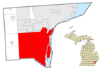 | |
| Charter townships | ||
| Civil township | ||
| Unincorporated communities | ||
| Footnotes | ‡This populated place also has portions in an adjacent county or counties | |
Municipalities and communities of Wayne County, Michigan, United States | ||
|---|---|---|
| Cities |
|  |
| Charter townships | ||
| Civil townships | ||
| Unincorporated communities | ||
| Footnotes | ‡This populated place also has portions in an adjacent county or counties | |
| Topics |  | |
|---|---|---|
| Detroit | ||
| Municipalities over 80,000 | ||
| Municipalities 40,000 to 80,000 | ||
| Cultural enclaves | ||
| Satellite cities | ||
| Counties in MSA | ||
| Counties in CSA | ||
| International | |
|---|---|
| National | |
| Geographic | |