
| Tope de Coroa | |
|---|---|
 View of the mountain summit (in the background) | |
| Highest point | |
| Elevation | 1,979 m (6,493 ft)[1][2] |
| Prominence | 1,979 m (6,493 ft)[1] |
| Listing | Ultra |
| Coordinates | 17°01′57″N 25°17′45″W / 17.03250°N 25.29583°W |
| Geography | |
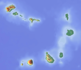 Tope de Coroa Location in Cape Verde, on the island of Santo Antão | |
| Location | Santo Antão, Cape Verde |
| Geology | |
| Mountain type | Stratovolcano |
| Last eruption | around 200,000 years ago |
Tope de Coroa is a mountain on the island of Santo Antão's, Cape Verde, Africa. At 1,979 m elevation, it is the highest point of the island.[2] It is in the western part of the island, 25 km west of the island capital Porto Novo. The mountain is entirely of volcanic origin. The area is the source of several streams including Ribeira de Monte Trigo which flows westward to Monte Trigo.

The mountain forms part of a natural park, covering 84.92 km2 (32.79 sq mi).[3][4] It contains 61% of the endemic angiosperm plants of Cape Verde, of which 25% are in the red list of endangered species, including Periploca laevigata subsp. chevalieri. Free grazing is a threat to the biodiversity of the area.[5] Tope de Coroa consists of relatively young volcanic rock, formed between 200,000 and 170,000 years ago.[6]
YouTube Encyclopedic
-
1/3Views:17 3643 730210 007
-
PASSO A PASSO COROA DE BISCUIT
-
CAP VERT: Santo Antão, Ponta do Sol: Film de Raymond GRELET.
-
Tiara com Flores de Cetim - how to make a new satin flower model
Transcription
See also
References
- ^ a b "Africa Ultra-Prominences" Peaklist.org. Retrieved 2012-04-22.
- ^ a b Cabo Verde, Statistical Yearbook 2015, Instituto Nacional de Estatística, p. 25
- ^ Resolução nº 36/2016, Estratégia e Plano Nacional de Negócios das Áreas Protegidas
- ^ Parques Naturais, Áreas protegidas Cabo Verde
- ^ Consultoria em Gestão de Recursos Naturais, Isildo Gomes, p. 17-30
- ^ Holm, Paul Martin (2006). Sampling the Cape Verde Mantle Plume: Evolution of Melt Compositions on Santo Antão, Cape Verde Island. Vol. 47. p. 145-18. doi:10.1093/petrology/egi071.
External links
- Áreas protegidas, Cabo Verde (in Portuguese)