
Toole County | |
|---|---|
 Toole County Courthouse in Shelby | |
 Location within the U.S. state of Montana | |
 Montana's location within the U.S. | |
| Coordinates: 48°39′N 111°41′W / 48.65°N 111.69°W | |
| Country | |
| State | |
| Founded | 1914 |
| Named for | Joseph Toole |
| Seat | Shelby |
| Largest city | Shelby |
| Area | |
| • Total | 1,946 sq mi (5,040 km2) |
| • Land | 1,916 sq mi (4,960 km2) |
| • Water | 30 sq mi (80 km2) 1.5% |
| Population (2020) | |
| • Total | 4,971 |
| • Estimate (2022) | 5,082 |
| • Density | 2.6/sq mi (0.99/km2) |
| Time zone | UTC−7 (Mountain) |
| • Summer (DST) | UTC−6 (MDT) |
| Congressional district | 2nd |
| Website | www |
| |
Toole County is a county in the northern portion of the U.S. state of Montana. As of the 2020 census, the population was 4,971.[1] Its county seat is Shelby.[2] The county was established in 1914 from parts of Hill County and Teton County and was named after Joseph Toole, the first and fourth governor of Montana. Its northern boundary is the Canada–United States border south of Alberta.
YouTube Encyclopedic
-
1/4Views:5894 6113 9871 672
-
Firefighters Convention Parade in Shelby Montana
-
WEEKEND GUIDE TO - Shelby, Montana
-
Climbing West Butte, Sweet Grass Hills, Montana USA 2015
-
Farmland for sale in Montana with Income from Wind Leases
Transcription
Geography
According to the United States Census Bureau, the county has a total area of 1,946 square miles (5,040 km2), of which 1,916 square miles (4,960 km2) is land and 30 square miles (78 km2) (1.5%) is water.[3]
Its northern boundary is the Canada–United States border. A part of its southern boundary by the southwestern county corner is formed by Marias River, which flows eastward through the southern part of the county. In the eastern part are several creeks, the largest of which is Willow, which rises in the Sweet Grass Hills and follows a southerly course through the county. In the Sweet Grass Hills and elsewhere indications of oil and gas have been found.
Major highways
 Interstate 15 - connects to Alberta Highway 4 at Canadian border
 U.S. Route 2
Adjacent counties
- Glacier County - west
- Pondera County - south
- Liberty County - east
- County of Warner No. 5, Alberta - north
- County of Forty Mile No. 8, Alberta - northeast
Demographics
| Census | Pop. | Note | %± |
|---|---|---|---|
| 1920 | 3,724 | — | |
| 1930 | 6,714 | 80.3% | |
| 1940 | 6,769 | 0.8% | |
| 1950 | 6,867 | 1.4% | |
| 1960 | 7,904 | 15.1% | |
| 1970 | 5,839 | −26.1% | |
| 1980 | 5,559 | −4.8% | |
| 1990 | 5,046 | −9.2% | |
| 2000 | 5,267 | 4.4% | |
| 2010 | 5,324 | 1.1% | |
| 2020 | 4,971 | −6.6% | |
| 2022 (est.) | 5,082 | [4] | 2.2% |
| U.S. Decennial Census[5] 1790–1960,[6] 1900–1990,[7] 1990–2000,[8] 2010–2020[1] | |||
2020 census
As of the 2020 census, there were 4,971 people living in the county.[citation needed]
2010 census
As of the 2010 census, there were 5,324 people, 2,015 households, and 1,246 families in the county. The population density was 2.8 inhabitants per square mile (1.1/km2). There were 2,336 housing units at an average density of 1.2 units per square mile (0.46 units/km2). The racial makeup of the county was 92.0% white, 4.5% American Indian, 0.5% black or African American, 0.4% Asian, 0.6% from other races, and 1.9% from two or more races. Those of Hispanic or Latino origin made up 2.4% of the population. In terms of ancestry, 30.8% were German, 17.7% were Irish, 15.8% were English, 10.5% were Norwegian, and 3.6% were American.
Of the 2,015 households, 27.3% had children under the age of 18 living with them, 49.8% were married couples living together, 7.4% had a female householder with no husband present, 38.2% were non-families, and 34.3% of all households were made up of individuals. The average household size was 2.26 and the average family size was 2.88. The median age was 41.5 years.
The median income for a household in the county was $42,949 and the median income for a family was $54,722. Males had a median income of $41,490 versus $32,582 for females. The per capita income for the county was $20,464. About 11.3% of families and 15.7% of the population were below the poverty line, including 23.2% of those under age 18 and 8.0% of those age 65 or over.
Politics
Toole County voters have only selected Republican Party candidates in national elections since 1964.
| Year | Republican | Democratic | Third party | |||
|---|---|---|---|---|---|---|
| No. | % | No. | % | No. | % | |
| 2020 | 1,596 | 75.32% | 467 | 22.04% | 56 | 2.64% |
| 2016 | 1,497 | 73.49% | 402 | 19.73% | 138 | 6.77% |
| 2012 | 1,440 | 68.51% | 582 | 27.69% | 80 | 3.81% |
| 2008 | 1,317 | 62.09% | 737 | 34.75% | 67 | 3.16% |
| 2004 | 1,583 | 68.50% | 690 | 29.86% | 38 | 1.64% |
| 2000 | 1,639 | 68.92% | 630 | 26.49% | 109 | 4.58% |
| 1996 | 1,203 | 48.47% | 874 | 35.21% | 405 | 16.32% |
| 1992 | 943 | 34.71% | 854 | 31.43% | 920 | 33.86% |
| 1988 | 1,505 | 57.14% | 1,070 | 40.62% | 59 | 2.24% |
| 1984 | 1,949 | 70.41% | 789 | 28.50% | 30 | 1.08% |
| 1980 | 2,000 | 70.18% | 634 | 22.25% | 216 | 7.58% |
| 1976 | 1,469 | 56.43% | 1,080 | 41.49% | 54 | 2.07% |
| 1972 | 1,679 | 59.64% | 897 | 31.87% | 239 | 8.49% |
| 1968 | 1,407 | 51.96% | 1,048 | 38.70% | 253 | 9.34% |
| 1964 | 1,223 | 42.55% | 1,649 | 57.38% | 2 | 0.07% |
| 1960 | 1,577 | 47.10% | 1,767 | 52.78% | 4 | 0.12% |
| 1956 | 1,927 | 56.89% | 1,460 | 43.11% | 0 | 0.00% |
| 1952 | 1,853 | 56.25% | 1,426 | 43.29% | 15 | 0.46% |
| 1948 | 1,092 | 37.81% | 1,756 | 60.80% | 40 | 1.39% |
| 1944 | 1,113 | 41.72% | 1,545 | 57.91% | 10 | 0.37% |
| 1940 | 1,218 | 38.28% | 1,954 | 61.41% | 10 | 0.31% |
| 1936 | 654 | 22.68% | 2,120 | 73.51% | 110 | 3.81% |
| 1932 | 862 | 29.99% | 1,917 | 66.70% | 95 | 3.31% |
| 1928 | 1,325 | 54.71% | 1,076 | 44.43% | 21 | 0.87% |
| 1924 | 697 | 37.49% | 439 | 23.61% | 723 | 38.89% |
| 1920 | 861 | 61.28% | 405 | 28.83% | 139 | 9.89% |
| 1916 | 698 | 35.40% | 1,075 | 54.51% | 199 | 10.09% |
Communities
City
- Shelby (county seat)
Towns
Census-designated places
Other unincorporated communities
Notable people
- Earl W. Bascom (1906-1995), "Father of Modern Rodeo" and Hall of Fame cowboy, artist, sculptor, actor, inventor; cowboyed in the 1920s on a ranch on Kicking Horse Creek once owned by his cousin C.M. Russell
- Charles M. Russell (1864-1926), cowboy artist and sculptor; ranched on Kicking Horse Creek near the Sweetgrass Hills; honored in the Hall of Great Westerners in Oklahoma City
See also
- List of lakes in Toole County, Montana
- List of mountains in Toole County, Montana
- National Register of Historic Places listings in Toole County MT
References
- ^ a b "State & County QuickFacts". United States Census Bureau. Retrieved May 9, 2023.
- ^ "Find a County". National Association of Counties. Retrieved June 7, 2011.
- ^ "2010 Census Gazetteer Files". U.S. Census Bureau. August 22, 2012. Archived from the original on December 5, 2014. Retrieved November 30, 2014.
- ^ "Annual Estimates of the Resident Population for Counties: April 1, 2020 to July 1, 2022". United States Census Bureau. Retrieved May 9, 2023.
- ^ "U.S. Decennial Census". United States Census Bureau. Retrieved November 30, 2014.
- ^ "Historical Census Browser". University of Virginia Library. Retrieved November 30, 2014.
- ^ "Population of Counties by Decennial Census: 1900 to 1990". United States Census Bureau. Retrieved November 30, 2014.
- ^ "Census 2000 PHC-T-4. Ranking Tables for Counties: 1990 and 2000" (PDF). United States Census Bureau. Archived (PDF) from the original on March 27, 2010. Retrieved November 30, 2014.
- ^ Leip, David. "Atlas of US Presidential Elections". uselectionatlas.org. Retrieved April 3, 2018.
- ^ Devon MT Google Maps (accessed January 7, 2019)
- ^ Dunkirk MT Google Maps (accessed January 7, 2019)
- ^ Ferdig MT Google Maps (accessed January 7, 2019)
- ^ Gold Butte MT Google Maps (accessed January 7, 2019)
- ^ Kippen MT Google Maps (accessed January 7, 2019)
- ^ Naismith MT Google Maps (accessed January 7, 2019)
- ^ Ohio Camp MT Google Maps (accessed January 7, 2019)
- ^ Virden MT Google Maps (accessed January 7, 2019)
External links
- Toole County Website (official site)
- City of Shelby (official site)
- (Shelby Area Chamber of Commerce)
- NBMC (24/7 Local News and Events)
- Shelby Promoter (weekly newspaper)
Places adjacent to Toole County, Montana | ||||||||||||||||
|---|---|---|---|---|---|---|---|---|---|---|---|---|---|---|---|---|
| ||||||||||||||||
Municipalities and communities of Toole County, Montana, United States | ||
|---|---|---|
| City | 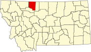 | |
| Towns | ||
| CDPs | ||
| Other communities | ||
| International | |
|---|---|
| National | |
| Other | |
48°39′N 111°41′W / 48.65°N 111.69°W