
| Tonnerre | |
|---|---|
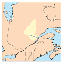 Watershed of Saguenay River | |
| Location | |
| Country | Canada |
| Province | Quebec |
| Region | Saguenay-Lac-Saint-Jean |
| Physical characteristics | |
| Source | Île Ronde Lake |
| • location | Lac-Ashuapmushuan, Quebec, MRC Le Domaine-du-Roy, Saguenay-Lac-Saint-Jean, Quebec |
| • coordinates | 49°26′13″N 74°03′34″W / 49.43694°N 74.05944°W |
| • elevation | 406 m (1,332 ft) |
| Mouth | Normandin River |
• location | Lac-Ashuapmushuan, Quebec, MRC Le Domaine-du-Roy, Saguenay-Lac-Saint-Jean, Quebec |
• coordinates | 49°21′08″N 74°04′35″W / 49.35222°N 74.07639°W |
• elevation | 383 m (1,257 ft) |
| Length | 12.6 km (7.8 mi)[1] |
| Basin features | |
| Tributaries | |
| • left |
|
| • right |
|
The rivière au Tonnerre (English: Tonnerre River) is a tributary of the Normandin River, flowing into the unorganized territory of Lac-Ashuapmushuan, Quebec in the Regional County Municipality (RCM) of Le Domaine-du-Roy, in the administrative region of Saguenay-Lac-Saint-Jean, in Quebec, in Canada.
The Tonnerre River flows entirely in the Township of Ducharme. Forestry is the main economic activity of this valley; recreational tourism activities, second.
The route 167 (northwesterly) connecting Chibougamau to Saint-Félicien, Quebec cuts the middle of the Tonnerre River. The Canadian National Railway runs along this road.
The surface of the Tonnerre River is usually frozen from early November to mid-May, however, safe ice circulation is generally from mid-November to mid-April.
Geography
- North side: Coquille River, Coquille Lake, Boisvert River (Normandin River), Armitage River;
- East side: Chaudière River (Normandin River), Atouk Creek, Little Chef's River;
- South side: Bouteville Creek, Normandin River, Poutrincourt Lake, Marquette River West;
- West side: Nicabau Lake, Rohault Lake, Bouteroue Lake, Boisvert River (Normandin River).
The Tonnerre River originates at the mouth of "Île Ronde Lake" (length: 2.8 kilometres (1.7 mi) width: 0.5 kilometres (0.31 mi) altitude: 406 metres (1,332 ft)) in the township of Ducharme. The mouth of this head lake is located at:
- 5.2 kilometres (3.2 mi) north-east of Nicabau Lake;
- 9.1 kilometres (5.7 mi) north of the mouth of the "Tonnerre River" (confluence with the Normandin River);
- 23.4 kilometres (14.5 mi) south-east of Obatogamau Lakes;
- 32.1 kilometres (19.9 mi) northwest of the mouth of the Normandin River (confluence with Ashuapmushuan Lake);
- 152.8 kilometres (94.9 mi) northwest of the mouth of the Ashuapmushuan River (confluence with Lac Saint-Jean).
From the mouth of Round Island Lake, the "Tonnerre River" flows over 12.6 kilometres (7.8 mi), according to the following segments:
- 2.3 kilometres (1.4 mi) towards the Southwest, to the dump (coming from the North-West) of the Crouton lakes, the Pooh, the Bannock, Astier and Carei;
- 2.7 kilometres (1.7 mi) southeasterly to the outlet (from the southeast) of Wilfrid Lake;
- 2.8 kilometres (1.7 mi) southwesterly to route 167;
- 2.1 kilometres (1.3 mi) south by cutting the Canadian National Railway, then crossing Harquail Lake (length: 2.3 kilometres (1.4 mi); altitude: 392 metres (1,286 ft)), to its mouth;
- 2.7 kilometres (1.7 mi) southerly crossing Verreault Lake (elevation: 389 kilometres (242 mi)) along its entire length to its mouth. Note: This lake is also fed by the outlet (coming from the North-East) of Jacques-Drouin, Guitare and Hassels lakes.[2]
The confluence of the "Tonnerre River" with the Normandin River is located at:
- 1.0 kilometre (0.62 mi) downstream north-east of the mouth of Nicabau Lake which is crossed by the Normandin River;
- 26.0 kilometres (16.2 mi) south-west of the mouth of the Normandin River (confluence with Ashuapmushuan Lake);
- 147.8 kilometres (91.8 mi) west of the mouth of the Ashuapmushuan River (confluence with the lac Saint-Jean);
- 186.7 kilometres (116.0 mi) northwest of the mouth of lac Saint-Jean (confluence with the Saguenay River).
Toponymy
The term "Normandin" is a family name of French origin.
The toponym "Rivière au Tonnerre" was formalized on June 8, 1971, at the Commission de toponymie du Québec.[3]
Notes and references
- ^ "Atlas of Canada". atlas.nrcan.gc.ca. Retrieved 2018-02-15.
- ^ Segments of the river measured from the Atlas of Canada (published on Internet) by the Department of Canada's natural resources.
- ^ Commission de toponymie du Quebec - Bank of Place Names - Toponym: "Rivière au Tonnerre".
See also
- Saguenay River
- Lac Saint-Jean, a body of water
- Ashuapmushuan River, a watercourse
- Ashuapmushuan Lake, a body of water
- Normandin River, a watercourse
- Lac-Ashuapmushuan, Quebec, an unorganized territory
- Le Domaine-du-Roy, a regional county municipality (MRC)
- List of rivers of Quebec