
Tongrim County
동림군 | |
|---|---|
| Korean transcription(s) | |
| • Chosŏn'gŭl | 동림군 |
| • Hancha | 東林郡 |
| • McCune-Reischauer | Tongrim-kun |
| • Revised Romanization | Dongrim-gun |
 | |
| Country | North Korea |
| Province | North P'yŏngan |
| Administrative divisions | 1 ŭp, 2 workers' districts, 20 ri |
| Area | |
| • Total | 415.3 km2 (160.3 sq mi) |
| Population (2008) | |
| • Total | 104,614[1] |
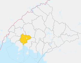
Tongrim County is a kun, or county, in coastal southwestern North P'yŏngan province, North Korea. It borders P'ihyŏn and Ch'ŏnma to the north, Sŏnch'ŏn to the east, Ch'ŏlsan to the southwest and Yŏmju to the west. To the south, it looks out on the Yellow Sea.
Geography
The landscape is dominated by low, rolling hills and basins. The highest point is Munsusan, rising to 736 m on the northern border. Tongrim is drained by the Ch'ŏngch'ŏn River and its tributaries, including the Maryŏng River and the Kokch'ŏn stream. Some 60% of the county is covered by forestland; only 26% of the area is cultivated.[citation needed]
Administrative divisions
Tongrim county is divided into 1 ŭp (town), 2 rodongjagu (workers' districts) and 20 ri (villages):
|
|
Climate
The year-round average temperature is 8.8 °C; the January mean is -8.7 °C, while the August average is 24 °C. Annual rainfall averages 1000 mm.[citation needed]
Economy
The cultivated land is irrigated, with crops including rice, maize, soybeans, wheat, barley, and tobacco. Aquaculture is also practiced. There are various mines and factories producing machinery including pumps.[citation needed]
Transportation
The P'yŏngŭi Line of the Korean State Railway passes through Tongrim county on its way between Sinŭiju and P'yŏngyang.[citation needed]
Places of interest
Noted landmarks include Tongrim Falls, a 10-meter waterfall, and the Tongrim Manchurian Ash, which is North Korean natural monument No. 11.[citation needed]
See also
References
- ^ 조선중앙통계국,2008년 인구 조사 Archived 2010-03-31 at the Wayback Machine,2009년.
- International Information Research Institute (국제정보연구소) (1999). "동림군". 北韓情報總覽 2000 [Bukhan jeongbo chong-ram 2000]. Seoul: Author. p. 841.
External links
- In Korean language online encyclopedias:

This North Korea location article is a stub. You can help Wikipedia by expanding it. |