
| Tioga Pass | |
|---|---|
 | |
| Elevation | 9,945 ft (3,031 m)[1] |
| Traversed by | |
| Location | Mono / Tuolumne counties, California, United States |
| Range | Sierra Nevada |
| Coordinates | 37°54′40″N 119°15′29″W / 37.91111°N 119.25806°W[1] |
| Topo map | USGS Tioga Pass |
 Location in California | |
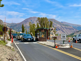
Tioga Pass is a mountain pass in the Sierra Nevada mountain range of California. State Route 120 runs through it, and serves as the eastern entry point for Yosemite National Park, at the Tioga Pass Entrance Station. It is the highest elevation highway pass in California and in the Sierra Nevada at an elevation of 9,945 ft (3,031 m).[1][2] Mount Dana is to the east of the pass, and Gaylor Peak to the west.
YouTube Encyclopedic
-
1/1Views:1 323
-
Ride over the Sierra Nevada Mountains (Tioga Pass) on a Harley
Transcription
Etymology
Tioga Pass is named after Tioga Mine, whose name came from the Tioga River in New York: Tioga is an Iroquois and Mohawk term meaning "where it forks".[citation needed]
Description
This pass, like many other passes in the Sierra Nevada, has a gradual approach from the west and drops off to the east dramatically, losing more than 3,000 ft (910 m) by the time the road reaches U.S. Route 395.
The pass is subject to winter closure due to high snowfall, normally from around the end of October until the end of May the following year, though these dates are subject to considerable variation. In heavy snow years, the road has closed in early October, and has remained closed as late as late July. In light snow years, the road may remain open until December and open as early as April.[3][4][5]
Tioga Pass is the most direct route from Bishop or Mammoth Lakes, California to Fresno, Merced, and Stockton. There are four highway passes to the north, between Yosemite and Lake Tahoe, but none to the south for about 200 mi (320 km), until Sherman Pass in southern Tulare County.
The pass is on the Great Basin Divide, which demarcates the Great Basin, which is the largest contiguous area of endorheic basins in North America.
Recreation
There are several trailheads into the Yosemite backcountry which begin at Tioga Pass, including the trail to the Gaylor Lakes to the west/northwest, and the trail to the summit of Mount Dana. Dana Meadows is immediately south of the pass alongside the highway, as the pass itself is roughly angled north–south as opposed to east–west. Dana Meadows contains several small lakes.
A popular recreation and camping area exists just north of the summit of the pass at Tioga Lake. It is in the Inyo National Forest.
Less than 7 miles to the southwest of the pass, inside Yosemite National Park, is Tuolumne Meadows. The Pacific Crest Trail passes through, and it crosses the highway here.
Climate
| Climate data for Tioga Pass, California (1981–2010) | |||||||||||||
|---|---|---|---|---|---|---|---|---|---|---|---|---|---|
| Month | Jan | Feb | Mar | Apr | May | Jun | Jul | Aug | Sep | Oct | Nov | Dec | Year |
| Mean daily maximum °F (°C) | 34.2 (1.2) |
34.6 (1.4) |
39.0 (3.9) |
43.4 (6.3) |
49.3 (9.6) |
57.4 (14.1) |
66.7 (19.3) |
66.1 (18.9) |
59.2 (15.1) |
49.4 (9.7) |
40.9 (4.9) |
35.9 (2.2) |
48.0 (8.9) |
| Daily mean °F (°C) | 22.0 (−5.6) |
22.1 (−5.5) |
26.1 (−3.3) |
30.6 (−0.8) |
37.1 (2.8) |
45.0 (7.2) |
54.1 (12.3) |
52.5 (11.4) |
46.8 (8.2) |
38.1 (3.4) |
29.9 (−1.2) |
24.5 (−4.2) |
35.7 (2.1) |
| Mean daily minimum °F (°C) | 10.0 (−12.2) |
9.7 (−12.4) |
13.0 (−10.6) |
17.9 (−7.8) |
24.9 (−3.9) |
32.6 (0.3) |
41.5 (5.3) |
40.8 (4.9) |
34.4 (1.3) |
26.8 (−2.9) |
18.9 (−7.3) |
13.2 (−10.4) |
23.6 (−4.6) |
| Average precipitation inches (mm) | 4.23 (107) |
3.97 (101) |
2.14 (54) |
1.81 (46) |
1.09 (28) |
0.71 (18) |
0.75 (19) |
0.67 (17) |
0.72 (18) |
1.34 (34) |
2.81 (71) |
3.84 (98) |
24.08 (611) |
| Average snowfall inches (cm) | 37.8 (96) |
43.8 (111) |
35.4 (90) |
31.6 (80) |
6.1 (15) |
2.5 (6.4) |
0.4 (1.0) |
0.0 (0.0) |
0.8 (2.0) |
7.5 (19) |
17.3 (44) |
40.9 (104) |
224.1 (568.4) |
| Source: WRCC [6] | |||||||||||||
Wildlife
Some of the wildlife in the area include birds of prey, marmots, bobcats, and occasionally bighorn sheep can be seen.
See also
References
- ^ a b c U.S. Geological Survey Geographic Names Information System: Tioga Pass
- ^ "Tioga Pass in California". AllTrips. Retrieved 2012-04-21.
- ^ "Tioga Road Opening & Closing Dates". National Park Service. Retrieved May 8, 2008.
- ^ "Tioga Pass Road Opening and Closing Dates". Mono Basin Clearing House. Retrieved May 8, 2008.
- ^ "Winter Driving Tips". Caltrans. Retrieved January 2, 2023.
- ^ "Climate in Tioga Pass, California". WRCC.
External links
 Media related to Tioga Pass (category) at Wikimedia Commons
- Tioga Pass Road Hiking Trails
- Tioga Pass Status from CalTrans
| Attractions |
| |||||||
|---|---|---|---|---|---|---|---|---|
| People | ||||||||
| Lodging and camping | ||||||||
| Natural disasters | ||||||||
| Transportation | ||||||||
| Nearby municipalities | ||||||||
| Additional information | ||||||||

| Mountains |
| |||||||||||
|---|---|---|---|---|---|---|---|---|---|---|---|---|
| Passes | ||||||||||||
| Rivers | ||||||||||||
| Lakes | ||||||||||||
| Protected areas |
| |||||||||||
| Communities | ||||||||||||
| Ski areas | ||||||||||||
| Trails | ||||||||||||
