
Tintah, Minnesota | |
|---|---|
 Location of Tintah, Minnesota | |
| Coordinates: 46°0′37″N 96°19′18″W / 46.01028°N 96.32167°W | |
| Country | United States |
| State | Minnesota |
| County | Traverse |
| Platted | March 1, 1887 |
| Incorporated | May 2, 1889 |
| Government | |
| • Mayor | Randall Don Bullis |
| Area | |
| • Total | 0.752 sq mi (1.947 km2) |
| • Land | 0.752 sq mi (1.947 km2) |
| • Water | 0.000 sq mi (0.000 km2) |
| Elevation | 997 ft (304 m) |
| Population | |
| • Total | 67 |
| • Estimate (2022)[4] | 65 |
| • Density | 89.10/sq mi (34.41/km2) |
| Time zone | UTC–6 (Central (CST)) |
| • Summer (DST) | UTC–5 (CDT) |
| ZIP Code | 56583 |
| Area code | 218 |
| FIPS code | 27-64948 |
| GNIS feature ID | 0653215[2] |
| Sales tax | 6.875%[5] |
Tintah is a city in Traverse County, Minnesota, United States. The population was 67 at the 2020 census.[3]
YouTube Encyclopedic
-
1/1Views:10 695 226
-
Native America before European Colonization
Transcription
Geography
According to the United States Census Bureau, the city has a total area of 0.752 square miles (1.95 km2), all land.[1]
Minnesota State Highway 9 serves as a main route in the community, and Minnesota State Highway 55 is nearby.
Demographics
| Census | Pop. | Note | %± |
|---|---|---|---|
| 1900 | 220 | — | |
| 1910 | 217 | −1.4% | |
| 1920 | 249 | 14.7% | |
| 1930 | 192 | −22.9% | |
| 1940 | 200 | 4.2% | |
| 1950 | 235 | 17.5% | |
| 1960 | 228 | −3.0% | |
| 1970 | 167 | −26.8% | |
| 1980 | 119 | −28.7% | |
| 1990 | 74 | −37.8% | |
| 2000 | 79 | 6.8% | |
| 2010 | 63 | −20.3% | |
| 2020 | 67 | 6.3% | |
| 2022 (est.) | 65 | [4] | −3.0% |
| U.S. Decennial Census[6] 2020 Census[3] | |||
2010 census
As of the 2010 census, there were 63 people, 29 households, and 17 families residing in the city. The population density was 82.9 inhabitants per square mile (32.0/km2). There were 34 housing units at an average density of 44.7 per square mile (17.3/km2). The racial makeup of the city was 98.4% White and 1.6% from two or more races.
There were 29 households, of which 24.1% had children under the age of 18 living with them, 37.9% were married couples living together, 13.8% had a female householder with no husband present, 6.9% had a male householder with no wife present, and 41.4% were non-families. 41.4% of all households were made up of individuals, and 24.1% had someone living alone who was 65 years of age or older. The average household size was 2.17 and the average family size was 2.82.
The median age in the city was 44.3 years. 27% of residents were under the age of 18; 6.2% were between the ages of 18 and 24; 19.1% were from 25 to 44; 23.8% were from 45 to 64; and 23.8% were 65 years of age or older. The gender makeup of the city was 57.1% male and 42.9% female.
2000 census
As of the 2000 census, there were 79 people, 37 households, and 21 families residing in the city. The population density was 104.7 inhabitants per square mile (40.4/km2). There were 45 housing units at an average density of 59.6 per square mile (23.0/km2). The racial makeup of the city was 100.00% White.
There were 37 households, out of which 24.3% had children under the age of 18 living with them, 43.2% were married couples living together, 10.8% had a female householder with no husband present, and 43.2% were non-families. 40.5% of all households were made up of individuals, and 27.0% had someone living alone who was 65 years of age or older. The average household size was 2.14 and the average family size was 2.86.
In the city, the population was spread out, with 26.6% under the age of 18, 5.1% from 18 to 24, 26.6% from 25 to 44, 12.7% from 45 to 64, and 29.1% who were 65 years of age or older. The median age was 40 years. For every 100 females, there were 92.7 males. For every 100 females age 18 and over, there were 87.1 males.
The median income for a household in the city was $15,500, and the median income for a family was $13,125. Males had a median income of $18,750 versus $0 for females. The per capita income for the city was $13,536. There were 36.8% of families and 23.4% of the population living below the poverty line, including no under eighteens and 26.1% of those over 64.
References
- ^ a b "2023 U.S. Gazetteer Files". United States Census Bureau. Retrieved July 24, 2022.
- ^ a b U.S. Geological Survey Geographic Names Information System: Tintah, Minnesota
- ^ a b c "Explore Census Data". United States Census Bureau. Retrieved February 12, 2024.
- ^ a b "City and Town Population Totals: 2020-2022". United States Census Bureau. February 12, 2024. Retrieved February 12, 2024.
- ^ "Tintah (MN) sales tax rate". Retrieved February 12, 2024.
- ^ "Census of Population and Housing". census.gov. Retrieved June 4, 2015.
Municipalities and communities of Traverse County, Minnesota, United States | ||
|---|---|---|
| Cities | 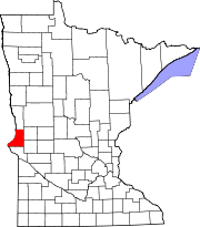 | |
| Townships | ||
| Unincorporated communities | ||
| Footnotes | ‡This populated place also has portions in an adjacent county or counties | |
46°00′35″N 96°19′21″W / 46.00972°N 96.32250°W