

The Tichitt Culture,[1][2][3] or Tichitt Tradition,[4][5][6][7][8][9] was created by proto-Mande peoples.[10] In 4000 BCE, the start of sophisticated social structure (e.g., trade of cattle as valued assets) developed among herders amid the Pastoral Period of the Sahara.[11] Saharan pastoral culture (e.g., fields of tumuli, lustrous stone rings, axes) was intricate.[12] By 1800 BCE, Saharan pastoral culture expanded throughout the Saharan and Sahelian regions.[11] The initial stages of sophisticated social structure among Saharan herders served as the segue for the development of sophisticated hierarchies found in African settlements, such as Dhar Tichitt.[11] After migrating from the Central Sahara, proto-Mande peoples established their civilization in the Tichitt region[10] of the Western Sahara.[8] The Tichitt Tradition of eastern Mauritania dates from 2200 BCE[1][13] to 200 BCE.[14][15]
Tichitt culture, at Dhar Néma, Dhar Tagant, Dhar Tichitt, and Dhar Walata, included a four-tiered hierarchical social structure, farming of cereals, metallurgy, numerous funerary tombs, and a rock art tradition.[3] At Dhar Tichitt and Dhar Walata, pearl millet may have also been independently domesticated amid the Neolithic.[16] Dhar Tichitt, which includes Dakhlet el Atrouss, may have served as the primary regional center for the multi-tiered hierarchical social structure of the Tichitt Tradition,[9] and the Malian Lakes Region, which includes Tondidarou, may have served as a second regional center of the Tichitt Tradition.[17] The settlements of Dhar Tichitt consisted of multiple stone-walled compounds containing houses and granaries/"storage facilities", sometimes with street layouts.[13][18] Additionally, around some settlements, larger stone common "circumvallation walls" were built, suggesting that "special purpose groups" cooperated as a result of decisions "enforced for the benefit of the community as a whole."[13][18] The urban[8] Tichitt Tradition may have been the earliest large-scale, complexly organized society in West Africa,[6] and an early civilization of the Sahara,[1][10] which may have served as the segue for state formation in West Africa.[12] Consequently, state-based urbanism in the Middle Niger and the Ghana Empire developed between 450 CE and 700 CE.[6]
YouTube Encyclopedic
-
1/5Views:50456121 2072 746560
-
Afri-Culture Concepts: Ancient Tichitt | Mandes in Antiquity | The ancient ancestors of AA's
-
An Archaeologist's History of Early Complex Societies in West Africa
-
The Ghana Empire (Wagadu) - Africa's Land of Gold
-
Oursi Hu-Beero - a house in medieval west africa
-
West Africa's Greatest Empire: The Hegemony of the Songhai Empire in West Africa
Transcription
Climate and Geography

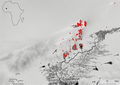
The Dhars, or cliffs, are located in the southeastern and central-southern regions of Mauritania.[19] The cliffs span 800 kilometers.[19] The Dhars (e.g., Dhar Tichitt, Dhar Walata, Dhar Tagant) of Mauritania are located north of the Senegal River.[7] The Dhars of Mauritania are located between the Hodh Depression and Tagant Plateau.[9] Dhar Néma and Dhar Tichitt are major escarpments in Mauritania.[20] From east to west, Dhar Néma, Dhar Walata, Dhar Tichitt, and Dhar Tagant form a semicircular shape around the Hodh/Aoukar Depression, which, prior to 4000 BCE, was an area with lakes of considerable size, and, after 1000 BCE, was an area that had become increasingly dried.[6] During the emergence of the Tichitt Tradition, it was an oasis area.[6]
After 4500 BP, the Malian Lakes Region, around Lake Fati, underwent aridification; thereafter, Megalake Timbuktu, which at its height reached depths of 264 meters in 3900 BP, developed from the inputs of the Middle Niger riverine system.[17] In the region, humidity reached its highest point in the first half of the 4th millennium BP, and reached its second highest point in the second half of the 4th millennium BP.[17] More than one thousand stone villages were constructed, which spans 800 kilometers from the Niger Bend to the region northward of Taoudenni Basin, as well as spanning 600,000 km2 from the border of Mali and Mauritania to the region west of Tagant.[17] In the Malian Lakes Region, which is located in northwestern Inland Niger Delta region of the Niger River, near Lake Faguibine and the Faguibine Depression, and north of Méma, these drystone constructed stone-walled settlement sites may be connected with the Tichitt Tradition of Mauritania.[17]

Tichitt cultural tradition
Between 4th millennium BCE and 1st millennium CE, pastoralists occupied the western region (e.g., Mauritania, Morocco) of the Sahara.[4] The pastoralist culture included social stratification, as evidenced by lavish items (e.g., beads, bracelets, hachettes, lustrous stone axes) found in tumuli.[4] In the Hodh Depression area of southern Mauritania, from early 2nd millennium to late 1st millennium BCE, the pastoralist culture developed into various forms of pre-state urbanism (e.g., habitat patterns of nucleation and differentiation).[4] By 2000 BCE, as aridification followed the Holocene Climate Optimum, the pastoralists had become agropastoralists and had established the Tichitt tradition in the Mauritanian settlement areas of Dhar Tichitt, Dhar Walata, and Dhar Néma, based on a hierarchical economy composed of pastoralism, agriculture (e.g., millet), and stonemasonry (e.g., architecture).[4] In the Sahelian region of West Africa, the corded roulette ceramics of the Tichitt Tradition developed and persisted among[5] dry stonewalled architecture[5][9] in Mauritania (e.g., Dhar Tichitt, Dhar Walata, Dhar Néma, Dhar Tagant) between 1900 BCE and 400 BCE.[5] Within these settled areas (e.g., Dhar Tichitt, Dhar Tagant, Dhar Walata) with stone walls, which vary in scale from (e.g., 2 hectares, 80 hectares), there were walled agricultural land used for livestock or gardening as well as land with granaries and tumuli.[15]

As areas where the Tichitt cultural tradition were present, Dhar Tichitt and Dhar Walata were occupied more frequently than Dhar Néma.[6] The eastern and central areas of Dhar Walata and Dhar Tichitt, which were primarily peopled between 2200/2000 BCE and 1200/1000 BCE and contained some areas (e.g., Akreijit, Chebka, Khimiya) with boundary walls, served as the primary areas of settlement (e.g., small villages, hamlets, seasonal camps) for the Dhars of Mauritania.[13] The fundamental unit of the Mauritanian Dhars (e.g., Dhar Néma, Dhar Walata, Dhar Tichitt) was the extended family[21] or polygamous family.[4] Based on the presence of an abundant amount of enclosed areas that may have been used to pen cattle and hundreds of tumuli, intergenerational ownership of property, via cattle wealth, may have been part of the Tichitt culture.[4] Planned, level streets spanned several hundred kilometers among the 400 drystone-constructed villages, hamlets, and towns.[8] Primary entry points of residences with access ramps (e.g., fortified, non-fortified) and watchtowers were also present.[8] Households used various tools (e.g., arrowheads, axes, borers, grindstones, grooved stones, needles, pendants).[8] At Dhar Walata and Dhar Tichitt, stone pillars, stone slabs, and stone blocks, which approximate to several hundred in total, are frequently arranged and aligned in three rows of three; these erected stones may have served as stilts for granaries.[22] There were also gardens and fields located within a walled enclosure ranging between nine and fourteen hectares.[22] At Dhar Nema, there are also stilted granaries, pottery, and tools used for milling.[22] At Dhar Walata and Dhar Tichitt, copper was also used.[8] Tichitt culture may have also made cultural contributions (e.g., architecture, ceramics) to Garamantian culture, which was then subsequently reconstrued and innovated by Garamantes as these contributions were incorporated into Garamantian culture.[23]
The people of Tichitt culture crafted (e.g., arrows, arrowheads, grindstones, quartz beads, scrapers) in workshops as well as farmed and penned livestock, fished, and hunted.[8] A primary feature of the Tichitt culture is the shepherding of livestock and the cultivation of pearl millet.[9] Various kinds of local food sources (e.g., Panicum laetum, Cenchrus biflorus, Pennisetum mollissimum; fruits from Ziziphus lotus, Balanites, Celtis integrifolia, and Ephedra altissima; Citrullus, Gazella, Addax nasomaculatus, Oryx dammah, Mellivora capensis, Taurotragus derbianus, Kobus, Hippotragus equinus, Tragelaphus, Cricetomys gambianus, Genetta genetta, Panthera pardus, Equus, Rhinoceros, Ichthyofauna, Clarias, Tilapia, Molluscs, Parreysia) were eaten by the people of the Tichitt culture.[24]

-
 Stone axes from Dhar Tichitt
 -
 Lithics associated with the Tichitt culture
 -
 Grinding stone
Dhar Tichitt
At Dhar Tichitt and Dhar Walata, the people of the Tichitt Tradition were considerably mobile each season; they practiced animal husbandry[15] (e.g., sheep, goat, cattle),[13] fished,[15] and, by at least 3600 BP, domesticated and farmed pearl millet.[15][25] However, farming of crops (e.g., millet) may have been a feature of the Tichitt cultural tradition as early as 3rd millennium BCE in Dhar Tichitt.[6] The origin of pearl millet at Dhar Tichitt may date to 3500 BCE.[26] At Dhar Tichitt, domesticated pearl millet imprints in pottery have been dated between 1900 BCE and 1500 BCE.[27] Based on the hundreds of tumuli present in Dhar Tichitt, compared to a dozen tumuli present in Dhar Walata, it is likely that Dhar Tichitt was the primary center of religion for the people of Tichitt culture.[4]
At Dhar Tichit, Dakhlet el Atrouss I, which is the largest archaeological site of the Tichitt Tradition and is 80 hectares in scale, serves as the primary regional center for the multi-tiered hierarchical social structure of Tichitt culture; it features nearly 600 settlement compounds, agropastoralism, a large enclosure for cattle, and monumental architecture as an aspect of its funerary culture, such as hundreds of tumuli nearby.[9] Along with Akrejit, it also features foundations for granaries.[9]
Rock Art
Engraved and painted Pastoral rock art relating to the agropastoralists of Dhar Tichitt, characterized by dark patina and developed using hammerstones only or hammerstones used with a lithic or metal implement, were composed of various rock artforms (e.g., humans/herders, domesticated and undomesticated animals, walled compounds, symbols – cattle, oxen, two ox carts being pulled by oxen, cows with udders, a calf, sheep, goats, two large ostriches) that date to the Late Stone Age.[28] Dating was confirmed by bones from a hippopotamus (2290±110 BP) and a few white rhinoceros (4000 BP – 2400 BP).[28] A notable attribute of the Dhar Tichitt rock art is the large depiction of a bull, which, due to its value in agropastoral life as a form of wealth, may have had symbolic and/or religious significance for the agropastoralists of Dhar Tichitt.[28] The painted Pastoral rock art of Tassili n'Ajjer, Algeria and engraved Pastoral rock art of Niger bear resemblance (e.g., color markings of the cattle) with the engraved cattle portrayed in the Dhar Tichitt rock art in Akreijit.[29] The engraved cattle pastoral rock art of Dhar Tichitt, which are displayed in enclosed areas that may have been used to pen cattle, is supportive evidence for cattle bearing ritualistic significance for the people of Dhar Tichitt.[29]

Dhar Walata/Oualata
At Dhar Walata, in the courtyard of nearby houses, enclosed, erected turriform gardens have been found, the earliest of which dates between 1894 cal BCE and 1435 cal BCE.[24] Hoes and fish hooks made of bone were also found.[24] Stone slabs may have been used as a ballast to avert the entry of animals into the village.[24] Reservoirs and dams may have been used to manage water from nearby rivers (wadis).[24] Millet, flour, and semolina may have been prepared to cook porridge.[24] At Dhar Walata, domesticated pearl millet imprints in pottery have been dated between 1900 BCE and 1500 BCE.[27]

Rock Art
The Neolithic Pastoral rock art of Dhar Walata and Dhar Tichitt may depict chariots being drawn forward by yoked oxen and a woman who has on a small tunic.[30] The rock art of Dhar Walata may depict a cart being drawn forward by an ox, a man who with a tunic on that extends over part of his legs, and a man with an elongated staff that may be used as a projectile and a shield.[30]
Human Remains
Two human skeletal remains were found at Dhar Walata.[19] Though one is undated, based on the date of the other human skeletal remains found nearby, is dated to 3930 ± 80 BP.[19]
Dhar Néma
In the late period of the Tichitt Tradition at Dhar Néma, domesticated pearl millet was used to temper the tuyeres of a oval-shaped low shaft furnace; this furnace was one out of 16 iron furnaces located on elevated ground.[14] Iron metallurgy may have developed before the second half of 1st millennium BCE, as indicated by pottery dated between 800 BCE and 200 BCE.[14] At Dhar Nema, domesticated pearl millet imprints in pottery have been dated between 1750 BCE and 1500 BCE.[27]
Rock Art
The engraved Pastoral rock art of Dhar Néma borders Dhar Walata.[30] The rock art of Dhar Néma, Dhar Walata, and Dhar Tichitt bear cultural/artistic commonalities (e.g., cattle, engraving methods) with one another.[30] While there are more quadruped depictions than anthropomorphic depictions at Dhar Néma, there are more anthropomorphic depictions found at Dhar Nema than at Dhar Walata or Dhar Tichitt.[30]
The Neolithic rock art of Dhar Néma portrays various animal depictions (e.g., cattle, oryxes, giraffes), including anthropomorphic figures (e.g., men; women; man sitting on an ox with a lasso, bow, or shield; man using a throwing weapon on an oryx; man sitting on a saddled ox; person holding a basket).[30] The depiction of the man arriving back from hunting an oryx likely occurred when the landscape was still a savanna, as indicated by the depiction of three trotting giraffes with a common heading.[30] Akin to the Y-symbol associated with the hunting cultures of the Sahara and Nile, the three half-lines symbol that is depicted in the Dhar Néma rock art may be associated with the hunting culture of Dhar Néma.[30]
Human Remains
Human skeletal remains found at Bou Khzama in Dhar Néma have been dated to 3690 ± 60 BP.[19] Another human skeletal remains found at Dhar Néma have been dated to 2095 ± 55 BP.[19]
Dhar Tagant
At Dhar Tagant, there are approximately 276 tumuli that have been surveyed.[31] At Dhar Tagant, there are also various geometric (e.g., rectilinear, circular) constructions, and a possible late period, involving a funerary tomb with a chapel at Foum el Hadjar from 1st millennium CE and wadis with evidence of crocodiles.[3] As part of a broader trend of iron metallurgy developed in the West African Sahel amid 1st millennium BCE, iron items (350 BCE – 100 CE) were found at Dhar Tagant, iron metalworking and/or items (800 BCE – 400 BCE) were found at Dia Shoma and Walaldé, and the iron remnants (760 BCE – 400 BCE) found at Bou Khzama and Djiganyai.[6] The iron materials that were found are evidence of iron metalworking at Dhar Tagant.[15]
While confirmation of the connection is still needed, Tabarit East tumuli of western Tagant are similar in form to Tichitt Tradition tumuli.[32] In southeastern Mauritania, there are more than 9000 tumuli; the monument-building techniques of this funerary tradition resulted in tumuli being able to persist in form for millennia to the present-day.[32] While smaller tumuli may have been built by members of the nuclear family, larger tumuli may have been built by members of nuclear and extended family.[32]
-
 Tichitt Tradition drystone tumulus
 -
 Two types of prehistoric funerary monuments in the Dhar Tagant region of south-eastern Mauritania
 -
 T150, a double-walled settlement on the flat plateau edge of the Dhar Tagant escarpment
Malian Lakes Region

The Malian Lakes Region may have served as the second regional center of the Tichitt Tradition.[17] In the Malian Lakes Region, there is a drystone enclosure that is greater than 4 meters in height and several hundred meters in circumference, two cemeteries, and within the enclosure, a possible cistern building with remnants of a room that is between 6 meters and 7 meters in diameter; there are also other drystone structures of different sizes and kinds, which include a large rectangular enclosure, enclosures with small-sized circular structures, a carved stone as part of a broader system of structures, stone walls, as well as cemeteries with stones positioned in the head and foot areas of the graves.[17] Additionally, there are stones that are 2 meters in diameter are set within circular patterns are found among a few stone structures, grindstone and millstone remnants, and pottery with decorative patterns.[17] Within the region, nearby Tondidarou, a stone wall may have served as a regional boundary, stone tumuli and circles that may be cemeteries, and a couple of drystone fortification remnants; there are also pottery and stone tools at Mobangou, as well as mounds and stone structures nearby Mobangou.[17] On the eastern side of Lake Fati, there are large enclosures on the massifs containing dozens of conjoined circular drystone structures, and on the eastern side of Lake Faguibine, there are similar enclosures and structures spanning 74 kilometers north from its eastern shoreside; there are also stone walls ranging about one meter in height.[17]
The Malian Lakes Region sites share connections with Tichitt Tradition sites via one of its categorized sites.[17] Tell-type site pottery of the Malian Lakes Region also is similar in appearance (e.g., folded strip roulettes, thickened rims) to Faïta pottery.[17] In total, there are 180 villages, hamlets, and many types of stone structures and enclosures.[17] Among the total constructed stone villages, 30 stone villages may have evidence of concessions with stone pillar structures in them; there is also Fati 6 where a drystone tell is of an intermediary architectural status between the earlier drystone structures in the escarpment region and the later drystone structures of the Tondidarou region; both show close resemblance and apparent connection with the architectural structures of the Tichitt culture.[17] The Malian Lakes Region and the Mauritanian Tichitt cultural region bear strong geographic resemblance (e.g., escarpments) and similar complex settlement patterns on and below the escarpments.[17] In the Malian Lakes Region, the stone villages may have been constructed between the 2nd millennium BCE and the 1st millennium BCE.[17] In 1st millennium CE, earthen tells were created in the plains, along the shoresides and in floodplains of the Niger River at Tondidarou; the difference in distance and dates may indicate that there was gradual change in settlement sites, from the regional section of the Malian Lake Region where the escarpments are located toward the regional section where Tondidarou is located, as well as gradual technical shift toward construction of earthen settlement mounds.[17] Altogether, the archaeological evidence on and below the Malian Lakes Region escarpments of the 2nd millennium BCE - 1st millennium BCE may serve as connective evidence between Mema, Tondidarou and other Middle Niger sites of the 1st millennium CE, and the Tichitt Tradition of Mauritania.[17]
-
 Map and satellite image
 -
 Field boundary on the western shore of Lake Fati
 -
 Location densities of sites, showing clear preferences for sandstone escarpments. Permanent water (1984–2021) in black, impermanent water in grey.
 -
 Location of documented sites. Permanent water (1984–2021) in black, impermanent water in grey.
 -
 Possible pillar structures in village sites of the Mali Lakes Region


Legacy

The Tichitt Tradition spread to the Middle Niger region (e.g., Méma, Macina, Dia Shoma, Jenne Jeno) of Mali where it developed into and persisted as Faïta Facies ceramics between 1300 BCE and 400 BCE among rammed earth architecture and iron metallurgy (which had developed after 900 BCE).[5] During the mid-1st millennium BCE, increasing desertification of the Green Sahara resulted in the migration from the Dhars (e.g., Dhar Tichitt, Dhar Walata, Dhar Néma) of Mauritania.[13] Some pastoralists from Dhar Tichitt may have migrated toward the southeast and other pastoralists may have migrated southward[1] (e.g., Middle Senegal River Valley of Senegal).[33] Dhar Néma may have served as a transitory area for the people of the Tichitt Tradition as the area of Dhar Tichitt started to become vacated by 300 BCE.[34] From Mauritania, the people of the Tichitt Tradition may have migrated into the Malian Lakes Region, Macina, and/or Méma.[34] In the northern areas of Macina and Mema, located in the Middle Niger, lithic items may have been brought from the Dhars (e.g., Dhar Tichitt, Dhar Walata, Dhar Tagant) of Mauritania.[7] By as early as the 3rd or 4th century BCE, migrating pastoralists from Dhar Tichitt may have arrived and dwelt in the regions of the Niger Bend and Niger Delta.[1] As aridification affected Lake Mega Chad, this resulted in the development of a nutrient abundant Lake Chad Basin; consequently, Tichitt culture (e.g., plant materials used to stylize ceramics with a braid and twist design) may have spread into its southern region as pastoralists from Dhar Tichitt peopled the Lake Chad Basin.[1] Some pastoralists may have also peopled the region that would eventually become the Ghana Empire as well as early Awdaghust.[1] In addition to complex social structure and agriculture, tumuli construction may have also spread from Tichitt, through the Inland Niger Delta, to Dogon Country.[16] Following the Tichitt Tradition, in the 1st millennium CE, the pre-state urbanism of southern Mauritania developed into state-based urbanism (e.g., nucleation of peoples and regional specialization) in the western Sudan.[4] Particularly, state-based urbanism in the Middle Niger and the Ghana Empire developed between 450 CE and 700 CE.[6]
References
- ^ a b c d e f g McDougall, E. Ann (2019). "Saharan Peoples and Societies". Oxford Research Encyclopedia of African History. Oxford Research Encyclopedias. doi:10.1093/acrefore/9780190277734.013.285. ISBN 978-0-19-027773-4. S2CID 159184437.
- ^ Maley, Jean; Vernet, Robert (July 2015). "Populations and Climatic Evolution in North Tropical Africa from the End of the Neolithic to the Dawn of the Modern Era". African Archaeological Review. 32 (2): 215–216. doi:10.1007/S10437-015-9190-Y. ISSN 0263-0338. JSTOR 43916734. OCLC 5858363395. S2CID 163024833.
- ^ a b c Sterry, Martin; Mattingly, David J. (26 March 2020). "Pre-Islamic Oasis Settlements in the Southern Sahara". Urbanisation and State Formation in the Ancient Sahara and Beyond. Cambridge University Press. p. 318. doi:10.1017/9781108637978.008. ISBN 9781108494441. OCLC 1128066278. S2CID 243375056.
- ^ a b c d e f g h i Monroe, J. Cameron (2018). ""Elephants for Want of Towns": Archaeological Perspectives on West African Cities and Their Hinterlands". Journal of Archaeological Research. 26 (4): 395. doi:10.1007/s10814-017-9114-2. ISSN 1059-0161. JSTOR 44984078. OCLC 7848239424. S2CID 149031750.
- ^ a b c d e MacDonald, K.C. (April 2011). "Betwixt Tichitt and the IND: the pottery of the Faita Facies, Tichitt Tradition". Azania: Archaeological Research in Africa. 46: 49, 51, 54, 56–57, 59–60. doi:10.1080/0067270X.2011.553485. ISSN 0067-270X. OCLC 4839360348. S2CID 161938622.
- ^ a b c d e f g h i MacDonald, Kevin C.; Vernet, Robert; Martinon-Torres, Marcos; Fuller, Dorian Q (April 2009). "Dhar Néma: From early agriculture to metallurgy in southeastern Mauritania". Azania: Archaeological Research in Africa. 44 (1): 3–4, 42. doi:10.1080/00671990902811330. ISSN 0067-270X. OCLC 4901241515. S2CID 111618144.
- ^ a b c MacDonald, Kevin C. (2011). A View from the South: Sub-Saharan Evidence for Contacts between North Africa, Mauritania and the Niger, 1000 BC–AD 700 (PDF). British Museum Press. p. 73. ISBN 9780861591763. ISSN 1747-3640. OCLC 678476323. S2CID 134384684. Archived from the original (PDF) on 12 May 2021.
- ^ a b c d e f g h Kea, Ray (26 November 2004). "Expansions and Contractions: World-Historical Change And The Western Sudan World-System (1200/1000 B.C. – 1200/1250 A.D.)". Journal of World-Systems Research. X (3): 738–740. doi:10.5195/JWSR.2004.286. ISSN 1076-156X. S2CID 147397386.
- ^ a b c d e f g Linares-Matás, Gonzalo J. (13 April 2022). "Spatial Organization and Socio-Economic Differentiation at the Dhar Tichitt Center of Dakhlet el Atrouss I (Southeastern Mauritania)". African Archaeological Review. 39 (2): 167–188. doi:10.1007/s10437-022-09479-5. ISSN 1572-9842. OCLC 9530792981. S2CID 248132575.
- ^ a b c Abd-El-Moniem, Hamdi Abbas Ahmed (May 2005). A New Recording of Mauritanian Rock Art (PDF). University of London. p. 210. OCLC 500051500. S2CID 130112115.
- ^ a b c Brass, Michael (June 2019). "The Emergence of Mobile Pastoral Elites during the Middle to Late Holocene in the Sahara". Journal of African Archaeology. 17 (1): 3. doi:10.1163/21915784-20190003. OCLC 8197260980. S2CID 198759644.
- ^ a b Brass, Michael (2007). "Reconsidering the emergence of social complexity in early Saharan pastoral societies, 5000 – 2500 B.C." Sahara (Segrate, Italy). Sahara (Segrate). 18: 7–22. ISSN 1120-5679. OCLC 6923202386. PMC 3786551. PMID 24089595. S2CID 13912749.
- ^ a b c d e f Holl, Augustin F.C. (2009). "Coping with uncertainty: Neolithic life in the Dhar Tichitt-Walata, Mauritania, (ca. 4000–2300 BP)". Comptes Rendus Geoscience. 341 (8–9): 703. Bibcode:2009CRGeo.341..703H. doi:10.1016/j.crte.2009.04.005. ISSN 1631-0713. OCLC 5900121710. S2CID 128545688.
- ^ a b c MacDonald, K.; Vernet, R. (2007). "Early domesticated pearl millet in Dhar Nema (Mauritania): evidence of crop processing waste as ceramic temper". Fields of Change: Progress in African Archaeobotany. Netherlands: Barkhuis. pp. 71–72. ISBN 9789077922309. OCLC 309688961. S2CID 130234059.
- ^ a b c d e f Kay, Andrea U. (2019). "Diversification, Intensification and Specialization: Changing Land Use in Western Africa from 1800 BC to AD 1500". Journal of World Prehistory. 32 (2): 179–228. doi:10.1007/s10963-019-09131-2. hdl:10261/181848. ISSN 0892-7537. OCLC 8112065264. S2CID 134223231.
- ^ a b Champion, Louis; et al. (2021). "Agricultural diversification in West Africa: an archaeobotanical study of the site of Sadia (Dogon Country, Mali)". Archaeological and Anthropological Sciences. 13 (4): 60. Bibcode:2021ArAnS..13...60C. doi:10.1007/s12520-021-01293-5. PMC 7937602. PMID 33758626.
- ^ a b c d e f g h i j k l m n o p q r Vernet, Robert; Gestrich, Nikolas; Coutros, Peter R. (27 September 2023). "The Tichitt Culture and the Malian Lakes Region". African Archaeological Review. doi:10.1007/s10437-023-09554-5. S2CID 263182276.
- ^ a b Holl, Augustin (1985). "Background to the Ghana Empire: archaeological investigations on the transition to statehood in the Dhar Tichitt region (Mauritania)". Journal of Anthropological Archaeology. 4 (2): 108. doi:10.1016/0278-4165(85)90005-4.
- ^ a b c d e f Maurer, Anne-France; et al. (15 December 2014). "Bone diagenesis in arid environments: An intra-skeletal approach". Palaeogeography, Palaeoclimatology, Palaeoecology. 416: 18. Bibcode:2014PPP...416...17M. doi:10.1016/J.PALAEO.2014.08.020. ISSN 0031-0182. OCLC 5901261079. S2CID 129292169.
- ^ Naia, Marisa; Brito, José Carlos (January 2021). Geographical Atlas of Mauritania. CIBIO/InBIO. p. 6.
- ^ Holl, Augustin F. C. (2012). "Dhar Tichitt, Walata and Nema". Les Nouvelles de l'Archéologie. 127 (127): 35–39. doi:10.4000/NDA.1584. ISSN 0242-7702. OCLC 8207522523. S2CID 194063851.
- ^ a b c Dupuy, Christian (2014). "Cereals and milk in the Sahara and the Sahel, from the epipaleolithic to the age of metals". Afriques Débats, Méthodes et Terrains d'Histoire. 5. doi:10.4000/AFRIQUES.1376. OCLC 6733603235. S2CID 160853354.
- ^ Mori, Lucia; et al. (October 2013). Life and death at Fewet. Edizioni All'Insegna del Giglio. p. 381. doi:10.1400/220016. ISBN 9788878145948. OCLC 881264296. S2CID 159219731.
- ^ a b c d e f Amblard-Pison, Sylvie (2014). "Between sands and stones: eating and drinking in the Neolithic villages of a Saharan refuge area in south-eastern Mauritania". Afriques Débats, Méthodes et Terrains d'Histoire. 5. doi:10.4000/AFRIQUES.1496. S2CID 190294373.
- ^ D'Andre, A.C.; et al. (2001). "Archaeobotanical evidence for pearl millet (Pennisefum glaucum) in sub-Saharan West Africa" (PDF). Antiquity. 75 (288): 346. doi:10.1017/S0003598X00060993. S2CID 162137155.
- ^ Shivhare, Radha; Lata, Charu (23 January 2017). "Exploration of Genetic and Genomic Resources for Abiotic and Biotic Stress Tolerance in Pearl Millet". Frontiers in Plant Science. 7. doi:10.3389/fpls.2016.02069. ISSN 1664-462X. OCLC 6942015845. PMC 5253385. PMID 28167949. S2CID 16369778.
- ^ a b c MacDonald, Kevin; Champion, Louis; Manning, Katie (March 2018). "Windé Koroji Ouest (Mali, Third and Second Millennia BCE): The Environmental and Subsistence Evidence" (PDF). Winds of Change: Archaeological Contributions in Honour of Peter Breunig. Verlag Dr. Rudolf Habelt. p. 172. ISBN 978-3-7749-4074-1. OCLC 1012394569.
- ^ a b c Holl, Augustin F. C. (June 2002). "Time, Space, and Image Making:Rock Art from the Dhar Tichitt (Mauritania)" (PDF). African Archaeological Review. 19 (2): 79–80, 83, 92–93, 100–101, 116. doi:10.1023/A:1015479826570. hdl:2027.42/43991. ISSN 0263-0338. JSTOR 25130740. OCLC 359124322. S2CID 54741966.
- ^ a b Smith, Andrew (2001). "Saharo-Sudanese Neolithic". Encyclopedia of Prehistory Volume 1: Africa. Encyclopedia of Prehistory. p. 251. doi:10.1007/978-1-4615-1193-9_19. ISBN 978-0-306-46255-9. OCLC 852789668. S2CID 127574765.
- ^ a b c d e f g h Amblard-Pison, Sylvie; et al. (2010). "The anthropomorphic rock engravings of Dhar Nema". Afrique Archéologie Arts. 6: 67–84. doi:10.4000/AAA.710. S2CID 192939738.
- ^ Lim, J (2020). "Archaeology". Geometric data for tumuli in Dhar Tagant, Mauritania. University of Oxford. doi:10.5287/BODLEIAN:NRYV1OB2R. S2CID 236798102.
- ^ a b c Lim, Jonathan S.; Matás, Gonzalo J. Linares (August 2023). "Dunes, death, and datasets: Modelling funerary monument construction in remote arid landscapes using spaceborne stereo imagery". Journal of Archaeological Science. 156: 105815. Bibcode:2023JArSc.156j5815L. doi:10.1016/j.jas.2023.105815. S2CID 259238156.
- ^ Mcintosh, Susan Keech (1993). "A tale of two floodplains: comparative perspectives on the emergence of complex societies and urbanism in the middle Niger and Senegal valleys" (PDF). The Development of Urbanism from a Global Perspective. Uppsala University. p. 2. S2CID 208195243.
- ^ a b Coutros, Peter R. (2017). "The Malian Lakes Region redefined: archaeological survey of the Gorbi Valley" (PDF). Antiquity. 91 (356): 483. doi:10.15184/aqy.2017.30. ISSN 0003-598X. OCLC 8271821798. S2CID 161053129.