
Thornfield Township | |
|---|---|
 Thornfield Township | |
| Coordinates: 36°42′31″N 92°39′32″W / 36.708527006542°N 92.65899559855124°W | |
| Country | United States |
| State | Missouri |
| County | Ozark |
| Elevation | 804 ft (245 m) |
| Area code | 417 |
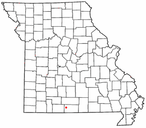
Thornfield is an unincorporated community in Ozark County, Missouri, United States.[1] It is located 15 miles (24 km) northwest of Gainesville, on Route 95 at the Little North Fork of the White River on the edge of the Mark Twain National Forest between Wasola to the northeast and Longrun to the southwest.[2][3] Hammond, the site of the historic Hammond Mill,[4] lies on the Little North Fork 2.5 miles (4.0 km) southeast of Thornfield. Thornfield has a post office with ZIP code 65762.[5]
A post office called Thornfield has been in open since 1878.[6] The area was named for the local Thornfield family.[7]
Thornfield R-1 Elementary School is about one mile east of the town on Route 95.[2][8]
Thornfield (GNIS FID: 752535) is a populated place located within the Township of Thornfield, a minor civil division (MCD) of Ozark County.
The elevation of Thornfield is 807 feet. Thornfield appears on the Thornfield U.S. Geological Survey Map.
YouTube Encyclopedic
-
1/2Views:2 703196 435
-
Satan's Computer Part 1: CHARLES BABBAGE, THEOSOPHY CLUB, ALAN TURING
-
Learn to Play Chess: The Phases of a Chess Game
Transcription
References
- ^ U.S. Geological Survey Geographic Names Information System: Thornfield
- ^ a b Thornfield, MO, 7.5 Minute Topographic Quadrangle, USGS, 2004
- ^ Ava, MO, 30x60 Minute Topographic Quadrangle, USGS, 1985
- ^ Ozark County’s Historic Mills, Hammond Mill
- ^ USPS
- ^ "Post Offices". Jim Forte Postal History. Retrieved November 27, 2016.
- ^ "Ozark County Place Names, 1928–1945". The State Historical Society of Missouri. Archived from the original on June 24, 2016. Retrieved November 27, 2016.
- ^ MO Dept. of Education
36°42′31″N 92°39′34″W / 36.70861°N 92.65944°W
Municipalities and communities of Ozark County, Missouri, United States | ||
|---|---|---|
| City |  | |
| Villages | ||
| Townships |
| |
| CDPs | ||
| Other communities | ||
| Ghost towns | ||
This Ozark County, Missouri state location article is a stub. You can help Wikipedia by expanding it. |