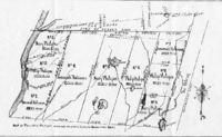


The Connecticut panhandle is the southwestern appendage of Connecticut, where it abuts New York State. It is contained entirely in Fairfield County and the Western Connecticut Planning Region, and includes all of Greenwich, Stamford, New Canaan, and Darien,[1] as well as parts of Norwalk and Wilton. It has some of the most expensive residential real estate in the United States.
The irregularity in the boundary is the result of territorial disputes in the late 17th century between the British colonies of New York and Connecticut. In an agreement on November 28, 1683, that established the New York–Connecticut border as 20 miles (32 km) east of the Hudson River, New York gave up its claim to this area of 61,660 acres (249.5 km2) east of the Byram River, whose residents considered themselves part of Connecticut. In exchange, New York received an equivalent area consisting of a 1.81-mile-wide (2.91 km) strip of land known as the "Oblong" running northwards from Ridgefield, Connecticut to the Massachusetts border, alongside the New York counties of Westchester, Putnam, and Dutchess. New York was also given undisputed claim to Rye, New York.[2][3][4][5][6]
See also
References
- ^ Frank R. Abate (2001). Connecticut Trivia. Thomas Nelson Inc. p. 19. ISBN 9781558539259.
- ^ Mark Stein (2008). How the States Got Their Shapes. HarperCollins. pp. 198–199. ISBN 9780061431395.
- ^ "Surveying Connecticut's Borders | ConnecticutHistory.org". connecticuthistory.org. Retrieved July 19, 2018.
- ^ "CT-NY-MA Tri-Point". www.ctmq.org. Retrieved July 19, 2018.
- ^ "The Oblong in Pawling: A History of a Quaker Hill Community in the Hudson Valley". Retrieved July 19, 2018.
- ^ "About Town: The Oblong | The Ridgefield Press". The Ridgefield Press. September 6, 2016. Archived from the original on July 19, 2018. Retrieved July 19, 2018.
External links
41°07′01″N 73°29′56″W / 41.117°N 73.499°W
