
Thawat Buri
ธวัชบุรี | |
|---|---|
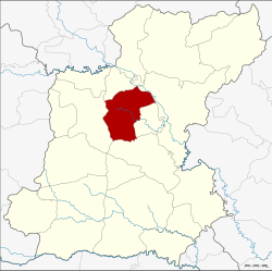 District location in Roi Et province | |
| Coordinates: 16°02′19″N 103°44′49″E / 16.03861°N 103.74694°E | |
| Country | Thailand |
| Province | Roi Et |
| Seat | Niwet |
| Area | |
| • Total | 374.0 km2 (144.4 sq mi) |
| Population (2005) | |
| • Total | 68,431 |
| • Density | 183.0/km2 (474/sq mi) |
| Time zone | UTC+7 (ICT) |
| Postal code | 45170 |
| Geocode | 4505 |
Thawat Buri (Thai: ธวัชบุรี, pronounced [tʰā.wát bū.rīː]) is a district (amphoe) of Roi Et province, Thailand.
Geography
The district is in central Roi Et Province. Neighboring districts are (from the north clockwise): Chiang Khwan, Selaphum, Thung Khao Luang, At Samat, and Mueang Roi Et.
History
In 1913 the district was renamed from Uthai Roi Et (อุไทยร้อยเอ็ด) to Saeng Badan (แซงบาดาล).[1] In 1939 it received its current name, Thawat Buri.[2]
Administration
The district is divided into 12 sub-districts (tambons), which are further subdivided into 147 villages (mubans). There are two sub-district municipalities (thesaban tambons). Ban Niwet covers parts of tambon Niwet, Thong Thani covers tambon Thong Thani and parts of Bueng Nakhon. There are a further 11 tambon administrative organizations (TAO).
| No. | Name | Thai name | Villages | Pop. | |
|---|---|---|---|---|---|
| 1. | Niwet | นิเวศน์ | 17 | 8,960 | |
| 2. | Thong Thani | ธงธานี | 10 | 6,188 | |
| 3. | Nong Phai | หนองไผ่ | 18 | 7,626 | |
| 4. | Thawat Buri | ธวัชบุรี | 12 | 4,792 | |
| 6. | Um Mao | อุ่มเม้า | 15 | 7,690 | |
| 7. | Ma-ue | มะอึ | 10 | 5,508 | |
| 10. | Khwao Thung | เขวาทุ่ง | 10 | 4,548 | |
| 15. | Phaisan | ไพศาล | 9 | 4,042 | |
| 17. | Mueang Noi | เมืองน้อย | 13 | 5,163 | |
| 20. | Bueng Nakhon | บึงนคร | 13 | 6,219 | |
| 22. | Ratchathani | ราชธานี | 11 | 3,573 | |
| 24. | Nong Phok | หนองพอก | 9 | 4,122 |
Missing numbers are tambons which now form Chiang Khwan and Thung Khao Luang Districts.
References
- ^ แจ้งความกระทรวงมหาดไทย เรื่อง เปลี่ยนนามอำเภอ (PDF). Royal Gazette (in Thai). 30 (ง): 1619–1620. October 19, 1913. Archived from the original (PDF) on May 10, 2012.
- ^ พระราชกฤษฎีกาเปลี่ยนนามอำเภอ กิ่งอำเภอ และตำบลบางแห่ง พุทธศักราช ๒๔๘๒ (PDF). Royal Gazette (in Thai). 56 (ก): 354–364. April 17, 1939. Archived from the original (PDF) on February 19, 2009.