
Thap Sakae
ทับสะแก | |
|---|---|
 Huai Yang, Thap Sakae, view toward the Myanmar border | |
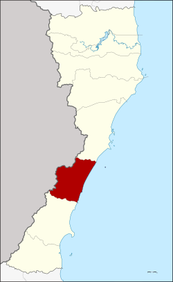 District location in Prachuap Khiri Khan province | |
| Coordinates: 11°30′0″N 99°37′18″E / 11.50000°N 99.62167°E | |
| Country | Thailand |
| Province | Prachuap Khiri Khan |
| Area | |
| • Total | 538.0 km2 (207.7 sq mi) |
| Population (2008) | |
| • Total | 47,645 |
| • Density | 88.31/km2 (228.7/sq mi) |
| Time zone | UTC+7 (ICT) |
| Postal code | 77130 |
| Geocode | 7703 |
Thap Sakae (Thai: ทับสะแก, pronounced [tʰáp sākɛ̄ː]) is a district (amphoe) in the southern part of Prachuap Khiri Khan province, central Thailand.
History
The area of Thap Sakae was separated from Mueang Prachuap Khiri Khan and Bang Saphan district. Due to its fertile land and sea, many people migrated to this area and established three villages, Huai Yang, Ang Thong, and Thap Sakae. When these villages grew bigger the government established Thap Sakae minor district (king amphoe) on 1 March 1939.[1] It was upgraded to a full district on 23 July 1958.[2]
Geography
Neighboring districts are Mueang Prachuap Khiri Khan to the north and Bang Saphan to the south.[3] To the west is the Tanintharyi Division of Myanmar, to the east the Gulf of Thailand.
The Huai Yang Waterfall National Park is in this district.
Administration
The district is divided into six sub-districts (tambons), which are further subdivided into 65 villages (mubans). Thap Sakae is also a sub-district municipality (thesaban tambon), which covers parts of the tambon Thap Sakae. There are further six tambon administrative organizations (TAO) covering the non-municipal areas.
| No. | Name | Thai | Villages | Pop. |
|---|---|---|---|---|
| 1. | Thap Sakae | ทับสะแก | 11 | 10,397 |
| 2. | Ang Thong | อ่างทอง | 11 | 8,570 |
| 3. | Na Hu Kwang | นาหูกวาง | 13 | 8,370 |
| 4. | Khao Lan | เขาล้าน | 11 | 8,229 |
| 5. | Huai Yang | ห้วยยาง | 13 | 8,239 |
| 6. | Saeng Arun | แสงอรุณ | 6 | 3,840 |
References
- ^ ประกาศกระทรวงมหาดไทย เรื่อง ตั้งกิ่งอำเภอทับสะแก ขึ้นอำเภอเมืองประจวบคีรีขันธ์ จังหวัดประจวบคีรีขันธ์ (PDF). Royal Gazette (in Thai). 55 (ง): 3878. 1939-02-20. Archived from the original (PDF) on June 1, 2012.
- ^ พระราชกฤษฎีกาจัดตั้งอำเภอกระสัง อำเภอกระนวน อำเภอบางกอกใหญ่ อำเภอขุนหาร อำเภอพนา อำเภอปากช่อง อำเภอวังเหนือ อำเภอวังชิ้น อำเภอแม่ทา อำเภอหนองหมู อำเภอสระแก้ว อำเภออมก๋อย อำเภอบางซ้าย อำเภอทับสะแก อำเภอบุณฑริก อำเภอลานสะกา อำเภอจอมบึง อำเภอท่ายาง อำเภอสามเงา อำเภอฟากท่า อำเภอบ้านเขว้า อำเภอชานุมาน อำเภอแม่พริก อำเภอท่าสองยาง อำเภอสะเมิง อำเภอหนองแขม อำเภอพระแสง พ.ศ. ๒๕๐๑ (PDF). Royal Gazette (in Thai). 75 (55 ก): 321–327. 1958-07-22. Archived from the original (PDF) on April 6, 2012.
- ^ Svasti, Pichaya (11 October 2018). "A place of gold". Bangkok Post. No. Life, Travel. Retrieved 11 October 2018.
External links
- amphoe.com (Thai)
This Prachuap Khiri Khan Province location article is a stub. You can help Wikipedia by expanding it. |