
| Thangool Queensland | |||||||||||||||
|---|---|---|---|---|---|---|---|---|---|---|---|---|---|---|---|
 Hotel Thangool, 2014 | |||||||||||||||
 Thangool | |||||||||||||||
| Coordinates | 24°29′12″S 150°34′34″E / 24.4866°S 150.5761°E | ||||||||||||||
| Population | 741 (2016 census locality)[1] | ||||||||||||||
| • Density | 1.0605/km2 (2.7468/sq mi) | ||||||||||||||
| Established | 1925 | ||||||||||||||
| Postcode(s) | 4716 | ||||||||||||||
| Elevation | 192 m (630 ft) | ||||||||||||||
| Area | 698.7 km2 (269.8 sq mi) | ||||||||||||||
| Time zone | AEST (UTC+10:00) | ||||||||||||||
| Location |
| ||||||||||||||
| LGA(s) | Shire of Banana | ||||||||||||||
| State electorate(s) | Callide | ||||||||||||||
| Federal division(s) | Capricornia | ||||||||||||||
| |||||||||||||||
| |||||||||||||||
Thangool /ˈθæŋɡuːl/[citation needed] is a rural town and locality in the Shire of Banana, Queensland, Australia.[2][3] In the 2016 census, the locality of Thangool had a population of 741 people.[1]
Geography

Thangool is 591 kilometres (367 mi) north west of the state capital, Brisbane and 12 kilometres (7.5 mi) south of the Shire administrative centre, Biloela.
Kariboe is a neighbourhood (24°30′00″S 150°35′00″E / 24.5°S 150.5833°E).[4]
Mount Scoria is a neighbourhood (24°32′00″S 150°34′00″E / 24.5333°S 150.5666°E).[5]
Thangool has the following named ranges:
- Banana Range (24°44′46″S 150°27′50″E / 24.7460°S 150.4638°E) in the south-west of the locality[6]
- Dawes Range (24°43′57″S 150°33′18″E / 24.7326°S 150.5550°E) in the south-east of the locality[6]
Thangool has the following named mountains:
- Mount Lookerbie (24°37′02″S 150°36′03″E / 24.6172°S 150.6009°E) 530 metres (1,740 ft)[7][8]
- Mount Scoria (24°32′02″S 150°35′58″E / 24.5338°S 150.5994°E) 292 metres (958 ft)[7][9]
- Mount Sugarloaf (24°27′15″S 150°42′48″E / 24.4542°S 150.7133°E) 484 metres (1,588 ft)[7][10]
- Prospect Peak (24°42′27″S 150°30′06″E / 24.7076°S 150.5018°E) 449 metres (1,473 ft)[7][11]
The former Callide Valley railway line ran through the locality and had the following three now-abandoned railway stations:
- Thangool railway station (24°29′11″S 150°34′36″E / 24.4865°S 150.5768°E)[12]
- Kariboe railway station (24°29′56″S 150°35′45″E / 24.4990°S 150.5957°E)[12]
- Mount Scoria railway station (24°32′04″S 150°36′58″E / 24.5345°S 150.6162°E)[12]
The predominant land use is grazing on native vegetation with a small amount of crop growing.[13]
History
The Thangool area was originally home to the Kangulu Aboriginal people.[14] European settlement in the area began with the Archer brothers who, on advice from the explorer Ludwig Leichhardt, set out from Eidsvold Station on the Burnett River to explore the area to the north in 1853, eventually reaching the Fitzroy River. Speculative ventures followed in the 1850s and 1860s, originally tentative attempts at sheep raising, but soon turning to cattle.
The town name Thangool comes from the Thangool railway station, which existed from 2 February 1924 until 1 August 1987. It is reportedly an Aboriginal word meaning possum.[2]
The neighbourhood Mount Scoria takes its name from the Mount Scoria railway station, assigned by the Queensland Railways Department on 21 June 1926, which is named after the mountain of the same name.[5]
The town was surveyed in 1925 and primitive shops constructed from corrugated iron and logs were established soon after. The Callide Valley railway line was extended to Thangool in 1925, before its final extension to Lawgi in 1931.[15]
Kariboe Creek Provisional School opened in 1926 but closed in 1927. Kariboe Creek State School opened on 9 April 1930 and closed December 1963.[16] It was named after a local creek.[17] Kariboe Creek State School was at 1 Mullers Lane (24°27′47″S 150°31′22″E / 24.4631°S 150.5229°E).[18]
Thangool State School opened on 5 April 1927.[19][20]
Mount Scoria State School opened on 3 November 1930 and closed in July 1958.[19] It was located to the immediate north-east of the Mount Scoria railway station (approx 24°31′59″S 150°36′59″E / 24.5330°S 150.6164°E).[21]
Thangool Baptist Church opened in 1932.[22][23] Approval to construct the church was given in November 1931.[24] A tender for the construction of the building was accepted in January 1932,[25] with constructing commencing about June 1932.[26] The church was officially opened on Saturday 16 July 1932.[27] The church was 30 by 20 feet (9.1 by 6.1 m).[28]
Kroombit Provisional School opened on 17 May 1933 and closed on 13 April 1936.[19]
Tiamby Provisional School opened on 1 July 1933. The school closed on 31 December 1942.[19] It was on the north-eastern corner of 3224 Crowsdale Camboon Road (24°40′53″S 150°28′26″E / 24.6813°S 150.4738°E).[18][29]
Clinker Creek State School opened in July 1938 and closed on 23 February 1942.[19][30][31] It was on the south-west corner of Drumburie Road and Frawleys Road (24°33′46″S 150°31′44″E / 24.56267°S 150.52876°E).[21][18]
By the 1930s, a cotton boom had allowed the town to support two hotels, two butchers, two bakers, a picture theatre, a cordial factory, a blacksmith and a bank.[32]
The name Kariboe comes from the Kariboe railway station, assigned on 19 September 1940 by the Queensland Railways Department, which in turns derives its name from pastoral run name used in mid-1850s by pastoralist Charles Archer. It is the Aboriginal language name for the local creek.[4]
At the 2006 census, the town of Thangool had a population of 339 while the locality had a population of 545.[33][34]
In the 2016 census, the locality of Thangool had a population of 741 people.[1]
The Red Steer Hotel closed in April 2017, leaving the town without a hotel, so the Thangool Recreation Club obtained a limited liquor licence to provide a place for locals to gather for a drink.[35]
Education

Thangool State School is a government primary (Prep-6) school for boys and girls at 2 Aerodrome Road (24°29′28″S 150°34′18″E / 24.4910°S 150.5716°E).[36][37] In 2015 the school had 115 students enrolled.[38] In 2018, the school had an enrolment of 143 students with 12 teachers (8 full-time equivalent) and 10 non-teaching staff (5 full-time equivalent).[39] Thangool State School has an active Facebook page.[40]
There are no secondary schools in Thangool. The nearest secondary school is Biloela State High School in Biloela to the north-west.[13]
Economy
Dryland farming in the area produces mainly sorghum and wheat but also some sunflower, mung beans and barley. Irrigated crops produced include cotton and lucerne as well as wheat and sorghum. A Thangool business, Queensland Squab Processors, supply 60 per cent of the Australian market for squab while a new business producing herbs for the food service industry was developed recently.
There are a number of homesteads in the locality, including:[41]
- Kurrajong (24°42′55″S 150°28′14″E / 24.7152°S 150.4706°E)
- Peaceful Haven (24°29′26″S 150°36′04″E / 24.4906°S 150.6010°E)
- Scoria (24°32′50″S 150°34′32″E / 24.5473°S 150.5756°E)
Facilities

Local businesses include two hotels; the Red Steer Hotel and the Hotel Thangool (49-55 Ramsay Street, 24°29′12″S 150°34′26″E / 24.4866°S 150.5739°E), a service station, post office, carpenters, welders, and an aircraft refuelling business.[32]
The Thangool Airport (also known as Thangool Aerodrome) services the Banana Shire area. It is at 42 Aerodrome Road (24°29′30″S 150°34′25″E / 24.4917°S 150.5736°E).[32][42]
Thangool racecourse is one of the largest racecourses in the area.[32]
Thangool Fire Station is at 25 Stanley Street (24°29′16″S 150°34′29″E / 24.4878°S 150.5746°E).[43][44]
Amenities

St Andrew's Anglican Church is at 35 Stanley Street (24°29′15″S 150°34′26″E / 24.4875°S 150.5739°E).[45]
Thangool Recreational Hall is in Blanchs Road.[46]
The Thangool branch of the Queensland Country Women's Association meets at the Thangool Recreational Hall.[47]
Attractions
Nearby Mount Scoria, a rare rock formation rising 150 metres (490 ft) above the surrounding plain, was an active volcano 20 to 26 million years ago. The mountain features impressive basalt columns formed by cooling lava. Despite its name the mountain features very little scoria, with most of the mountain made up of vesicular basalt.[14]
Events
The Thangool Cup Races is an annual horse racing event held in September. Each November there is a Christmas market.[48]
References
- ^ a b c Australian Bureau of Statistics (27 June 2017). "Thangool (SSC)". 2016 Census QuickStats. Retrieved 20 October 2018.
- ^ a b "Thangool – town in Shire of Banana (entry 33811)". Queensland Place Names. Queensland Government. Retrieved 25 October 2019.
- ^ "Thangool – locality in Shire of Banana (entry 49574)". Queensland Place Names. Queensland Government. Retrieved 25 October 2019.
- ^ a b "Kariboe – locality unbounded in Shire of Banana (entry 39271)". Queensland Place Names. Queensland Government. Retrieved 26 December 2020.
- ^ a b "Mount Scoria – locality unbounded in Shire of Banana (entry 39298)". Queensland Place Names. Queensland Government. Retrieved 26 December 2020.
- ^ a b "Mountain ranges beaches and sea passages - Queensland". Queensland Open Data. Queensland Government. 12 November 2020. Archived from the original on 25 November 2020. Retrieved 25 November 2020.
- ^ a b c d "Mountain peaks and capes - Queensland". Queensland Open Data. Queensland Government. 12 November 2020. Archived from the original on 25 November 2020. Retrieved 25 November 2020.
- ^ "Mount Lookerbie – mountain in Banana Shire (entry 20063)". Queensland Place Names. Queensland Government. Retrieved 25 November 2020.
- ^ "Mount Scoria – mountain in Banana Shire (entry 30121)". Queensland Place Names. Queensland Government. Retrieved 25 November 2020.
- ^ "Mount Sugarloaf – mountain in Banana Shire (entry 32776)". Queensland Place Names. Queensland Government. Retrieved 25 November 2020.
- ^ "Prospect Peak – mountain in Banana Shire (entry 27568)". Queensland Place Names. Queensland Government. Retrieved 25 November 2020.
- ^ a b c "Railway stations and sidings - Queensland". Queensland Open Data. Queensland Government. 2 October 2020. Archived from the original on 5 October 2020. Retrieved 5 October 2020.
- ^ a b "Queensland Globe". State of Queensland. Retrieved 10 January 2021.
- ^ a b "Mount Scoria — Nature, culture and history". Environmental Protection Agency (Queensland). 2007. Archived from the original on 27 September 2007. Retrieved 19 July 2007.
- ^ QR Corporate – Rail as foremost mode of travel – Competition to rail as foremost mode of travel Archived 12 September 2009 at the Wayback Machine
- ^ "Agency ID 9071, Kariboe Creek State School". Queensland State Archives. Retrieved 27 December 2022.
- ^ "Kariboe Creek – creek in the Shire of Banana (entry 17743)". Queensland Place Names. Queensland Government. Retrieved 15 January 2018.
- ^ a b c "Queensland Two Mile series sheet 2m163" (Map). Queensland Government. 1950. Archived from the original on 26 December 2022. Retrieved 27 December 2022.
- ^ a b c d e Queensland Family History Society (2010), Queensland schools past and present (Version 1.01 ed.), Queensland Family History Society, ISBN 978-1-921171-26-0
- ^ "Opening and closing dates of Queensland Schools". Queensland Government. Retrieved 18 April 2019.
- ^ a b "Queensland Two Mile series sheet 2m163" (Map). Queensland Government. 1939. Retrieved 27 December 2022.
- ^ "Queensland Baptist churches by date of erection/opening". Baptist Church Archives Queensland. Archived from the original on 26 December 2022. Retrieved 29 November 2021.
- ^ "1932 Thangool". Baptist Church Archives Queensland. Archived from the original on 4 December 2021. Retrieved 29 November 2021.
- ^ "BAPTIST". The Brisbane Courier. No. 23, 025. Queensland, Australia. 14 November 1931. p. 5. Retrieved 4 December 2021 – via National Library of Australia.
- ^ "BAPTIST". The Brisbane Courier. No. 23, 090. Queensland, Australia. 30 January 1932. p. 5. Retrieved 4 December 2021 – via National Library of Australia.
- ^ "THANGOOL". Morning Bulletin. No. 20, 555. Queensland, Australia. 3 June 1932. p. 5. Retrieved 4 December 2021 – via National Library of Australia.
- ^ "THANGOOL". Morning Bulletin. No. 20590. Queensland, Australia. 14 July 1932. p. 11. Retrieved 4 December 2021 – via National Library of Australia.
- ^ "THANGOOL". The Central Queensland Herald. Vol. 3, no. 113. Queensland, Australia. 25 February 1932. p. 39. Retrieved 4 December 2021 – via National Library of Australia.
- ^ "Agency ID 10589, Tiamby State School". Queensland State Archives. Retrieved 27 December 2022.
- ^ "CLINKER CREEK SCHOOL". Morning Bulletin. No. 22, 331. Queensland, Australia. 22 February 1938. p. 6. Retrieved 27 December 2022 – via National Library of Australia.
- ^ "New School At Clinker Creek". The Evening News. No. 4979. Queensland, Australia. 15 July 1938. p. 7. Retrieved 27 December 2022 – via National Library of Australia.
- ^ a b c d "Our Town Thangool" (PDF). Community Development Profile. Banana Shire Council. 2005. Archived from the original (PDF) on 29 September 2007. Retrieved 19 July 2007.
- ^ Australian Bureau of Statistics (25 October 2007). "Thangool (L) (Urban Centre/Locality)". 2006 Census QuickStats. Retrieved 28 October 2007.
- ^ Australian Bureau of Statistics (25 October 2007). "Thangool (SSC)". 2006 Census QuickStats. Retrieved 11 January 2021.
- ^ Jarrett, Vanessa (12 May 2017). "Rec club licence gives town new watering hole". Morning Bulletin. Retrieved 11 January 2021.
- ^ "State and non-state school details". Queensland Government. 9 July 2018. Archived from the original on 21 November 2018. Retrieved 21 November 2018.
- ^ "Thangool State School". Archived from the original on 1 April 2020. Retrieved 21 November 2018.
- ^ "Thangool State School Annual Report" (PDF). Education Queensland. Archived (PDF) from the original on 2 February 2017. Retrieved 30 January 2017.
- ^ "ACARA School Profile 2018". Australian Curriculum, Assessment and Reporting Authority. Archived from the original on 27 August 2020. Retrieved 28 January 2020.
- ^ "Thangool State School". Facebook. Archived from the original on 10 January 2021. Retrieved 30 January 2017.
- ^ "Homesteads - Queensland". Queensland Open Data. Queensland Government. 18 November 2020. Archived from the original on 24 November 2020. Retrieved 24 November 2020.
- ^ "Aerodromes". Banana Shire Council. Archived from the original on 20 October 2020. Retrieved 10 January 2021.
- ^ "Emergency services facilities - Queensland". Queensland Open Data. Queensland Government. 18 November 2020. Archived from the original on 24 November 2020. Retrieved 24 November 2020.
- ^ "Central Region". Queensland Fire and Emergency Services. Archived from the original on 1 November 2020. Retrieved 10 January 2021.
- ^ "Parish of Callide Valley". Anglican Diocese of Rockhampton. Archived from the original on 10 March 2020. Retrieved 10 January 2021.
- ^ "Halls". Banana Shire Council. Retrieved 11 January 2021.
- ^ "Branch Locations". Queensland Country Women's Association. Archived from the original on 26 December 2018. Retrieved 26 December 2018.
- ^ "Simple Pleasures: Banana Shire" (PDF). The Gladstone Region. Tourism Queensland. p. 3. Archived (PDF) from the original on 15 July 2014. Retrieved 8 June 2014.
Further reading
- Thangool State School history update 1927 - 2002 : incorporating historical anecdotes, stories and data from: Clinker Creek, Dawes, Harrami, Kariboe Creek, Lawgi, Mardale, Mt Scoria, Thangool, Yaparaba State Schools, Thangool State School, 2002, ISBN 978-1-876674-45-8
External links
- "Thangool". Queensland Places. Centre for the Government of Queensland, University of Queensland.
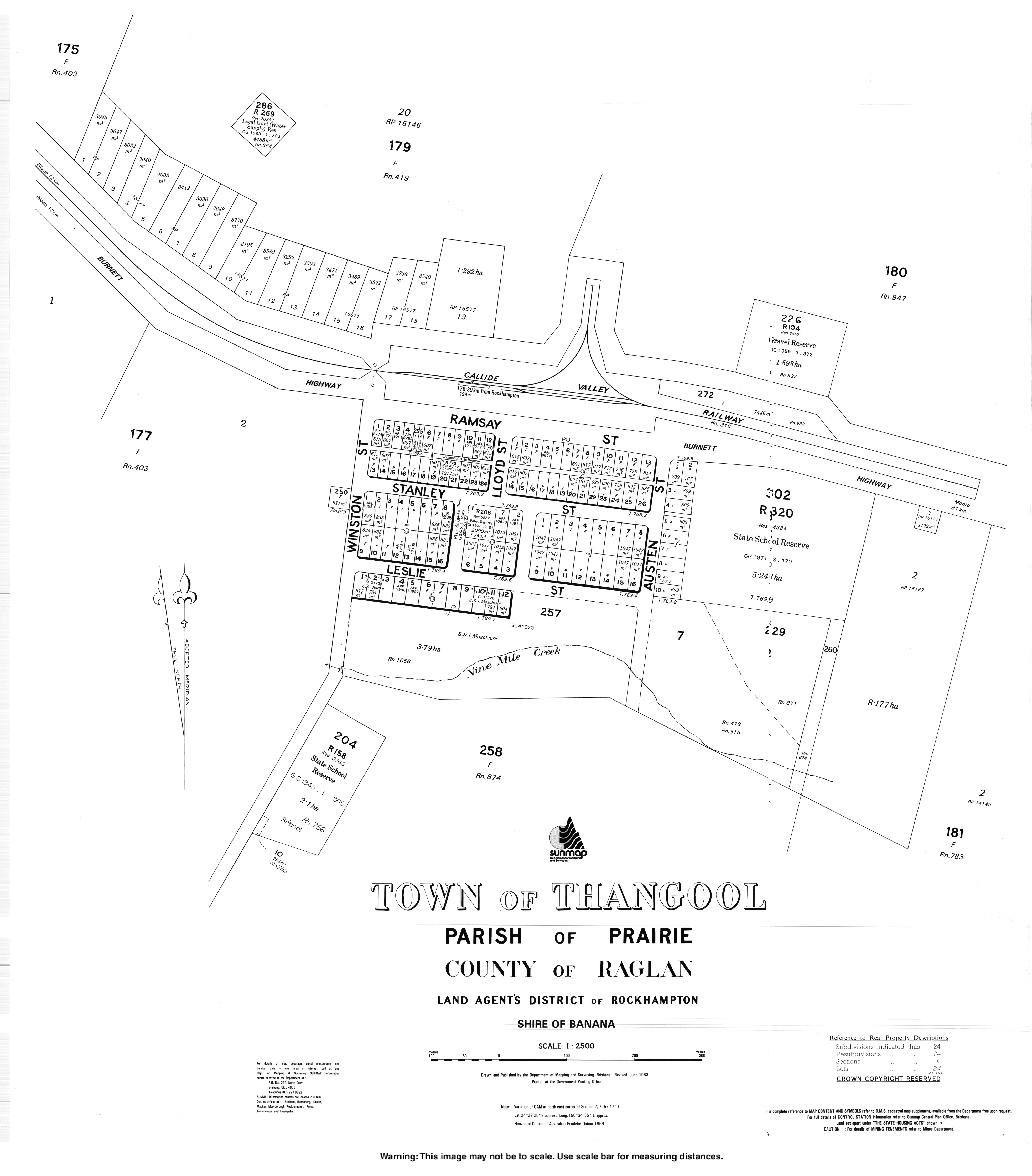
- "Town map of Thangool". Queensland Government. 1983.
- "Thangool & District 2017/2027 Place Based Plan". Banana Shire Council. — provides an overview of the facilities