
Tenja | |
|---|---|
      | |
 Tenja  Tenja | |
| Coordinates: 45°30′N 18°44′E / 45.500°N 18.733°E | |
| Country | |
| Region | Slavonia (Podunavlje) |
| County | |
| City | |
| Government | |
| • Body | Local Committee |
| Area | |
| • Total | 19.0 sq mi (49.3 km2) |
| Population (2021)[2] | |
| • Total | 6,260 |
| • Density | 330/sq mi (130/km2) |
| Time zone | UTC+1 (CET) |
| • Summer (DST) | UTC+2 (CEST) |
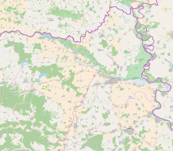
Tenja (Serbian Cyrillic: Тења, Hungarian: Tenye, German: Tenne) is a village in eastern Slavonia, Croatia, located just southeast of Osijek. The population is 7,376.[3]
YouTube Encyclopedic
-
1/2Views:1 691549
-
Videonajava za djelo Poštarska bajka (Karel Čapek), OŠ Tenja
-
OS Tenja - Mostovi prijateljstva
Transcription
History
Croatian War of Independence
During the Croatian War of Independence, Tenja was under the control of Serb rebel forces. It was a part of the self-proclaimed SAO Eastern Slavonia, Baranja and Western Syrmia (1991–1992), Republic of Serbian Krajina (1992-1995) and United Nations protectorate of Eastern Slavonia, Baranja and Western Syrmia (1995-1998).
Between July and November 1991, Serb forces killed at least 29 non-Serb civilians in the Tenja massacre, while another 3,000 residents were displaced from their homes.[4]
UNTAES peacekeeping mission
Between 1996 and 1998 Tenja was under the United Nations Transitional Administration for Eastern Slavonia, Baranja and Western Sirmium (UNTAES) administration.
Transitional Municipality of Tenja
The UNTAES mission made an executive decision to create the so-called Transitional Municipality of Tenja at the time of transition of the region to the control of the Croatian Government.[5] In January 1997 Transitional Administrator Jacques Paul Klein established new municipalities of Trpinja, Negoslavci, Markušica, Šodolovci and Jagodnjak with Serb majority which are today part of the Joint Council of Municipalities.[5] In Tenja and Mirkovci were declared so called transitional municipalities with Serb ethnic majority which were to become part of Vinkovci and Osijek respectively after an additional transitional period of one year.[5]
Notes
- ^ Register of spatial units of the State Geodetic Administration of the Republic of Croatia. Wikidata Q119585703.
- ^ "Population by Age and Sex, by Settlements, 2021 Census". Census of Population, Households and Dwellings in 2021. Zagreb: Croatian Bureau of Statistics. 2022.
- ^ "Population by Age and Sex, by Settlements, 2011 Census: Tenja". Census of Population, Households and Dwellings 2011. Zagreb: Croatian Bureau of Statistics. December 2012.
- ^ "The Humanitarian Law Center files a criminal complaint against more than 30 individuals for war crimes committed in Croatia in 1991". Retrieved 29 April 2022.
- ^ a b c Kopajtich-Škrlec, Nives (2012). "Područno ustrojstvo u Republici Hrvatskoj, problemi i perspektiva". Sveske za javno pravo (8): 17–26.
| History |  | |
|---|---|---|
| Districts | ||
| Suburbs | ||
| Buildings and landmarks | ||
| Churches |
| |
| Culture | ||
| Galleries and museums |
| |
| Education |
| |
| Sports venues | ||
| Transport | ||
| Festivals | ||
| Neighboring municipalities | ||
| Authority control databases: National |
|---|
45°30′06″N 18°44′42″E / 45.501655°N 18.744884°E
This Osijek-Baranja County geography article is a stub. You can help Wikipedia by expanding it. |