
Tecoman
Tecoman City | |
|---|---|
 Panoramic view of downtown Tecomán. | |
 Coat of arms | |
| Motto: Lime Capital of the World | |
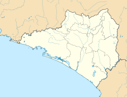 Tecoman Location in Mexico  Tecoman Tecoman (Mexico) | |
| Coordinates: 18°54′32″N 103°52′29″W / 18.90889°N 103.87472°W | |
| Country | |
| State | Colima |
| Municipality | Tecomán |
| Area | |
| • Land | 834.77 km2 (322.31 sq mi) |
| Population (2010) | |
| • City | 112,726 |
| • Metro | 141,421 |
| Time zone | UTC-6 (Central Standard Time) |
| • Summer (DST) | UTC-5 (Central Daylight Time) |
Tecomán is a city and seat of the municipality of Tecomán in the Mexican state of Colima, about 50 km south of the city of Colima. In the 2005 census the city had a population of 112,726 people. It is the third-largest community in the state of Colima. The municipality has an area of 834.77 km2 (322.31 sq mi). Near the coast on Federal Highway 200, it is situated a rich agricultural industries region and is known as the "lime capital of the world".[1] Due to its soaring homicide rate, Tecomán became the deadliest municipality in Mexico in 2016.[2]
YouTube Encyclopedic
-
1/3Views:3 6752 04411 321
-
Tecomán Colima "Capitál del limón"
-
Sopes y Café Carmelita la más sabrosa tradición en Tecomán Colima @cotidiano399
-
Así es la entrada de Tecomán Colima, Cotidiano399
Transcription
Economy
The main economic activities of the area are:
- Agriculture: Limes, coconuts, tamarind, mango and bananas.
- Livestock: Cattle, pigs, sheep, goats and apiculture.
- Industrial: Citrus and coconut agroindustry
- Mining: Dolomite, limestone and silver
Geography
Climate
| Climate data for Tecomán | |||||||||||||
|---|---|---|---|---|---|---|---|---|---|---|---|---|---|
| Month | Jan | Feb | Mar | Apr | May | Jun | Jul | Aug | Sep | Oct | Nov | Dec | Year |
| Record high °C (°F) | 37.5 (99.5) |
38.0 (100.4) |
38.0 (100.4) |
39.0 (102.2) |
41.0 (105.8) |
38.0 (100.4) |
41.0 (105.8) |
40.0 (104.0) |
39.5 (103.1) |
41.0 (105.8) |
40.0 (104.0) |
38.0 (100.4) |
41.0 (105.8) |
| Mean daily maximum °C (°F) | 31.9 (89.4) |
31.9 (89.4) |
32.0 (89.6) |
32.3 (90.1) |
33.1 (91.6) |
33.7 (92.7) |
33.9 (93.0) |
33.8 (92.8) |
33.4 (92.1) |
33.8 (92.8) |
33.5 (92.3) |
32.8 (91.0) |
33.0 (91.4) |
| Daily mean °C (°F) | 23.9 (75.0) |
23.7 (74.7) |
23.9 (75.0) |
24.6 (76.3) |
26.4 (79.5) |
28.3 (82.9) |
28.5 (83.3) |
28.4 (83.1) |
28.1 (82.6) |
28.1 (82.6) |
26.9 (80.4) |
25.3 (77.5) |
26.3 (79.3) |
| Mean daily minimum °C (°F) | 15.9 (60.6) |
15.4 (59.7) |
15.9 (60.6) |
16.9 (62.4) |
19.6 (67.3) |
22.8 (73.0) |
23.1 (73.6) |
23.0 (73.4) |
22.8 (73.0) |
22.3 (72.1) |
20.2 (68.4) |
17.8 (64.0) |
19.6 (67.3) |
| Record low °C (°F) | 9.0 (48.2) |
1.5 (34.7) |
9.5 (49.1) |
8.5 (47.3) |
11.0 (51.8) |
16.0 (60.8) |
16.0 (60.8) |
18.0 (64.4) |
18.5 (65.3) |
14.0 (57.2) |
10.0 (50.0) |
1.6 (34.9) |
1.5 (34.7) |
| Average precipitation mm (inches) | 32.6 (1.28) |
2.0 (0.08) |
0.6 (0.02) |
0.2 (0.01) |
17.6 (0.69) |
107.8 (4.24) |
154.9 (6.10) |
181.5 (7.15) |
181.4 (7.14) |
80.8 (3.18) |
38.5 (1.52) |
12.7 (0.50) |
810.6 (31.91) |
| Average precipitation days (≥ 0.1 mm) | 1.3 | 0.3 | 0.2 | 0.1 | 0.8 | 7.5 | 11.2 | 11.9 | 10.9 | 4.9 | 1.6 | 1.0 | 51.7 |
| Source: Servicio Meteorologico Nacional[3] | |||||||||||||
Tourism
Nearby Beaches & recreational areas:
- Playa El Real. 10 km. south of Tecomán. Open sea, good surfing.
- Playa Boca de Pascuales. 12 km. from Tecomán. Surfing beach for the experienced. Enramadas serving fresh seafood.
- Playa de Tecuanillo. Narrow, fine-sanded, not-too-steep beach
- Laguna de Amela. Deep lagoon surrounded by lush vegetation.
- Laguna de Alcuzahue. Lagoon 8 km from Tecomán. Visit the Crocodile reserve.
- Playa Paraiso. Open sea, Ramadas serving delicious freshly cooked food with Coconut drinks. Usually a calm beach except during rainy season.
- Boca De Apiza.
References
- ^ Nguyen, C. Thi (September 23, 2008). "Mariscos from the Lime Capital of the World". chowhound.com. Chowhound. Retrieved August 4, 2017.
- ^ Ahmed, Azam (August 4, 2017). "Mexico's Deadliest Town. Mexico's Deadliest Year". New York Times. p. A1. Retrieved August 4, 2017.
- ^ NORMALES CLIMATOLÓGICAS 1971-2000 Archived 2013-07-16 at the Wayback Machine, National Meteorological Service of Mexico. Retrieved August 7, 2012 .
External links
- Ayuntamiento de Tecomán Official website
- Tecoman Info
- https://web.archive.org/web/20080708062104/http://www.tecomense.com.mx/
- Eco-volunteering projects with sea turtles.
- Link to tables of population data from Census of 2005 INEGI: Instituto Nacional de Estadística, Geografía e Informática
- Colima Enciclopedia de los Municipios de México
Colima (capital) | ||
| Municipalities (municipal seats) |  | |