


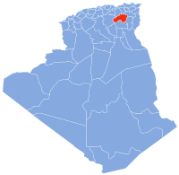
Tazoult District is a district of Batna Province, Algeria. The capital is Tazoult, a small city of 5,000 inhabitants.
YouTube Encyclopedic
-
1/3Views:1 9911 34410 203
-
Villa Olive Press - Kefalonia Virtual Villa Tours.
-
Talk About Booleans - English
-
Blender 2.8 Modeling, UI and some thoughts again ^^
Transcription
Geography
It is 1200 m above sea level, and surrounded by Jebel Doufana and Oustili Mountains to the west and Jebel Tafrent to the south. Average temperature (°C) ranges from 5° in Winter to 26° in Summer though temperatures as high as 40° have been recorded.[1][2]
Department
Since 1984, the commune of Tazoult consists of the following areas:
- Boukha
- Bouzène
- Chaabet El Ghoul
- Chenatif
- Draa Ben Sebbah
- Steward
- Latrèche
- Markouna
- Merfeg Sidi Belkeir
- Oued Bouhayoun
- Oustilli
- Tazoult
- Tifiracine
- Touafez

The prison of Lambaesis was known for its harsh conditions and hosted Algerian nationalists the Algerian war of independence.
The current mayor is Cherif Guedouar who replaced long term mayor Moussa Fellah in 2012.[3]
Toponymy
The name of Tazoult is a Berber word for khol in Tuareg or antimony in other Algerian or Moroccan variants.[4][5]
Population
- 1880 = 4732
- 1966 = 64813
- 1977 =9314
- 1984 =11000
- 1998 = 22114
- 2008 = 27493
Municipalities
See also
References
- ^ "Travel Weather Averages (Weatherbase)". Weatherbase.
- ^ "Le Soir d'Algérie".
- ^ Lounes Gribissa, "Land to Tazoult: Common cramped," El Watan on 10 November 2010
- ^ Achour Cheurfi, Dictionary Algerian localities Casbah Editions, (Algiers, 2011)
- ^ Dalila Ouitis, Concise of place names and place names of Algeria, Ed. Djoussour, (Algiers 2009)
35°29′24″N 6°15′36″E / 35.49000°N 6.26000°E
This article about a location in Batna Province is a stub. You can help Wikipedia by expanding it. |