
Taunton, Minnesota | |
|---|---|
 Location of Taunton, Minnesota | |
| Coordinates: 44°35′40″N 96°3′50″W / 44.59444°N 96.06389°W | |
| Country | United States |
| State | Minnesota |
| County | Lyon |
| Government | |
| • Type | Mayor – Council |
| • Mayor | Mike Breyfogle[citation needed] |
| Area | |
| • Total | 1.01 sq mi (2.61 km2) |
| • Land | 1.01 sq mi (2.61 km2) |
| • Water | 0.00 sq mi (0.00 km2) |
| Elevation | 1,171 ft (357 m) |
| Population (2020) | |
| • Total | 136 |
| • Density | 135.05/sq mi (52.15/km2) |
| Time zone | UTC-6 (Central (CST)) |
| • Summer (DST) | UTC-5 (CDT) |
| ZIP code | 56291 |
| Area code | 507 |
| FIPS code | 27-64264[3] |
| GNIS feature ID | 2396033[2] |
Taunton is a city in Lyon County, Minnesota, United States. The population was 139 at the 2010 census.[4]
YouTube Encyclopedic
-
1/1Views:393
-
How to Pronounce taunton - American English
Transcription
History
Taunton was platted in 1886 by the railroad.[5] It was named after Taunton, Massachusetts.[5] A post office has been in operation in Taunton since 1888.[6] Taunton was incorporated in 1900.[7] Celebrating 100 years of landmark buildings, this commemorative plate was designed by Nancy Koch titled "Taunton's Hundred Years 1886 - 1986. The commemorative plate depicts eight buildings; Public School - First school built in 1889, Taunton City Hall - Organized, Taunton Fire Station - Built in 1907, Beck's Hardware - Built in 1903, Taunton State Bank - Built in 1905, STS Cyril and Methodius - Built in 1895, STS Cyril and Methodius Rectory - Built in 1905, Ray's Standard - Built in 1927, Co-op Elevator - Organized in 1911.[8]
Geography
According to the United States Census Bureau, the city has a total area of 1.01 square miles (2.62 km2), all land.[9]
Demographics
| Census | Pop. | Note | %± |
|---|---|---|---|
| 1910 | 205 | — | |
| 1920 | 183 | −10.7% | |
| 1930 | 211 | 15.3% | |
| 1940 | 207 | −1.9% | |
| 1950 | 217 | 4.8% | |
| 1960 | 233 | 7.4% | |
| 1970 | 195 | −16.3% | |
| 1980 | 177 | −9.2% | |
| 1990 | 175 | −1.1% | |
| 2000 | 207 | 18.3% | |
| 2010 | 139 | −32.9% | |
| 2020 | 136 | −2.2% | |
| U.S. Decennial Census[10] | |||
2010 census
As of the census[11] of 2010, there were 139 people, 68 households, and 35 families residing in the city. The population density was 137.6 inhabitants per square mile (53.1/km2). There were 78 housing units at an average density of 77.2 per square mile (29.8/km2). The racial makeup of the city was 100.0% White.[12]
There were 68 households, of which 23.5% had children under the age of 18 living with them, 39.7% were married couples living together, 8.8% had a female householder with no husband present, 2.9% had a male householder with no wife present, and 48.5% were non-families. 38.2% of all households were made up of individuals, and 13.2% had someone living alone who was 65 years of age or older. The average household size was 2.04 and the average family size was 2.71.
The median age in the city was 42.2 years. 23.7% of residents were under the age of 18; 5.1% were between the ages of 18 and 24; 25.2% were from 25 to 44; 28.1% were from 45 to 64; and 18% were 65 years of age or older. The gender makeup of the city was 45.3% male and 54.7% female.
2000 census
As of the census[3] of 2000, there were 207 people, 72 households, and 39 families residing in the city. The population density was 206.5 inhabitants per square mile (79.7/km2). There were 77 housing units at an average density of 76.8 per square mile (29.7/km2). The racial makeup of the city was 98.55% White, 0.48% Asian, and 0.97% from two or more races.[13]
There were 72 households, out of which 23.6% had children under the age of 18 living with them, 47.2% were married couples living together, 5.6% had a female householder with no husband present, and 45.8% were non-families. 37.5% of all households were made up of individuals, and 22.2% had someone living alone who was 65 years of age or older. The average household size was 2.24 and the average family size was 3.00.
In the city, the population was spread out, with 19.8% under the age of 18, 4.3% from 18 to 24, 20.8% from 25 to 44, 13.5% from 45 to 64, and 41.5% who were 65 years of age or older. The median age was 50 years. For every 100 females, there were 86.5 males. For every 100 females age 18 and over, there were 88.6 males.
The median income for a household in the city was $23,125, and the median income for a family was $38,125. Males had a median income of $22,500 versus $20,893 for females. The per capita income for the city was $14,658. About 18.5% of families and 25.0% of the population were below the poverty line, including 43.3% of those under the age of eighteen and 23.1% of those 65 or over.
See also
References
- ^ "2020 U.S. Gazetteer Files". United States Census Bureau. Retrieved July 24, 2022.
- ^ a b U.S. Geological Survey Geographic Names Information System: Taunton, Minnesota
- ^ a b "U.S. Census website". United States Census Bureau. Retrieved January 31, 2008.
- ^ "2010 Census Redistricting Data (Public Law 94-171) Summary File". American FactFinder. United States Census Bureau. Retrieved April 27, 2011.[dead link]
- ^ a b Chicago and North Western Railway Company (1908). A History of the Origin of the Place Names Connected with the Chicago & North Western and Chicago, St. Paul, Minneapolis & Omaha Railways. p. 129.
- ^ "Lyon County". Jim Forte Postal History. Retrieved March 29, 2015.
- ^ Upham, Warren (1920). Minnesota Geographic Names: Their Origin and Historic Significance. Minnesota Historical Society. p. 314.
- ^ "Taunton Minnesota Gallery". www.lakesnwoods.com. Retrieved March 4, 2021.
- ^ "US Gazetteer files 2010". United States Census Bureau. Archived from the original on January 25, 2012. Retrieved November 13, 2012.
- ^ "Census of Population and Housing". Census.gov. Retrieved June 4, 2015.
- ^ "U.S. Census website". United States Census Bureau. Retrieved November 13, 2012.
- ^ "Taunton, Minnesota Population & Demographics". AreaVibes. Retrieved March 4, 2021.
- ^ "Taunton, MN Population - Census 2010 and 2000 Interactive Map, Demographics, Statistics, Quick Facts - CensusViewer". censusviewer.com. Retrieved March 4, 2021.
Municipalities and communities of Lyon County, Minnesota, United States | ||
|---|---|---|
| Cities | 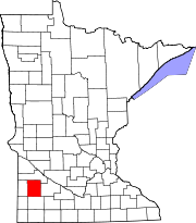 | |
| Townships | ||
| Unincorporated communities | ||