
Tamu Township
တမူးမြို့နယ် | |
|---|---|
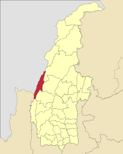 Location in Sagaing region | |
| Coordinates: 24°12′49.06″N 94°18′20.16″E / 24.2136278°N 94.3056000°E | |
| Country | |
| Region | Sagaing Region |
| District | Tamu District |
| Capital | Tamu |
| Area | |
| • Total | 511.70 sq mi (1,325.30 km2) |
| Elevation | 2,400 ft (700 m) |
| Population (2019)[1] | 114,572 |
| Time zone | UTC+6.30 (MMT) |
Tamu Township is a township in Tamu District in the Sagaing Division of Burma.[2] The principal town is Tamu. Tamu township is the only township of Tamu District, which borders India.
YouTube Encyclopedic
-
1/3Views:1 7511 001311
-
Phailen Kho Nop Dan by Lhainei Haokip
-
Street Dance @ Tamu, Myanmar
-
People out on streets to celebrate the Water festival - Tamu, Myanmar
Transcription
History
On January 7, 2024, in the midst of the Myanmar civil war, the Myanmar military engaged in airstrikes on the village of Kanan within Khampat, Tamu Township near the village church and a school, killing 17 civilians, including nine children, and wounded 20.[3][4]
List of towns
| Town | Burmese name | Population | ±% p.a. | Area | Density | ||||
|---|---|---|---|---|---|---|---|---|---|
| Khampat | ခမ်းပါတ် | 15,400 | 14,910 | 3.29% | 33.33 | 12.87 | 462 | 1,197 | |
| Myothit | မြို့သစ် | 1,308 | 1,274 | 2.67% | 3.34 | 1.29 | 392 | 1,014 | |
| Tamu | တမူး | 97,864 | 93,085 | 5.13% | 19.81 | 7.65 | 4,940 | 12,795 | |
Villages
- Ahlaw
- Kanan (ကနန်; in Khampat)[3][4]
- Kun Tawng Ywar Thit (ကွန်းတောင်းရွာသစ်; also Chin village)[5]
- Kyuntawyaeshin (ကျွန်းတောရေရှင်)
References
- ^ a b c Myanmar Information Management Unit (2019). Tamu Myone Daethasaingyarachatlatmya တမူးမြို့နယ် ဒေသဆိုင်ရာအချက်လက်များ [Tamu Township Regional Information] (PDF) (Report) (in Burmese). Retrieved 25 January 2024.
- ^ "Myanmar States/Divisions & Townships Overview Map" Myanmar Information Management Unit (MIMU)
- ^ a b "Air Attack in Myanmar Kills 17, Including Children, but Military Denies Responsibility". VOA. Bangkok. Associated Press. 7 January 2024.
- ^ a b Wei, Brian (January 13, 2024). "Witnesses Describe Aftermath of Myanmar Junta Airstrike". The Irrawaddy. Irrawaddy Publishing Group. Retrieved 25 January 2024.
- ^ "Junta Torches Village In Tamu Township". Burma News International. 31 March 2023. Retrieved 25 January 2024.
Of the 29 houses in Kun Tawng Ywar Thit (also called Chin village)...
External links
- Maplandia World Gazetteer - map showing the township boundary


This Tamu District location article is a stub. You can help Wikipedia by expanding it. |