
| Takur Ghar | |
|---|---|
| Highest point | |
| Elevation | 3,191 m (10,469 ft) |
| Coordinates | 33°20′32″N 69°12′50″E / 33.3421°N 69.2138°E |
| Naming | |
| Native name | كوۀ تاكر (Pashto) |
| Geography | |
| Location | Southeastern Afghanistan |
| Province | Paktia |
| Parent range | Arma Mountains |
Takur Ghar is a high mountain located in the Arma Mountains of southeastern Afghanistan. The peak is on the eastern border of the Shah-i-Kot Valley.
The peak of Takur Ghar was the location of fierce fighting between US Special Operations Forces and al-Qaeda insurgents, as well as Taliban fighters, during Operation Anaconda in March 2002 as part of the larger US war in Afghanistan. [1]
Takur Ghar is featured in the 2010 video game Medal of Honor.
YouTube Encyclopedic
-
1/1Views:22 629
-
Operation Anaconda | The battle of Roberts' Ridge
Transcription
References
- ^ Naylor, Sean (2005). Not a Good Day to Die: The Untold Story of Operation Anaconda. New York: Penguin Group.
| Districts | 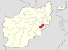 | |
|---|---|---|
| Populated places | ||
| Landforms | ||
| Other | ||
This Paktia Province, Afghanistan location article is a stub. You can help Wikipedia by expanding it. |